Directions to Life Support Team (Lynchburg) with public transportation
The following transit lines have routes that pass near Life Support Team
 Bus: 1A, 1B, 9, GREYHOUND US0600, 3A.
- Train: NORTHEAST REGIONAL, CRESCENT.
How to get to Life Support Team by bus?
Click on the bus route to see step by step directions with maps, line arrival times and updated time schedules.
How to get to Life Support Team by train?
Click on the train route to see step by step directions with maps, line arrival times and updated time schedules.
Bus stops near Life Support Team in Lynchburg
Train station near Life Support Team in Lynchburg
- Lynchburg Station, 30 min walk,VIEW
Bus lines to Life Support Team in Lynchburg
What are the closest stations to Life Support Team?
The closest stations to Life Support Team are:
- Main St. & 11th St. is 22 yards away, 1 min walk.
- Commerce St. & 10th St. (Outbound) is 156 yards away, 3 min walk.
- Commerce St. & 10th St. (Inbound) is 173 yards away, 3 min walk.
- Church St. & 10th St. is 281 yards away, 4 min walk.
- Commerce St. & 7th St. is 547 yards away, 7 min walk.
- Lynchburg Station is 2447 yards away, 30 min walk.
Which bus lines stop near Life Support Team?
These bus lines stop near Life Support Team: 1A, 1B, 9, GREYHOUND US0600.
Which train line stops near Life Support Team?
NORTHEAST REGIONAL (Roanoke)
What’s the nearest train station to Life Support Team in Lynchburg?
The nearest train station to Life Support Team in Lynchburg is Lynchburg Station. It’s a 30 min walk away.
What’s the nearest bus station to Life Support Team in Lynchburg?
The nearest bus station to Life Support Team in Lynchburg is Main St. & 11th St.. It’s a 1 min walk away.
What time is the first train to Life Support Team in Lynchburg?
The CRESCENT is the first train that goes to Life Support Team in Lynchburg. It stops nearby at 9:41 AM.
What time is the last train to Life Support Team in Lynchburg?
The CRESCENT is the last train that goes to Life Support Team in Lynchburg. It stops nearby at 10:16 PM.
What time is the first bus to Life Support Team in Lynchburg?
The 1B is the first bus that goes to Life Support Team in Lynchburg. It stops nearby at 4:55 AM.
What time is the last bus to Life Support Team in Lynchburg?
The 3B is the last bus that goes to Life Support Team in Lynchburg. It stops nearby at 9:32 PM.
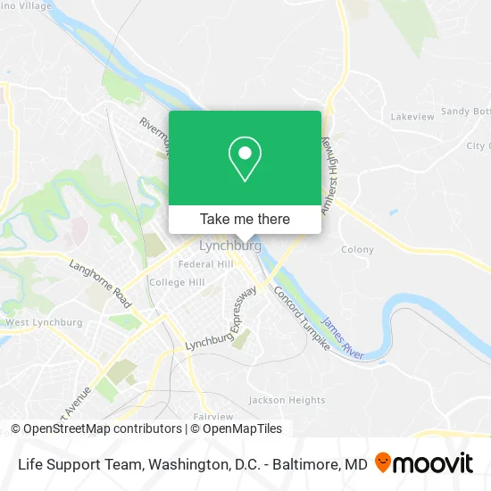
See Life Support Team, Lynchburg, on the map
Public Transit to Life Support Team in Lynchburg
Wondering how to get to Life Support Team in Lynchburg? Moovit helps you find the best way to get to Life Support Team with step-by-step directions from the nearest public transit station.
Moovit provides free maps and live directions to help you navigate through your city. View schedules, routes, timetables, and find out how long does it take to get to Life Support Team in real time.
Looking for the nearest stop or station to Life Support Team? Check out this list of stops closest to your destination: Main St. & 11th St.; Commerce St. & 10th St. (Outbound); Commerce St. & 10th St. (Inbound); Church St. & 10th St.; Commerce St. & 7th St.; Lynchburg Station.
Bus: 1A, 1B, 9, GREYHOUND US0600, 3A, 3B, 5.Train: NORTHEAST REGIONAL, CRESCENT.
Want to see if there’s another route that gets you there at an earlier time? Moovit helps you find alternative routes or times. Get directions from and directions to Life Support Team easily from the Moovit App or Website.
We make riding to Life Support Team easy, which is why over 1.5 million users, including users in Lynchburg, trust Moovit as the best app for public transit. You don’t need to download an individual bus app or train app, Moovit is your all-in-one transit app that helps you find the best bus time or train time available.
For information on prices of bus and train, costs and ride fares to Life Support Team, please check the Moovit app.
Use the app to navigate to popular places including to the airport, hospital, stadium, grocery store, mall, coffee shop, school, college, and university.
Life Support Team Address: 1000 Jefferson St Lynchburg, VA 24504 street in Lynchburg
- Riverfront Lot,
- Thriveworks,
- Blair Smith Architect,
- Colonial Brokerage House,
- Stimulus Advertising,
- Dominion Seven Architects,
- Medical Practice Website Pros,
- Zola's Beauty,
- Lynchburg River Lofts,
- El Mariachi Mexican Restaurant,
- American Brew Pub Wine Bar,
- Maylynn's,
- The Loft,
- The Cornerstone Company,
- Water Dog,
- Maylynn's Creamery Downtown,
- Maylynn S Creamer,
- Skyla Jade Studios,
- The Glass House,
- Glass House
Places Near Life Support Team (Lynchburg)
- Marriott Marquis Washington, DC, Washington,
- Basilica of the National Shrine, Washington,
- Georgetown, Washington,
- M&T Bank Stadium, Baltimore,
- Washington DC VA Medical Center, Washington,
- Pennsylvania Ave NW (3rd st and pennsylvania), Washington,
- Westfield Montgomery Mall, Montgomery County,
- National Museum of African American History and Culture, Washington,
- Capital One Arena, Washington,
- Camden Yards, Baltimore,
- National Zoo, Washington,
- Sibley Memorial Hospital, Washington,
- Rock Creek Tennis Center, Washington,
- National Mall, Washington,
- Amazon Hq2, Arlington County,
- Washington National Cathedral, Washington,
- Warner Theatre, Washington,
- PG Mall, Prince George's County,
- Museum Of The Bible, Washington,
- The Anthem, Washington
How to get to popular places in Washington, D.C. - Baltimore, MD with public transit
Get around Lynchburg by public transit!
Traveling around Lynchburg has never been so easy. See step by step directions as you travel to any attraction, street or major public transit station. View bus and train schedules, arrival times, service alerts and detailed routes on a map, so you know exactly how to get to anywhere in Lynchburg.
When traveling to any destination around Lynchburg use Moovit's Live Directions with Get Off Notifications to know exactly where and how far to walk, how long to wait for your line, and how many stops are left. Moovit will alert you when it's time to get off — no need to constantly re-check whether yours is the next stop.
Wondering how to use public transit in Lynchburg or how to pay for public transit in Lynchburg? Moovit public transit app can help you navigate your way with public transit easily, and at minimum cost. It includes public transit fees, ticket prices, and costs. Looking for a map of Lynchburg public transit lines? Moovit public transit app shows all public transit maps in Lynchburg with all Bus, Train, Metro, Light Rail and Ferry routes and stops on an interactive map.
Washington, D.C. - Baltimore, MD has 5 transit type(s), including: Bus, Train, Metro, Light Rail and Ferry, operated by several transit agencies, including WMATA, Montgomery County Ride On, Fairfax Connector, TheBus, PRTC, DASH - Alexandria, Arlington Transit (ART), RTA of Central Maryland, MDOT MTA, MDOT MTA Light RailLink, MDOT MTA Commuter Bus, MDOT MTA Local Bus, FXBGO!, Virginia Railway Express (VRE) and MARC