How to get to Light Rail Jerusalem by bus?
Click on the bus route to see step by step directions with maps, line arrival times and updated time schedules.
From IKEA Eshtaol, Mateh Yehuda Regional Council
46 minFrom Tirosh Moshav, Tirosh
61 minFrom Big Brother House, Mateh Yehuda Regional Council
53 minFrom Kiftzuba, Tzova
86 minFrom Eshtaol Forest, Mateh Yehuda Regional Council
45 minFrom Mini Israel, Mateh Yehuda Regional Council
65 minFrom Har Tov B Industrial Zone, Beit Shemesh
49 min
Bus stops near Light Rail Jerusalem in Beit Shemesh
Bus lines to Light Rail Jerusalem in Beit Shemesh
- 22, Devorah HaNeviah/Miriam HaNeviah,VIEW
- 2, Zechariah the Prophet/Terminal,VIEW
- 4, Railway Terminal/Drop Off,VIEW
- 4A, Rav Hanan/Mar Ukba,VIEW
- 23, Rabbi Yitzchak Napcha/Rav Chilkiya Bar Tovi,VIEW
- 323, Beit Shemesh,VIEW
- 445, Beit Shemesh,VIEW
- 459, Dimona,VIEW
- 485, Ofakim,VIEW
- 600, Jerusalem,VIEW
- 621, Beit Shemesh,VIEW
- 626, Jerusalem,VIEW
- 630, Beit Shemesh,VIEW
- 690 - Accessibility by advance reservation ♿, Ramat Gan,VIEW
- 691 - Accessibility by advance reservation ♿, Beit Shemesh,VIEW
- 26, HaAmoraim Boulevard/Ravina,VIEW
- 507, Rehovot,VIEW
- 509, Lod,VIEW
- 3, Klein/Aharonson,VIEW
- 12, Railway Terminal/Drop Off,VIEW
What are the closest stations to Light Rail Jerusalem?
The closest stations to Light Rail Jerusalem are:
- Nahal Hever/Tzeelim is 91 meters away, 2 min walk.
- Nahal Tzalim Blvd/Nahal Haver is 182 meters away, 3 min walk.
- Nahal Tzalim/Haver is 183 meters away, 3 min walk.
- Nachal Tzalim Blvd/Nachal Kishon Blvd is 409 meters away, 6 min walk.
- Nahal Arugot/Jordan River Boulevard is 988 meters away, 13 min walk.
Which bus lines stop near Light Rail Jerusalem?
These bus lines stop near Light Rail Jerusalem: 128, 2, 424, 600, 616, 626, 885.
What’s the nearest bus station to Light Rail Jerusalem in Beit Shemesh?
The nearest bus station to Light Rail Jerusalem in Beit Shemesh is Nahal Hever/Tzeelim. It’s a 2 min walk away.
What time is the first bus to Light Rail Jerusalem in Beit Shemesh?
The 4 is the first bus that goes to Light Rail Jerusalem in Beit Shemesh. It stops nearby at 5:25 AM.
What time is the last bus to Light Rail Jerusalem in Beit Shemesh?
The 691 - Accessibility by advance reservation ♿ is the last bus that goes to Light Rail Jerusalem in Beit Shemesh. It stops nearby at 2:01 AM.
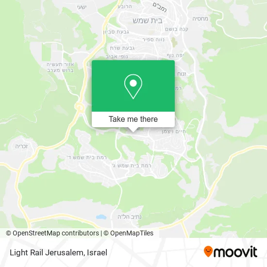
See Light Rail Jerusalem, Beit Shemesh, on the map
Public Transit to Light Rail Jerusalem in Beit Shemesh
Wondering how to get to Light Rail Jerusalem in Beit Shemesh? Moovit helps you find the best way to get to Light Rail Jerusalem with step-by-step directions from the nearest public transit station.
Moovit provides free maps and live directions to help you navigate through your city. View schedules, routes, timetables, and find out how long does it take to get to Light Rail Jerusalem in real time.
Looking for the nearest stop or station to Light Rail Jerusalem? Check out this list of stops closest to your destination: Nahal Hever/Tzeelim; Nahal Tzalim Blvd/Nahal Haver; Nahal Tzalim/Haver; Nachal Tzalim Blvd/Nachal Kishon Blvd; Nahal Arugot/Jordan River Boulevard.
Bus: 128, 2, 424, 600, 616, 626, 885, 22, 4, 4A, 23, 323, 26, 507, 509, 3, 12, 15, 148.
Want to see if there’s another route that gets you there at an earlier time? Moovit helps you find alternative routes or times. Get directions from and directions to Light Rail Jerusalem easily from the Moovit App or Website.
We make riding to Light Rail Jerusalem easy, which is why over 1.5 million users, including users in Beit Shemesh, trust Moovit as the best app for public transit. You don’t need to download an individual bus app or train app, Moovit is your all-in-one transit app that helps you find the best bus time or train time available.
For information on prices of bus, costs and ride fares to Light Rail Jerusalem, please check the Moovit app.
Use the app to navigate to popular places including to the airport, hospital, stadium, grocery store, mall, coffee shop, school, college, and university.
Light Rail Jerusalem Address: ירושלים 99000 בית שמש street in Beit Shemesh
- Amir Farm,
- La Piedra,
- Maryam Well - Event Hall and Garden,
- Yavne 38,
- Jerusalem 102,
- Kiryat Arba 6,
- Polling Station 80.1 - Vezot LeYehuda School Beit Shemesh,
- Talmud Torah Mishkenot Yaakov,
- RBS Gelt Center,
- Beit Shemesh Shelter,
- Shelter - Beit Shemesh, Nahal Nitzanim,
- Commercial Center,
- Geula Books - Toys and Books,
- Ptachya - Special Education Institutions,
- Shelter - Beit Shemesh, Nahal Nitzanim,
- Beit Shemesh Shelter,
- Arugot Stream Park,
- Beit Shemesh Shelter,
- Shelter - Beit Shemesh, Nahal Zohar,
- Home Place
Places Near Light Rail Jerusalem (Beit Shemesh)
- Dizengoff Center, Tel Aviv-Yafo,
- Beilinson Hospital, Petah Tikva,
- Yarkon Park, Tel Aviv-Yafo,
- Glilot Complex, Hof HaSharon Regional Council,
- Azrieli, Tel Aviv-Yafo,
- Expo Tel Aviv, Tel Aviv-Yafo,
- Assuta Hospital - Ramat HaHayal, Tel Aviv-Yafo,
- Ramat Gan Stadium, Ramat Gan,
- Kashcafe, Kiryat Ata,
- Tel Hashomer Base, Ramat Gan,
- Gideon Camp - Military Base 7, Emek Lod Regional Council,
- Moovit Office, Nes Ziona,
- Southern Medical Center, Ramat Negev Regional Council,
- Bloomfield Stadium, Tel Aviv-Yafo,
- HaKotel, Jerusalem,
- Bislach 17, Ramat Negev Regional Council,
- Tel HaShomer North Gate, Ramat Gan,
- Ichilov Hospital, Tel Aviv-Yafo,
- Menora Mivtachim Arena, Tel Aviv-Yafo,
- Carmel Market, Tel Aviv-Yafo
How to get to popular places in Israel with public transit
Get around Beit Shemesh by public transit!
Traveling around Beit Shemesh has never been so easy. See step by step directions as you travel to any attraction, street or major public transit station. View bus and train schedules, arrival times, service alerts and detailed routes on a map, so you know exactly how to get to anywhere in Beit Shemesh.
When traveling to any destination around Beit Shemesh use Moovit's Live Directions with Get Off Notifications to know exactly where and how far to walk, how long to wait for your line, and how many stops are left. Moovit will alert you when it's time to get off — no need to constantly re-check whether yours is the next stop.
Wondering how to use public transit in Beit Shemesh or how to pay for public transit in Beit Shemesh? Moovit public transit app can help you navigate your way with public transit easily, and at minimum cost. It includes public transit fees, ticket prices, and costs. Looking for a map of Beit Shemesh public transit lines? Moovit public transit app shows all public transit maps in Beit Shemesh with all Bus, Israel Railways, Light Rail, Carmelit / Rachbalit and Shuttle routes and stops on an interactive map.
Israel has 5 transit type(s), including: Bus, Israel Railways, Light Rail, Carmelit / Rachbalit and Shuttle, operated by several transit agencies, including Dan, Tel Aviv Light Rail - Tevel - Red Line, Israel Railways, Egged, Metropoline, Kavim, Electra Afikim, Nateev Express, Extra, Extra Jerusalem, Jerusalem Light Rail - Kfir, Egged Jerusalem Envelope Route, Dan Badarom, Dan Beer-Sheva and Electra Afikim Transport