How to get to Lil' Creamery by bus?
Click on the bus route to see step by step directions with maps, line arrival times and updated time schedules.
From Soundcheck, Washington
77 minFrom Foggy Bottom, Washington
66 minFrom The Conrad, Washington
85 minFrom Constitution Ave NW (17th street and constitution avenue nw), Washington
82 minFrom U.S. Office of Personnel Management (OPM), Washington
80 minFrom ICE Headquarters, Washington
74 minFrom L'Ardente, Washington
145 minFrom Social Security Administration, Washington
127 minFrom Succotash, Washington
89 minFrom Capital Hilton Hotel, Washington
73 min
How to get to Lil' Creamery by train?
Click on the train route to see step by step directions with maps, line arrival times and updated time schedules.
How to get to Lil' Creamery by metro?
Click on the metro route to see step by step directions with maps, line arrival times and updated time schedules.
From Soundcheck, Washington
33 minFrom Foggy Bottom, Washington
26 minFrom The Conrad, Washington
34 minFrom Constitution Ave NW (17th street and constitution avenue nw), Washington
43 minFrom U.S. Office of Personnel Management (OPM), Washington
41 minFrom ICE Headquarters, Washington
34 minFrom L'Ardente, Washington
36 minFrom Social Security Administration, Washington
28 minFrom Succotash, Washington
30 minFrom Capital Hilton Hotel, Washington
36 min
Bus stops near Lil' Creamery in Alexandria
Metro station near Lil' Creamery in Alexandria
- Potomac Yard, 30 min walk,VIEW
Train station near Lil' Creamery in Alexandria
- Alexandria, 33 min walk,VIEW
Bus lines to Lil' Creamery in Alexandria
What are the closest stations to Lil' Creamery?
The closest stations to Lil' Creamery are:
- Madison St + N Henry St is 35 yards away, 1 min walk.
- Pendleton St & Henry St is 291 yards away, 4 min walk.
- First St + N Fayette St is 423 yards away, 6 min walk.
- Potomac Yard is 2515 yards away, 30 min walk.
- Alexandria is 2762 yards away, 33 min walk.
Which bus lines stop near Lil' Creamery?
These bus lines stop near Lil' Creamery: 30, 31, A12, A1X.
Which train lines stop near Lil' Creamery?
These train lines stop near Lil' Creamery: MANASSAS LINE, PALMETTO.
Which metro lines stop near Lil' Creamery?
These metro lines stop near Lil' Creamery: BLUE, YELLOW.
What’s the nearest metro station to Lil' Creamery in Alexandria?
The nearest metro station to Lil' Creamery in Alexandria is Potomac Yard. It’s a 30 min walk away.
What’s the nearest bus station to Lil' Creamery in Alexandria?
The nearest bus station to Lil' Creamery in Alexandria is Madison St + N Henry St. It’s a 1 min walk away.
What time is the first metro to Lil' Creamery in Alexandria?
The YELLOW is the first metro that goes to Lil' Creamery in Alexandria. It stops nearby at 5:02 AM.
What time is the last metro to Lil' Creamery in Alexandria?
The YELLOW is the last metro that goes to Lil' Creamery in Alexandria. It stops nearby at 12:37 AM.
What time is the first train to Lil' Creamery in Alexandria?
The SILVER METEOR is the first train that goes to Lil' Creamery in Alexandria. It stops nearby at 5:54 AM.
What time is the last train to Lil' Creamery in Alexandria?
The SILVER METEOR is the last train that goes to Lil' Creamery in Alexandria. It stops nearby at 5:54 AM.
What time is the first bus to Lil' Creamery in Alexandria?
The A11 is the first bus that goes to Lil' Creamery in Alexandria. It stops nearby at 4:41 AM.
What time is the last bus to Lil' Creamery in Alexandria?
The 30 is the last bus that goes to Lil' Creamery in Alexandria. It stops nearby at 2:00 AM.
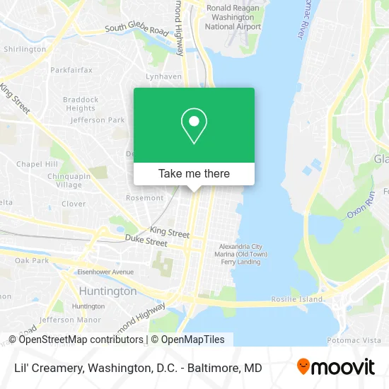
See Lil' Creamery, Alexandria, on the map
Public Transit to Lil' Creamery in Alexandria
Wondering how to get to Lil' Creamery in Alexandria? Moovit helps you find the best way to get to Lil' Creamery with step-by-step directions from the nearest public transit station.
Moovit provides free maps and live directions to help you navigate through your city. View schedules, routes, timetables, and find out how long does it take to get to Lil' Creamery in real time.
Looking for the nearest stop or station to Lil' Creamery? Check out this list of stops closest to your destination: Madison St + N Henry St; Pendleton St & Henry St; First St + N Fayette St; Potomac Yard; Alexandria.
Bus: 30, 31, A12, A1X, A11.Train: MANASSAS LINE, PALMETTO, CARDINAL, CAROLINIAN, CRESCENT, FLORIDIAN, NORTHEAST REGIONAL.Metro: BLUE, YELLOW.
Want to see if there’s another route that gets you there at an earlier time? Moovit helps you find alternative routes or times. Get directions from and directions to Lil' Creamery easily from the Moovit App or Website.
We make riding to Lil' Creamery easy, which is why over 1.5 million users, including users in Alexandria, trust Moovit as the best app for public transit. You don’t need to download an individual bus app or train app, Moovit is your all-in-one transit app that helps you find the best bus time or train time available.
For information on prices of bus, metro and train, costs and ride fares to Lil' Creamery, please check the Moovit app.
Use the app to navigate to popular places including to the airport, hospital, stadium, grocery store, mall, coffee shop, school, college, and university.
Lil' Creamery Address: 1014 Madison St Alexandria, VA 22314 street in Alexandria
- Madison Street Tattoo,
- Ben Nielsen's Alexandria Auto Care,
- R&H Appliance Repairs,
- Marshall High School,
- The Dalton Apartments,
- Wood's Home Services,
- Post Office,
- John Adams Playground,
- EV Charging Station,
- Educational Consulting Services,
- Alexandria Black History Museum,
- Comcast,
- Appliance Repair Alexandria VA,
- 913 Parker Gray School Way Alexandria VA,
- Braddock Road Metro, Virginia,
- Center for Human Capital,
- Canal Center Plaza Shuttle,
- 1200 First St Garage,
- National Arts Strategies,
- Ernest
Places Near Lil' Creamery (Alexandria)
- Museum Of The Bible, Washington,
- Westfield Montgomery Mall, Montgomery County,
- Marriott Marquis Washington, DC, Washington,
- The Anthem, Washington,
- Washington National Cathedral, Washington,
- Warner Theatre, Washington,
- Georgetown, Washington,
- Camden Yards, Baltimore,
- M&T Bank Stadium, Baltimore,
- National Theatre, Washington,
- National Zoo, Washington,
- Basilica of the National Shrine, Washington,
- National Museum of African American History and Culture, Washington,
- Washington DC VA Medical Center, Washington,
- Capital One Arena, Washington,
- Pennsylvania Ave NW (3rd st and pennsylvania), Washington,
- Amazon Hq2, Arlington County,
- PG Mall, Prince George's County,
- Sibley Memorial Hospital, Washington,
- Rock Creek Tennis Center, Washington
How to get to popular places in Washington, D.C. - Baltimore, MD with public transit
Get around Alexandria by public transit!
Traveling around Alexandria has never been so easy. See step by step directions as you travel to any attraction, street or major public transit station. View bus and train schedules, arrival times, service alerts and detailed routes on a map, so you know exactly how to get to anywhere in Alexandria.
When traveling to any destination around Alexandria use Moovit's Live Directions with Get Off Notifications to know exactly where and how far to walk, how long to wait for your line, and how many stops are left. Moovit will alert you when it's time to get off — no need to constantly re-check whether yours is the next stop.
Wondering how to use public transit in Alexandria or how to pay for public transit in Alexandria? Moovit public transit app can help you navigate your way with public transit easily, and at minimum cost. It includes public transit fees, ticket prices, and costs. Looking for a map of Alexandria public transit lines? Moovit public transit app shows all public transit maps in Alexandria with all Bus, Train, Metro, Light Rail and Ferry routes and stops on an interactive map.
Washington, D.C. - Baltimore, MD has 5 transit type(s), including: Bus, Train, Metro, Light Rail and Ferry, operated by several transit agencies, including WMATA, Montgomery County Ride On, Fairfax Connector, TheBus, PRTC, DASH - Alexandria, Arlington Transit (ART), RTA of Central Maryland, MDOT MTA, MDOT MTA Light RailLink, MDOT MTA Commuter Bus, MDOT MTA Local Bus, FXBGO!, Virginia Railway Express (VRE) and MARC