How to get to Lilly Architects - Tulsa Ok by bus?
Click on the bus route to see step by step directions with maps, line arrival times and updated time schedules.
From Dollar Rent A Car
46 minFrom Champions at Owen Elementary School
44 minFrom Del Rio Auto Sales
41 minFrom Security Checkpoint
46 minFrom FedEx
45 minFrom Tulsa Spca (Tulsa Spay & Neuter Clinic)
51 minFrom 21st & Memorial
53 minFrom WESTERN UNION
47 minFrom Lewis & 51st St S (S Lewis Ave&E 51nd St S)
60 minFrom Green Country Marketplace
48 min
Bus stops near Lilly Architects - Tulsa Ok
Bus lines to Lilly Architects - Tulsa Ok
What are the closest stations to Lilly Architects - Tulsa Ok?
The closest stations to Lilly Architects - Tulsa Ok are:
- (7467) Archer St & Main St Wb is 184 yards away, 3 min walk.
- (0157) N Denver Ave & W Archer Nb is 279 yards away, 4 min walk.
- (8389) 1st St & Boston Ave Wb is 583 yards away, 8 min walk.
- (7012) 1st St & Cincinnati Ave Wb is 1036 yards away, 13 min walk.
Which bus lines stop near Lilly Architects - Tulsa Ok?
These bus lines stop near Lilly Architects - Tulsa Ok: 117, 140, 150, 201, 250, 700.
What’s the nearest bus station to Lilly Architects - Tulsa Ok?
The nearest bus station to Lilly Architects - Tulsa Ok is (7467) Archer St & Main St Wb. It’s a 3 min walk away.
What time is the first bus to Lilly Architects - Tulsa Ok?
The 110 is the first bus that goes to Lilly Architects - Tulsa Ok. It stops nearby at 5:32 AM.
What time is the last bus to Lilly Architects - Tulsa Ok?
The 700 is the last bus that goes to Lilly Architects - Tulsa Ok. It stops nearby at 10:09 PM.
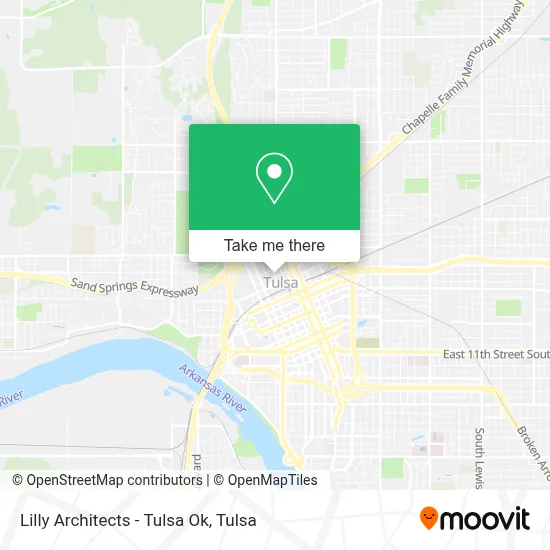
See Lilly Architects - Tulsa Ok on the map
Public Transportation to Lilly Architects - Tulsa Ok
Wondering how to get to Lilly Architects - Tulsa Ok? Moovit helps you find the best way to get to Lilly Architects - Tulsa Ok with step-by-step directions from the nearest public transit station.
Moovit provides free maps and live directions to help you navigate through your city. View schedules, routes, timetables, and find out how long does it take to get to Lilly Architects - Tulsa Ok in real time.
Looking for the nearest stop or station to Lilly Architects - Tulsa Ok? Check out this list of stops closest to your destination: (7467) Archer St & Main St Wb; (0157) N Denver Ave & W Archer Nb; (8389) 1st St & Boston Ave Wb; (7012) 1st St & Cincinnati Ave Wb.
Bus: 117, 140, 150, 201, 250, 700, 110, 130, 900.
Want to see if there’s another route that gets you there at an earlier time? Moovit helps you find alternative routes or times. Get directions from and directions to Lilly Architects - Tulsa Ok easily from the Moovit App or Website.
We make riding to Lilly Architects - Tulsa Ok easy, which is why over 1.5 million users, including users in Tulsa, trust Moovit as the best app for public transit. You don’t need to download an individual bus app or train app, Moovit is your all-in-one transit app that helps you find the best bus time or train time available.
For information on prices of bus, costs and ride fares to Lilly Architects - Tulsa Ok, please check the Moovit app.
Use the app to navigate to popular places including to the airport, hospital, stadium, grocery store, mall, coffee shop, school, college, and university.
Lilly Architects - Tulsa Ok Address: 203 N Main St Ste 213 street in Tulsa
- Chrysalis Salon (Chrysalis Spa),
- The Canopy,
- Energy Reclamation,
- Brady Artists Studio,
- The Lounge (Bull in the Alley),
- Hansonbrosbeer,
- Misfit Kitchen,
- Kilpatrick Bail Bonds,
- Wick & Flame Candle Bar,
- Boston Apartment Hotel Established 1928,
- Cabin Boys,
- Rate,
- Kevin Adams - State and Federal Criminal Defense,
- Restaurant Basque,
- Asemio,
- Archer Nail Bar,
- Tulsa Arts District,
- Brady Halloween Party,
- Atlantico Miramar Fl,
- Ariane Betancourt
Places Near Lilly Architects - Tulsa Ok
- Woodland Hills Mall, Tulsa,
- Alagon Spa (Olympus Spa), Tulsa,
- River Spirit Casino, Tulsa,
- Saint Francis Hospital, Tulsa,
- Tulsa State Fair, Tulsa,
- Broken Arrow, OK, Broken Arrow,
- Tulsa Ok, Tulsa,
- 71st & Memorial, Tulsa,
- St Francis South Cardinal Building, Tulsa,
- Plaza Santa Cecilia, Tulsa,
- Amazon Fulfillment Center-TUL2, Tulsa,
- S Garnett Rd / E 21st St, Tulsa,
- Hard Rock Casino, Tulsa,
- St. Francis Hospital Outpatient Infusion, Tulsa,
- Bixby, OK, Bixby,
- Walmart, Tulsa,
- Tulsa Zoo, Tulsa,
- Osage Casino, Tulsa,
- Fallout Shelter, Tulsa,
- Zavala Plus, Tulsa
How to get to popular places in Tulsa with public transit
Get around Tulsa by public transit!
Traveling around Tulsa has never been so easy. See step by step directions as you travel to any attraction, street or major public transit station. View bus and train schedules, arrival times, service alerts and detailed routes on a map, so you know exactly how to get to anywhere in Tulsa.
When traveling to any destination around Tulsa use Moovit's Live Directions with Get Off Notifications to know exactly where and how far to walk, how long to wait for your line, and how many stops are left. Moovit will alert you when it's time to get off — no need to constantly re-check whether yours is the next stop.
Wondering how to use public transit in Tulsa or how to pay for public transit in Tulsa? Moovit public transit app can help you navigate your way with public transit easily, and at minimum cost. It includes public transit fees, ticket prices, and costs. Looking for a map of Tulsa public transit lines? Moovit public transit app shows all public transit maps in Tulsa with all bus routes and stops on an interactive map.
Tulsa has 1 transit type(s), including: bus, operated by several transit agencies, including MetroLink Tulsa and Greyhound-us