How to get to Line'Cl by bus?
Click on the bus route to see step by step directions with maps, line arrival times and updated time schedules.
From Aquamoovprunay, Prunay
62 minFrom Spirit S Art, Sillery
39 minFrom Cuisinella, Reims
31 minFrom Parc D'Affaire Reims Champigny, Champigny
43 minFrom Relais Nautique, Sillery
36 minFrom Gare de Champagne Ardenne TGV, Bezannes
37 minFrom Girardin, Prunay
58 minFrom Le Relais de, Sillery
45 minFrom Bistrot de la Gare, Prunay
59 minFrom Thillois, Thillois
50 min
Bus stops near Line'Cl in Reims
Light Rail stations near Line'Cl in Reims
- Courlancy, 7 min walk,VIEW
Bus lines to Line'Cl in Reims
- C, Gare Centre,VIEW
- E5, Cathedrale,VIEW
- E2, St-Etienne/Sui.,VIEW
- E3, Saint-Symphorien,VIEW
- E4, Betheniville,VIEW
- U1, C.C. Cernay,VIEW
- O1, Moulin Housse,VIEW
- U8, La Couturelle,VIEW
- U9, C.C. Cormontreuil,VIEW
- 23, Royale,VIEW
- U2, Route De Witry,VIEW
- U3, Maurencienne,VIEW
- 22, Royale,VIEW
- 20, Fac Des Sciences,VIEW
- U4, Orgeval,VIEW
What are the closest stations to Line'Cl?
The closest stations to Line'Cl are:
- Cathedrale is 434 meters away, 6 min walk.
- Courlancy is 495 meters away, 7 min walk.
- Saint-Symphorien is 496 meters away, 7 min walk.
- Jamot is 516 meters away, 7 min walk.
- Etape is 551 meters away, 8 min walk.
- Saint-Andre is 633 meters away, 9 min walk.
- Royale is 806 meters away, 11 min walk.
- Porte De Mars is 939 meters away, 13 min walk.
Which bus lines stop near Line'Cl?
These bus lines stop near Line'Cl: E5, U2, U8.
Which light rail line stops near Line'Cl?
TRAM (Neufchatel)
What’s the nearest light rail station to Line'Cl in Reims?
The nearest light rail station to Line'Cl in Reims is Courlancy. It’s a 7 min walk away.
What’s the nearest bus station to Line'Cl in Reims?
The nearest bus station to Line'Cl in Reims is Cathedrale. It’s a 6 min walk away.
What time is the first light rail to Line'Cl in Reims?
The TRAM is the first light rail that goes to Line'Cl in Reims. It stops nearby at 5:14 AM.
What time is the last light rail to Line'Cl in Reims?
The TRAM is the last light rail that goes to Line'Cl in Reims. It stops nearby at 12:57 AM.
What time is the first bus to Line'Cl in Reims?
The U9 is the first bus that goes to Line'Cl in Reims. It stops nearby at 5:22 AM.
What time is the last bus to Line'Cl in Reims?
The U2 is the last bus that goes to Line'Cl in Reims. It stops nearby at 12:46 AM.
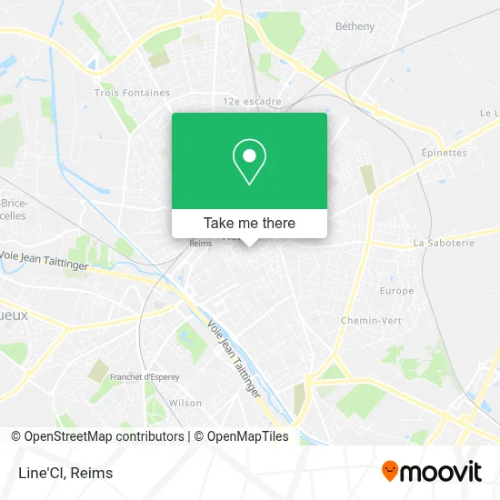
See Line'Cl, Reims, on the map
Public Transit to Line'Cl in Reims
Wondering how to get to Line'Cl in Reims? Moovit helps you find the best way to get to Line'Cl with step-by-step directions from the nearest public transit station.
Moovit provides free maps and live directions to help you navigate through your city. View schedules, routes, timetables, and find out how long does it take to get to Line'Cl in real time.
Looking for the nearest stop or station to Line'Cl? Check out this list of stops closest to your destination: Cathedrale; Courlancy; Saint-Symphorien; Jamot; Etape; Saint-Andre; Royale; Porte De Mars.
Bus: E5, U2, U8, C, E2, E3, E4, U1, O1, U9, 23, U3, 22.Light Rail: TRAM.
Want to see if there’s another route that gets you there at an earlier time? Moovit helps you find alternative routes or times. Get directions from and directions to Line'Cl easily from the Moovit App or Website.
We make riding to Line'Cl easy, which is why over 1.5 million users, including users in Reims, trust Moovit as the best app for public transit. You don’t need to download an individual bus app or train app, Moovit is your all-in-one transit app that helps you find the best bus time or train time available.
For information on prices of bus and light rail, costs and ride fares to Line'Cl, please check the Moovit app.
Use the app to navigate to popular places including to the airport, hospital, stadium, grocery store, mall, coffee shop, school, college, and university.
Line'Cl Address: Place du Forum street in Reims
- Musée Le Vergeur,
- Fontaine Place Du Forum,
- Salon Du Forum,
- Parking Forum Élus,
- Blp Architectes,
- Mistigriff,
- La Poste,
- Dr. Lallemand Helen,
- Ma3j,
- Picadeli, Bar à Salades,
- Dr. Mauprivez Arnaud,
- Studio Photo Louisemary,
- Bossa,
- King's Lobster,
- Mister Hot Dog,
- Mme Barbosa Juliana,
- Kinh Boutik,
- Cuivre,
- Groupe d'Études Archéologiques Champagne-Ardennes (Geaca) à Reims,
- Ogf
Places Near Line'Cl (Reims)
- Parc Des Expositions, Reims,
- Tinqueux, Tinqueux,
- CHU, Reims,
- Bétheny, Bétheny,
- Ikea, Thillois,
- Moulin De La Housse, Reims,
- Hôpital Maison Blanche, Reims,
- Hôpital Debré, Reims,
- Gare Tgv, Bezannes,
- La Neuvillette, Reims,
- Campus Croix Rouge, Reims,
- Bezannes, Bezannes,
- Leclerc, Saint-Brice-Courcelles,
- Cormontreuil, Reims,
- Croix Blandin, Reims,
- St Remi, Reims,
- Carrefour, Tinqueux,
- E. Leclerc Champfleury, Champfleury,
- Parc de Champagne, Reims,
- Polyclinique Reims Bezannes, Bezannes
How to get to popular places in Reims with public transit
Get around Reims by public transit!
Traveling around Reims has never been so easy. See step by step directions as you travel to any attraction, street or major public transit station. View bus and train schedules, arrival times, service alerts and detailed routes on a map, so you know exactly how to get to anywhere in Reims.
When traveling to any destination around Reims use Moovit's Live Directions with Get Off Notifications to know exactly where and how far to walk, how long to wait for your line, and how many stops are left. Moovit will alert you when it's time to get off — no need to constantly re-check whether yours is the next stop.
Wondering how to use public transit in Reims or how to pay for public transit in Reims? Moovit public transit app can help you navigate your way with public transit easily, and at minimum cost. It includes public transit fees, ticket prices, and costs. Looking for a map of Reims public transit lines? Moovit public transit app shows all public transit maps in Reims with all Bus and Light Rail routes and stops on an interactive map.
Reims has 2 transit type(s), including: Bus and Light Rail, operated by several transit agencies, including Transdev Reims