Directions to Line Services (Tatuquara) with public transportation
The following transit lines have routes that pass near Line Services
How to get to Line Services by bus?
Click on the bus route to see step by step directions with maps, line arrival times and updated time schedules.
From Rua Paulo Setúbal, Boqueirão
54 minFrom Rua Nova Aurora, Sítio Cercado
38 minFrom Rua Waldemar Loureiro Campos, Boqueirão
50 minFrom Rua Tenente Sandro Luiz Kampa 182, Fazenda Rio Grande
44 minFrom UniCesumar - Campus Curitiba, Portão
51 minFrom Avenida Presidente Kennedy 4121, Portão
46 minFrom Novo Mundo, Novo Mundo
33 minFrom Rua Eduardo Pinto da Rocha, Sítio Cercado
58 minFrom Avenida Das Araucarias, Fazenda Rio Grande
56 minFrom Campo Comprido, Campo Comprido
49 min
Bus stops near Line Services in Tatuquara
Bus lines to Line Services in Tatuquara
- X37 SANTA RITA / PINHEIRINHO (SEMI-DIRETO), Santa Rita (Av. Pero Vaz Caminha) → Terminal Pinheirinho,VIEW
- 619 SANTA RITA / CIC, Terminal Tatuquara → Terminal CIC,VIEW
- 650 SANTA RITA / PINHEIRINHO, Terminal Pinheirinho → Terminal Tatuquara,VIEW
- 679 MAD. TATUQUARA, Terminal Pinheirinho ↺ Tatuquara (Circular),VIEW
- 685 RIO BONITO / CIC, Terminal CIC → Rio Bonito,VIEW
- 707 TATUQUARA / CENTRO, Praça Rui Barbosa → Terminal Tatuquara,VIEW
- 773 VIZINHANÇA / SANTA RITA, Terminal CIC → Terminal Tatuquara,VIEW
- 655 JARDIM DA ORDEM, Jardim da Ordem → Terminal Pinheirinho,VIEW
What are the closest stations to Line Services?
The closest stations to Line Services are:
- R. Jovenilson Américo de Oliveira, 116 is 6 meters away, 1 min walk.
- Rua Ernesto Germano Francisco Hannemann, 390 is 256 meters away, 4 min walk.
Which bus lines stop near Line Services?
These bus lines stop near Line Services: 650 SANTA RITA / PINHEIRINHO, 685 RIO BONITO / CIC, 707 TATUQUARA / CENTRO.
What’s the nearest bus station to Line Services in Tatuquara?
The nearest bus station to Line Services in Tatuquara is R. Jovenilson Américo de Oliveira, 116. It’s a 1 min walk away.
What time is the first bus to Line Services in Tatuquara?
The 679 MAD. TATUQUARA is the first bus that goes to Line Services in Tatuquara. It stops nearby at 3:20 AM.
What time is the last bus to Line Services in Tatuquara?
The 679 MAD. TATUQUARA is the last bus that goes to Line Services in Tatuquara. It stops nearby at 1:49 AM.
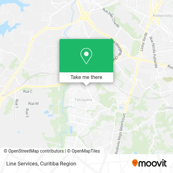
See Line Services, Tatuquara, on the map
Public Transit to Line Services in Tatuquara
Wondering how to get to Line Services in Tatuquara? Moovit helps you find the best way to get to Line Services with step-by-step directions from the nearest public transit station.
Moovit provides free maps and live directions to help you navigate through your city. View schedules, routes, timetables, and find out how long does it take to get to Line Services in real time.
Looking for the nearest stop or station to Line Services? Check out this list of stops closest to your destination: R. Jovenilson Américo de Oliveira; Rua Ernesto Germano Francisco Hannemann.
Bus: 650 SANTA RITA / PINHEIRINHO, 685 RIO BONITO / CIC, 707 TATUQUARA / CENTRO, X37 SANTA RITA / PINHEIRINHO (SEMI-DIRETO), 619 SANTA RITA / CIC, 679 MAD. TATUQUARA, 655 JARDIM DA ORDEM.
Want to see if there’s another route that gets you there at an earlier time? Moovit helps you find alternative routes or times. Get directions from and directions to Line Services easily from the Moovit App or Website.
We make riding to Line Services easy, which is why over 1.5 million users, including users in Tatuquara, trust Moovit as the best app for public transit. You don’t need to download an individual bus app or train app, Moovit is your all-in-one transit app that helps you find the best bus time or train time available.
For information on prices of bus, costs and ride fares to Line Services, please check the Moovit app.
Use the app to navigate to popular places including to the airport, hospital, stadium, grocery store, mall, coffee shop, school, college, and university.
Line Services Address: Rua Jovenilson Américo de Oliveira, 116 Tatuquara Curitiba-PR 81480-230 street in Tatuquara
- Mk7 Comercio de Veículos,
- Rua Jovenilson Américo de Oliveira, 116 - Tatuquara,
- auto escola comando,
- Vermeio Moto Peça,
- C. E. Guilherme A. Maranhão,
- Apm da Escola Est. Jardim da Ordem,
- Colegio Est Desembargador Guilherme de Albuquerque Maranhao,
- Auto Stilo Car,
- Auto Estilo Veiculos,
- E-Sindico - Administracao de Condominios e Servicos,
- Rua Jovenilson Américo de Oliveira,
- Unidade De Saúde Moradias Da Ordem - Ubs,
- Ljap Montagem de Vidros,
- MG Cell,
- Cleverson Mari,
- Little Cosmeticos,
- Whs Consultorias, Treinamentos e Auditorias,
- Coimpa Comercial Imobiliária Paranaense Ltda,
- Escola Municipal Dona Pompilia,
- Rua Tenente Antônio Emílio Vaz Lobo
Places Near Line Services (Tatuquara)
- Campo Largo, Campo,
- Shopping Estação, Rebouças,
- Hhhhh, Fazendinha,
- Hospital Universitário Evangélico de Curitiba, Bigorrilho,
- Shopping Palladium, Portão,
- Hospital Madalena Sofia, Bairro Alto,
- Hospital de Clínicas (HC - UFPR), Centro,
- Hospital Da Cruz Vermelha, Batel,
- Parque Barigui, Mercês,
- Jockey Plaza Shopping Center, Tarumã,
- Hospital Erasto Gaertner, Jardim Das Américas,
- Pontifícia Universidade Católica do Paraná (PUCPR), Prado Velho,
- Hospital do Rocio, Campo,
- Hospital Nossa Senhora Das Graças, Mercês,
- Rua General Mário Tourinho, Campina Do Siqueira,
- Rua Martim Afonso 558, Mercês,
- Jardim Botânico de Curitiba PR, Centro,
- Hospital Angelina Caron, Campina Grande Do Sul,
- Park Shopping Barigüi, Mossunguê,
- Arena Da Baixada - Curitiba
How to get to popular places in Curitiba Region with public transit
Get around Tatuquara by public transit!
Traveling around Tatuquara has never been so easy. See step by step directions as you travel to any attraction, street or major public transit station. View bus and train schedules, arrival times, service alerts and detailed routes on a map, so you know exactly how to get to anywhere in Tatuquara.
When traveling to any destination around Tatuquara use Moovit's Live Directions with Get Off Notifications to know exactly where and how far to walk, how long to wait for your line, and how many stops are left. Moovit will alert you when it's time to get off — no need to constantly re-check whether yours is the next stop.
Wondering how to use public transit in Tatuquara or how to pay for public transit in Tatuquara? Moovit public transit app can help you navigate your way with public transit easily, and at minimum cost. It includes public transit fees, ticket prices, and costs. Looking for a map of Tatuquara public transit lines? Moovit public transit app shows all public transit maps in Tatuquara with all Bus and Cable Car routes and stops on an interactive map.
Curitiba Region has 2 transit type(s), including: Bus and Cable Car, operated by several transit agencies, including Sistema Integrado de Mobilidade (URBS), Sistema Integrado de Mobilidade (AMEP), URBS (Cartões bancários e Dinheiro), URBS (Cartões bancários / Cartão URBS), AMEP (Cartões bancários / Cartão MetroCard), AMEP (Cartões bancários / Cartão MetroCard / Dinheiro), Viação Colombo (Dinheiro), TRIAR (Cartão TRIAR / Dinheiro), Empresa Curitiba Cerro Azul (Dinheiro), Expresso Nossa Senhora da Penha (Dinheiro), Empresa Campo Alto Tijucas (Dinheiro), Auto Viação São José (Cartão VEM / Dinheiro), BRT S/A (Cartão VEM / Dinheiro), TransPiedade (Cartão Cidadão / Dinheiro) and Oceânica Sul (Cartão Transporte / Dinheiro)