How to get to Line 112 Longoni -> L.go Preneste by bus?
Click on the bus route to see step by step directions with maps, line arrival times and updated time schedules.
From Basilica of Saint Paul Outside the Walls (Abbey of Saint Paul Outside the Walls), Roma
76 minFrom New Villa Claudia Clinic, Roma
90 minFrom Trastevere, Roma
64 minFrom Castelli Romani, Roma
76 minFrom San Paolo Outside the Walls, Roma
75 minFrom Basilica of Saint Paul Outside the Walls, Roma
76 minFrom Church of Jesus, Roma
63 minFrom Colony Hotel, Roma
87 minFrom S.Anna Hospital - ASL Roma A, Roma
59 min
How to get to Line 112 Longoni -> L.go Preneste by train?
Click on the train route to see step by step directions with maps, line arrival times and updated time schedules.
How to get to Line 112 Longoni -> L.go Preneste by metro?
Click on the metro route to see step by step directions with maps, line arrival times and updated time schedules.
From Basilica of Saint Paul Outside the Walls (Abbey of Saint Paul Outside the Walls), Roma
73 minFrom Trastevere, Roma
78 minFrom Castelli Romani, Roma
61 minFrom San Paolo Outside the Walls, Roma
73 minFrom Basilica of Saint Paul Outside the Walls, Roma
73 minFrom Church of Jesus, Roma
73 minFrom S.Anna Hospital - ASL Roma A, Roma
72 min
Bus stops near Line 112 Longoni -> L.go Preneste in Roma
Train station near Line 112 Longoni -> L.go Preneste in Roma
- Serenissima, 10 min walk,VIEW
Metro station near Line 112 Longoni -> L.go Preneste in Roma
- Ponte Mammolo, 36 min walk,VIEW
Bus lines to Line 112 Longoni -> L.go Preneste in Roma
- 437, Rebibbia (Metro B),VIEW
- 058, Ponte Mammolo (Metro B),VIEW
- 075, Tonino Bello,VIEW
- 541, Fillia,VIEW
- 543, Vertunni/Salcito (FL2),VIEW
- N543, Vertunni,VIEW
- 309, Santa Maria Del Soccorso (MB),VIEW
- 319, Balsamo Crivelli,VIEW
- 450, Monti Tiburtini/Pertini (H),VIEW
- 451, Ponte Mammolo (Metro B),VIEW
- 508, Mondavio,VIEW
- N041, Alba Adriatica/Barisciano,VIEW
What are the closest stations to Line 112 Longoni -> L.go Preneste?
The closest stations to Line 112 Longoni -> L.go Preneste are:
- Salviati is 605 meters away, 9 min walk.
- Serenissima is 734 meters away, 10 min walk.
- Collatina/Appiani is 1099 meters away, 15 min walk.
- Collatina/Martora is 1160 meters away, 16 min walk.
- Franceschini/Zanardi is 1193 meters away, 16 min walk.
- Togliatti/Station (Fl2) is 1372 meters away, 19 min walk.
- Sacco E Vanzetti/Niccolai is 1670 meters away, 22 min walk.
- Ponte Mammolo is 2773 meters away, 36 min walk.
Which bus lines stop near Line 112 Longoni -> L.go Preneste?
These bus lines stop near Line 112 Longoni -> L.go Preneste: 075, 150F, 309, 437, 541.
Which train line stops near Line 112 Longoni -> L.go Preneste?
FL2 (Tivoli)
Which metro line stops near Line 112 Longoni -> L.go Preneste?
B (Rebibbia/Jonio)
What’s the nearest train station to Line 112 Longoni -> L.go Preneste in Roma?
The nearest train station to Line 112 Longoni -> L.go Preneste in Roma is Serenissima. It’s a 10 min walk away.
What’s the nearest bus station to Line 112 Longoni -> L.go Preneste in Roma?
The nearest bus station to Line 112 Longoni -> L.go Preneste in Roma is Salviati. It’s a 9 min walk away.
What time is the first metro to Line 112 Longoni -> L.go Preneste in Roma?
The B is the first metro that goes to Line 112 Longoni -> L.go Preneste in Roma. It stops nearby at 5:31 AM.
What time is the last metro to Line 112 Longoni -> L.go Preneste in Roma?
The B is the last metro that goes to Line 112 Longoni -> L.go Preneste in Roma. It stops nearby at 2:04 AM.
What time is the first train to Line 112 Longoni -> L.go Preneste in Roma?
The FL2 is the first train that goes to Line 112 Longoni -> L.go Preneste in Roma. It stops nearby at 6:33 AM.
What time is the last train to Line 112 Longoni -> L.go Preneste in Roma?
The FL2 is the last train that goes to Line 112 Longoni -> L.go Preneste in Roma. It stops nearby at 10:14 PM.
What time is the first bus to Line 112 Longoni -> L.go Preneste in Roma?
The N543 is the first bus that goes to Line 112 Longoni -> L.go Preneste in Roma. It stops nearby at 3:03 AM.
What time is the last bus to Line 112 Longoni -> L.go Preneste in Roma?
The N543 is the last bus that goes to Line 112 Longoni -> L.go Preneste in Roma. It stops nearby at 3:20 AM.
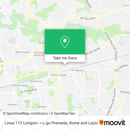
See Line 112 Longoni -> L.go Preneste, Roma, on the map
Public Transit to Line 112 Longoni -> L.go Preneste in Roma
Wondering how to get to Line 112 Longoni -> L.go Preneste in Roma? Moovit helps you find the best way to get to Line 112 Longoni -> L.go Preneste with step-by-step directions from the nearest public transit station.
Moovit provides free maps and live directions to help you navigate through your city. View schedules, routes, timetables, and find out how long does it take to get to Line 112 Longoni -> L.go Preneste in real time.
Looking for the nearest stop or station to Line 112 Longoni -> L.go Preneste? Check out this list of stops closest to your destination: Salviati; Serenissima; Collatina/Appiani; Collatina/Martora; Franceschini/Zanardi; Togliatti/Station (Fl2); Sacco E Vanzetti/Niccolai; Ponte Mammolo.
Bus: 075, 150F, 309, 437, 541, 058, 543, N543, 319, 450.Train: FL2, R, R.Metro: B.
Want to see if there’s another route that gets you there at an earlier time? Moovit helps you find alternative routes or times. Get directions from and directions to Line 112 Longoni -> L.go Preneste easily from the Moovit App or Website.
We make riding to Line 112 Longoni -> L.go Preneste easy, which is why over 1.5 million users, including users in Roma, trust Moovit as the best app for public transit. You don’t need to download an individual bus app or train app, Moovit is your all-in-one transit app that helps you find the best bus time or train time available.
For information on prices of bus, metro and train, costs and ride fares to Line 112 Longoni -> L.go Preneste, please check the Moovit app.
Use the app to navigate to popular places including to the airport, hospital, stadium, grocery store, mall, coffee shop, school, college, and university.
Location: Roma, Rome and Lazio
- Avezzano-Roma Termini Train,
- La Pampa Original Italian Steakhouse,
- A24,
- Police Headquarters-Immigration Office,
- Desigual,
- Rome Police Headquarters,
- Immigration Office,
- Rome Police Headquarters Immigration Office,
- Electrical Technologies by Saverio Pagnozzi,
- Salviati Street / Teofilo Patini Street,
- Profiles and Sheets,
- Cillichemie Italiana Srl - Rome Agency,
- A24 - Palmiro Togliatti Exit,
- Sommovigo Street Higher Education Institute,
- Public Schools Municipal Kindergarten,
- Police, Via Magnasco,
- SVM Vacations,
- Ciesse,
- Flying Tiger Copenhagen,
- Collatina Street / Palmiro Togliatti Avenue
Places Near Line 112 Longoni -> L.go Preneste (Roma)
- Casilino Polyclinic, Roma,
- Tiber Island, Roma,
- Roma Est Shopping Center, Roma,
- The Wow Side, Fiumicino,
- Olympic Stadium, Rome, Roma,
- Gravity, Roma,
- Cristo Re Hospital, Roma,
- Villa Borghese, Roma,
- Trastevere Quarter, Roma,
- Tor Vergata, Roma,
- Termini Station, Roma,
- IDI (Dermopatico Dell'Immacolata Institute), Roma,
- Auditorium Music Park, Roma,
- Coppedè Quarter, Roma,
- Santa Maria Maggiore, Roma,
- Gemelli Polyclinic, Roma,
- Sandro Pertini Hospital, Roma,
- Scuderie Del Quirinale, Roma,
- Paths, Roma,
- The Sail, Roma
How to get to popular places in Rome and Lazio with public transit
Get around Roma by public transit!
Traveling around Roma has never been so easy. See step by step directions as you travel to any attraction, street or major public transit station. View bus and train schedules, arrival times, service alerts and detailed routes on a map, so you know exactly how to get to anywhere in Roma.
When traveling to any destination around Roma use Moovit's Live Directions with Get Off Notifications to know exactly where and how far to walk, how long to wait for your line, and how many stops are left. Moovit will alert you when it's time to get off — no need to constantly re-check whether yours is the next stop.
Wondering how to use public transit in Roma or how to pay for public transit in Roma? Moovit public transit app can help you navigate your way with public transit easily, and at minimum cost. It includes public transit fees, ticket prices, and costs. Looking for a map of Roma public transit lines? Moovit public transit app shows all public transit maps in Roma with all Bus, Train, Metro, Light Rail, Ferry, Funicular and Gondola routes and stops on an interactive map.
Rome and Lazio has 7 transit type(s), including: Bus, Train, Metro, Light Rail, Ferry, Funicular and Gondola, operated by several transit agencies, including ATAC, Cotral, Trenitalia, Troiani Transportation Services, BIS, ATR Mobility, Tuscia, Shuttle, Seatour, Troiani Bus Lines, CSC Mobility, Terravision, ATRAL, Tambus and Sitbus