How to get to Little Free Library by bus?
Click on the bus route to see step by step directions with maps, line arrival times and updated time schedules.
From Saint Sophia Greek Orthodox Cathedral, Washington
64 minFrom Embassy Row, Washington
67 minFrom Childrens Hospital, Washington
55 minFrom 1919 Connecticut Ave NW, Washington
56 minFrom Washington Hilton, Washington
56 minFrom The Churchill Hotel, Washington
55 minFrom Purple Patch Food and Drink, Washington
50 minFrom National Institutes of Health (NIH), Montgomery County
51 minFrom The Home Depot, Washington
84 minFrom British Embassy, Washington
70 min
How to get to Little Free Library by metro?
Click on the metro route to see step by step directions with maps, line arrival times and updated time schedules.
From Saint Sophia Greek Orthodox Cathedral, Washington
72 minFrom Embassy Row, Washington
68 minFrom Childrens Hospital, Washington
61 minFrom 1919 Connecticut Ave NW, Washington
61 minFrom Washington Hilton, Washington
60 minFrom The Churchill Hotel, Washington
59 minFrom Purple Patch Food and Drink, Washington
47 minFrom National Institutes of Health (NIH), Montgomery County
69 minFrom The Home Depot, Washington
45 minFrom British Embassy, Washington
70 min
Bus stops near Little Free Library in Montgomery County
Metro station near Little Free Library in Montgomery County
- Silver Spring, 22 min walk,VIEW
Train station near Little Free Library in Montgomery County
- Silver Spring Marc Wb, 24 min walk,VIEW
Bus lines to Little Free Library in Montgomery County
- 8, 8-Silver Spring-Wheaton,VIEW
- 9, 9-Silver Spring-Wheaton,VIEW
- 13, 13-Silver Spring-Takoma,VIEW
- 14, 14-Silver Spring-Takoma,VIEW
- 21, 21-Silver Spring-Briggs Chaney P&R,VIEW
- 22, 22-Silver Spring-Hillandale,VIEW
- M52, Colesville Rd-Burtonsville,VIEW
- M54, Colesville Rd-Greencastle,VIEW
- M20, North To Wheaton,VIEW
What are the closest stations to Little Free Library?
The closest stations to Little Free Library are:
- Colesville Rd & Silgo Creek Pkwy is 75 yards away, 2 min walk.
- Colesville Rd & Dale Dr is 253 yards away, 4 min walk.
- Georgia Av+Highland Dr is 860 yards away, 11 min walk.
- Silver Spring is 1823 yards away, 22 min walk.
- Silver Spring Marc Wb is 2013 yards away, 24 min walk.
Which bus lines stop near Little Free Library?
These bus lines stop near Little Free Library: 14, 9, M20, M54.
Which metro line stops near Little Free Library?
RED (Glenmont)
What’s the nearest metro station to Little Free Library in Montgomery County?
The nearest metro station to Little Free Library in Montgomery County is Silver Spring. It’s a 22 min walk away.
What’s the nearest train station to Little Free Library in Montgomery County?
The nearest train station to Little Free Library in Montgomery County is Silver Spring Marc Wb. It’s a 24 min walk away.
What’s the nearest bus station to Little Free Library in Montgomery County?
The nearest bus station to Little Free Library in Montgomery County is Colesville Rd & Silgo Creek Pkwy. It’s a 2 min walk away.
What time is the first metro to Little Free Library in Montgomery County?
The RED is the first metro that goes to Little Free Library in Montgomery County. It stops nearby at 5:07 AM.
What time is the last metro to Little Free Library in Montgomery County?
The RED is the last metro that goes to Little Free Library in Montgomery County. It stops nearby at 12:31 AM.
What time is the first train to Little Free Library in Montgomery County?
The MARC is the first train that goes to Little Free Library in Montgomery County. It stops nearby at 5:51 AM.
What time is the last train to Little Free Library in Montgomery County?
The MARC is the last train that goes to Little Free Library in Montgomery County. It stops nearby at 7:37 PM.
What time is the first bus to Little Free Library in Montgomery County?
The M20 is the first bus that goes to Little Free Library in Montgomery County. It stops nearby at 4:19 AM.
What time is the last bus to Little Free Library in Montgomery County?
The M20 is the last bus that goes to Little Free Library in Montgomery County. It stops nearby at 1:58 AM.
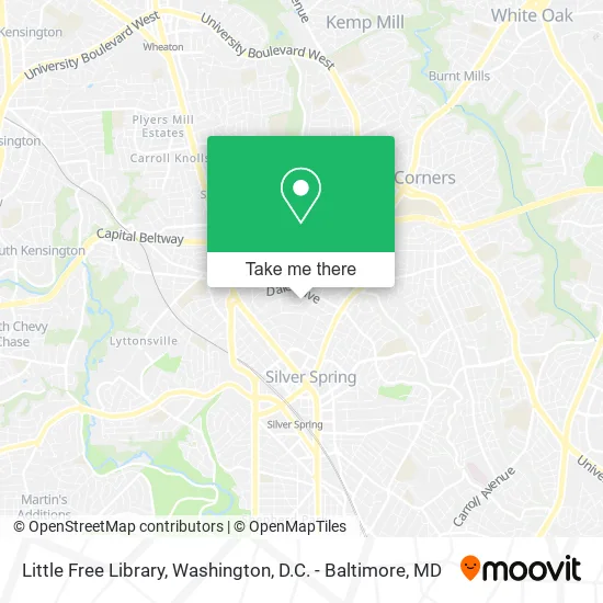
See Little Free Library, Montgomery County, on the map
Public Transit to Little Free Library in Montgomery County
Wondering how to get to Little Free Library in Montgomery County? Moovit helps you find the best way to get to Little Free Library with step-by-step directions from the nearest public transit station.
Moovit provides free maps and live directions to help you navigate through your city. View schedules, routes, timetables, and find out how long does it take to get to Little Free Library in real time.
Looking for the nearest stop or station to Little Free Library? Check out this list of stops closest to your destination: Colesville Rd & Silgo Creek Pkwy; Colesville Rd & Dale Dr; Georgia Av+Highland Dr; Silver Spring; Silver Spring Marc Wb.
Bus: 14, 9, M20, M54, 8, 13, 21, M52.Train: MARC.Metro: RED.
Want to see if there’s another route that gets you there at an earlier time? Moovit helps you find alternative routes or times. Get directions from and directions to Little Free Library easily from the Moovit App or Website.
We make riding to Little Free Library easy, which is why over 1.5 million users, including users in Montgomery County, trust Moovit as the best app for public transit. You don’t need to download an individual bus app or train app, Moovit is your all-in-one transit app that helps you find the best bus time or train time available.
For information on prices of bus and metro, costs and ride fares to Little Free Library, please check the Moovit app.
Use the app to navigate to popular places including to the airport, hospital, stadium, grocery store, mall, coffee shop, school, college, and university.
Little Free Library Address: 1200 Highland Dr Silver Spring, MD 20910 street in Montgomery County
- Moth Extermination,
- Herbers Jr, Jerome E MD,
- Unlimited Systems Engineering,
- Clement Dale Dr,
- Greensweep,
- Light Energy Technology,
- Wheaton Mall,
- Elizabeth Chomas Photography,
- DC Consumer Law Group PLLC,
- Meyer Tom & Sheryl Rabbi,
- Sligo Creek Park,
- Mulligan John,
- Skillful Physical Therapy,
- Zinnia,
- Prestige Carpet Cleaning Carpet Cleaning,
- The Tavern,
- Homer & Martha Gudelsky Foundation,
- Edible Arrangements,
- Maid Brigade,
- Housing Justice
Places Near Little Free Library (Montgomery County)
- Marriott Marquis Washington, DC, Washington,
- Pennsylvania Ave NW (3rd st and pennsylvania), Washington,
- Sibley Memorial Hospital, Washington,
- Museum Of The Bible, Washington,
- Georgetown, Washington,
- The Anthem, Washington,
- Amazon Hq2, Arlington County,
- Washington DC VA Medical Center, Washington,
- Basilica of the National Shrine, Washington,
- National Zoo, Washington,
- Camden Yards, Baltimore,
- Westfield Montgomery Mall, Montgomery County,
- National Mall, Washington,
- PG Mall, Prince George's County,
- National Museum of African American History and Culture, Washington,
- Rock Creek Tennis Center, Washington,
- Washington National Cathedral, Washington,
- M&T Bank Stadium, Baltimore,
- Capital One Arena, Washington,
- Warner Theatre, Washington
How to get to popular places in Washington, D.C. - Baltimore, MD with public transit
Get around Montgomery County by public transit!
Traveling around Montgomery County has never been so easy. See step by step directions as you travel to any attraction, street or major public transit station. View bus and train schedules, arrival times, service alerts and detailed routes on a map, so you know exactly how to get to anywhere in Montgomery County.
When traveling to any destination around Montgomery County use Moovit's Live Directions with Get Off Notifications to know exactly where and how far to walk, how long to wait for your line, and how many stops are left. Moovit will alert you when it's time to get off — no need to constantly re-check whether yours is the next stop.
Wondering how to use public transit in Montgomery County or how to pay for public transit in Montgomery County? Moovit public transit app can help you navigate your way with public transit easily, and at minimum cost. It includes public transit fees, ticket prices, and costs. Looking for a map of Montgomery County public transit lines? Moovit public transit app shows all public transit maps in Montgomery County with all Bus, Train, Metro, Light Rail and Ferry routes and stops on an interactive map.
Washington, D.C. - Baltimore, MD has 5 transit type(s), including: Bus, Train, Metro, Light Rail and Ferry, operated by several transit agencies, including WMATA, Montgomery County Ride On, Fairfax Connector, TheBus, PRTC, DASH - Alexandria, Arlington Transit (ART), RTA of Central Maryland, MDOT MTA, MDOT MTA Light RailLink, MDOT MTA Commuter Bus, MDOT MTA Local Bus, FXBGO!, Virginia Railway Express (VRE) and MARC