Directions to Live Thatch (Boston) with public transportation
The following transit lines have routes that pass near Live Thatch
 Bus: 1, SL4, SL5, 8, 15.
- Train: FRAMINGHAM/WORCESTER, NEEDHAM, FRANKLIN/FOXBORO, ORANGE LINE, PROVIDENCE/STOUGHTON.
- Subway: GREEN LINE E, ORANGE LINE.
How to get to Live Thatch by bus?
Click on the bus route to see step by step directions with maps, line arrival times and updated time schedules.
From Roadrunner, Boston
51 minFrom VA Hospital, Boston
54 minFrom Arsenal Mall, Watertown Town
54 minFrom Charlestown, Boston
58 minFrom Ac Hotel Cambridge, Cambridge
77 minFrom Malden, MA, Malden
90 minFrom Boda Borg, Malden
94 minFrom West Roxbury VA Medical Center, Boston
51 minFrom East Boston, Boston
61 minFrom Mount Ida College, Newton
84 min
How to get to Live Thatch by train?
Click on the train route to see step by step directions with maps, line arrival times and updated time schedules.
How to get to Live Thatch by subway?
Click on the subway route to see step by step directions with maps, line arrival times and updated time schedules.
Train station near Live Thatch in Boston
- Ruggles, 1 min walk,VIEW
Bus stops near Live Thatch in Boston
Subway station near Live Thatch in Boston
- Northeastern University, 7 min walk,VIEW
Bus lines to Live Thatch in Boston
- 8, Kenmore via South Bay Center - Harbor Point via South Bay Center,VIEW
- 15, Ruggles - Fields Corner,VIEW
- SL4, South Station - Nubian,VIEW
- SL5, Downtown - Nubian,VIEW
- 1, Nubian,VIEW
- 47, Broadway,VIEW
- 9, City Point,VIEW
- 171, Logan Airport Via Andrew,VIEW
- CT3, Avenue Louis Pasteur (Limited Stops),VIEW
- 19, Kenmore,VIEW
What are the closest stations to Live Thatch?
The closest stations to Live Thatch are:
- Ruggles is 62 yards away, 1 min walk.
- Washington St @ Massachusetts Ave is 107 yards away, 2 min walk.
- Massachusetts Ave @ Washington St is 115 yards away, 2 min walk.
- Harrison Ave @ Melnea Cass Blvd is 129 yards away, 2 min walk.
- Melnea Cass Blvd @ Harrison Ave is 164 yards away, 2 min walk.
- Melnea Cass Blvd @ Washington St is 376 yards away, 5 min walk.
- Northeastern University is 573 yards away, 7 min walk.
Which bus lines stop near Live Thatch?
These bus lines stop near Live Thatch: 1, SL4, SL5.
Which train lines stop near Live Thatch?
These train lines stop near Live Thatch: FRAMINGHAM/WORCESTER, NEEDHAM.
Which subway lines stop near Live Thatch?
These subway lines stop near Live Thatch: GREEN LINE E, ORANGE LINE.
What’s the nearest subway station to Live Thatch in Boston?
The nearest subway station to Live Thatch in Boston is Northeastern University. It’s a 7 min walk away.
What’s the nearest train station to Live Thatch in Boston?
The nearest train station to Live Thatch in Boston is Ruggles. It’s a 1 min walk away.
What’s the nearest bus station to Live Thatch in Boston?
The nearest bus stations to Live Thatch in Boston are Washington St @ Massachusetts Ave, Massachusetts Ave @ Washington St, Harrison Ave @ Melnea Cass Blvd and Melnea Cass Blvd @ Harrison Ave. The closest one is a 2 min walk away.
What time is the first subway to Live Thatch in Boston?
The GREEN LINE E is the first subway that goes to Live Thatch in Boston. It stops nearby at 5:16 AM.
What time is the last subway to Live Thatch in Boston?
The GREEN LINE E is the last subway that goes to Live Thatch in Boston. It stops nearby at 2:10 AM.
What time is the first train to Live Thatch in Boston?
The PROVIDENCE/STOUGHTON is the first train that goes to Live Thatch in Boston. It stops nearby at 4:28 AM.
What time is the last train to Live Thatch in Boston?
The PROVIDENCE/STOUGHTON is the last train that goes to Live Thatch in Boston. It stops nearby at 12:34 AM.
What time is the first bus to Live Thatch in Boston?
The 171 is the first bus that goes to Live Thatch in Boston. It stops nearby at 3:51 AM.
What time is the last bus to Live Thatch in Boston?
The 1 is the last bus that goes to Live Thatch in Boston. It stops nearby at 2:41 AM.
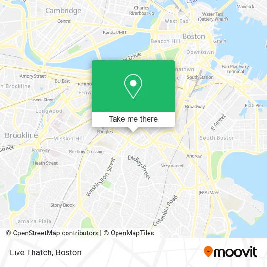
See Live Thatch, Boston, on the map
Public Transit to Live Thatch in Boston
Wondering how to get to Live Thatch in Boston? Moovit helps you find the best way to get to Live Thatch with step-by-step directions from the nearest public transit station.
Moovit provides free maps and live directions to help you navigate through your city. View schedules, routes, timetables, and find out how long does it take to get to Live Thatch in real time.
Looking for the nearest stop or station to Live Thatch? Check out this list of stops closest to your destination: Ruggles; Washington St @ Massachusetts Ave; Massachusetts Ave @ Washington St; Harrison Ave @ Melnea Cass Blvd; Melnea Cass Blvd @ Harrison Ave; Melnea Cass Blvd @ Washington St; Northeastern University.
Bus: 1, SL4, SL5, 8, 15, 47, 9, 171.Train: FRAMINGHAM/WORCESTER, NEEDHAM, FRANKLIN/FOXBORO, ORANGE LINE, PROVIDENCE/STOUGHTON.Subway: GREEN LINE E, ORANGE LINE.
Want to see if there’s another route that gets you there at an earlier time? Moovit helps you find alternative routes or times. Get directions from and directions to Live Thatch easily from the Moovit App or Website.
We make riding to Live Thatch easy, which is why over 1.7 million users, including users in Boston, trust Moovit as the best app for public transit. You don’t need to download an individual bus app or train app, Moovit is your all-in-one transit app that helps you find the best bus time or train time available.
For information on prices of bus, subway and train, costs and ride fares to Live Thatch, please check the Moovit app.
Use the app to navigate to popular places including to the airport, hospital, stadium, grocery store, mall, coffee shop, school, college, and university.
Live Thatch Address: 1904 Washington St street in Boston
- Michael L. Bivins Basketball Court,
- Washington St Electrical,
- Church Of St. Augustine & St. Martin,
- Residence Inn Boston Downtown South End,
- Lion of Juda,
- Libreria Cristina Oasis - Congregacion Leon de Juda,
- new hampshire!,
- MoneyGram,
- Residence Inn by Marriott,
- Residence Inn by Marriott Boston Downtown / South End,
- Alpha Immigrant Center,
- Rosie's Place,
- Northampton,
- E Springfield St & Washington St,
- Mike's City Diner (Mikes City Diner),
- Growth & DVLPT Boston Medical Center,
- Alice M Wang, MD,
- Juliana I Castedo, MD,
- Lauren C NG, PHD,
- Marisol Figueira, MD
Places Near Live Thatch (Boston)
- Isabella Stewart Gardner Museum, Boston,
- Wilbur Theatre, Boston,
- Td Garden, Boston,
- Faneuil Hall, Boston,
- Boston Medical Center, Boston,
- Massachusetts General Hospital, Boston,
- Museum Of Science, Boston,
- Seaport District, Boston,
- House Of Blues, Boston,
- North End, Boston,
- Quincy Market, Boston,
- Prudential Center, Boston,
- Wang Theater, Boston,
- Boston Common, Boston,
- Castle Island, Boston,
- Boston Convention & Exhibition Center, Boston,
- Mgm Music Hall, Boston,
- Leader Bank Pavilion (Leader Bank Pavillion), Boston,
- Boston Children's Hospital, Boston,
- Cheers, Boston
How to get to popular places in Boston with public transit
Get around Boston by public transit!
Traveling around Boston has never been so easy. See step by step directions as you travel to any attraction, street or major public transit station. View bus and train schedules, arrival times, service alerts and detailed routes on a map, so you know exactly how to get to anywhere in Boston.
When traveling to any destination around Boston use Moovit's Live Directions with Get Off Notifications to know exactly where and how far to walk, how long to wait for your line, and how many stops are left. Moovit will alert you when it's time to get off — no need to constantly re-check whether yours is the next stop.
Wondering how to use public transit in Boston or how to pay for public transit in Boston? Moovit public transit app can help you navigate your way with public transit easily, and at minimum cost. It includes public transit fees, ticket prices, and costs. Looking for a map of Boston public transit lines? Moovit public transit app shows all public transit maps in Boston with all Bus, Train, Subway and Ferry routes and stops on an interactive map.
Boston has 4 transit type(s), including: Bus, Train, Subway and Ferry, operated by several transit agencies, including MBTA, Southeastern Regional Transit Authority, MetroWest Regional Transit Authority, Rhode Island Public Transit Authority, WRTA, Lowell Regional Transit Authority, Merrimack Valley Transit, Montachusett Regional Transit Authority, Cape Cod Regional Transit Authority, Brockton Area Transit Authority, Martha's Vineyard Transit Authority, the WAVE - Nantucket Regional Transit Authority, GATRA, Cape Ann Transportation Authority and Massport