How to get to Lizard Label Co by bus?
Click on the bus route to see step by step directions with maps, line arrival times and updated time schedules.
From Community Coach 77 Bus Stop, Livingston
52 minFrom The Funplex, East Hanover
58 minFrom Saint Barnabas Medical Center, Livingston
96 minFrom Lakeland Bus Stop, Parsippany-Troy Hills
25 minFrom Parsippany, NJ, Parsippany-Troy Hills
61 minFrom Wayne, NJ, Wayne
70 minFrom Mountainside Hospital, Glen Ridge
58 minFrom Clifton, NJ, Clifton
111 minFrom West Orange, NJ, West Orange
53 minFrom MMNJ, Parsippany-Troy Hills
48 min
Bus stops near Lizard Label Co in Fairfield
Bus lines to Lizard Label Co in Fairfield
What are the closest stations to Lizard Label Co?
The closest stations to Lizard Label Co are:
- Us-46 at Clinton Rd is 960 yards away, 12 min walk.
- Us-46 at Lehigh Dr is 1118 yards away, 14 min walk.
Which bus lines stop near Lizard Label Co?
These bus lines stop near Lizard Label Co: 29, 71, 874.
What’s the nearest bus station to Lizard Label Co in Fairfield?
The nearest bus station to Lizard Label Co in Fairfield is Us-46 at Clinton Rd. It’s a 12 min walk away.
What time is the first bus to Lizard Label Co in Fairfield?
The 874 is the first bus that goes to Lizard Label Co in Fairfield. It stops nearby at 6:19 AM.
What time is the last bus to Lizard Label Co in Fairfield?
The 874 is the last bus that goes to Lizard Label Co in Fairfield. It stops nearby at 6:51 PM.
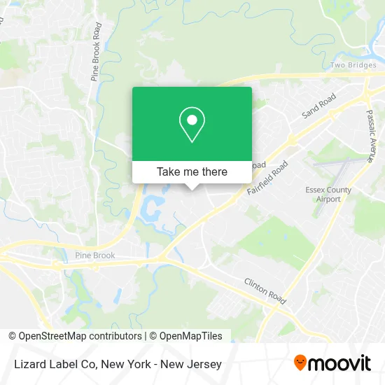
See Lizard Label Co, Fairfield, on the map
Public Transit to Lizard Label Co in Fairfield
Wondering how to get to Lizard Label Co in Fairfield? Moovit helps you find the best way to get to Lizard Label Co with step-by-step directions from the nearest public transit station.
Moovit provides free maps and live directions to help you navigate through your city. View schedules, routes, timetables, and find out how long does it take to get to Lizard Label Co in real time.
Looking for the nearest stop or station to Lizard Label Co? Check out this list of stops closest to your destination: Us-46 at Clinton Rd; Us-46 at Lehigh Dr.
Bus: 29, 71, 874.
Want to see if there’s another route that gets you there at an earlier time? Moovit helps you find alternative routes or times. Get directions from and directions to Lizard Label Co easily from the Moovit App or Website.
We make riding to Lizard Label Co easy, which is why over 1.5 million users, including users in Fairfield, trust Moovit as the best app for public transit. You don’t need to download an individual bus app or train app, Moovit is your all-in-one transit app that helps you find the best bus time or train time available.
For information on prices of bus, costs and ride fares to Lizard Label Co, please check the Moovit app.
Use the app to navigate to popular places including to the airport, hospital, stadium, grocery store, mall, coffee shop, school, college, and university.
Lizard Label Co Address: 10 Commerce Rd street in Fairfield
- Joe DS Appliances,
- Mjg Screen Printing & Embroidery,
- Fmd Distribution Llc,
- Joe D's Appliances,
- Lizard Label Co,
- Dara Food Us,
- Encore Energy Group,
- Nema Food,
- Sapphire Flavors & Fragrances,
- Nema Halal,
- General Doors,
- Fairfield Fire Hall Rental,
- Albau Aluminum & Glass System Llc,
- Freight Depot Center,
- Pcs Pump and Process,
- Bornstein Sons Inc,
- Adroit Global Usa,
- Plymouth St. Ballfield,
- Veseris,
- Caffe Borbone America
Places Near Lizard Label Co (Fairfield)
- Hudson Yards, Manhattan,
- Katz's Deli, Manhattan,
- Wall Street, Manhattan,
- qqqq, Manhattan,
- Chinatown, Manhattan,
- Pier 83, Manhattan,
- Times Square, Manhattan,
- Rockefeller Center, Manhattan,
- Mountainside Hospital, Glen Ridge,
- 26 Federal Plaza, Manhattan,
- Queens Center Mall, Queens,
- 111 Centre New York City Supreme Court, Manhattan,
- 911 Memorial, Manhattan,
- Bellevue Hospital, Manhattan,
- SoHo, Manhattan,
- 376 Hudson Street, Manhattan,
- San Gennaro Feast, Manhattan,
- 1 Police Plaza, Manhattan,
- 3 Stone St, Manhattan,
- 66 John Street, Manhattan
How to get to popular places in New York - New Jersey with public transit
Get around Fairfield by public transit!
Traveling around Fairfield has never been so easy. See step by step directions as you travel to any attraction, street or major public transit station. View bus and train schedules, arrival times, service alerts and detailed routes on a map, so you know exactly how to get to anywhere in Fairfield.
When traveling to any destination around Fairfield use Moovit's Live Directions with Get Off Notifications to know exactly where and how far to walk, how long to wait for your line, and how many stops are left. Moovit will alert you when it's time to get off — no need to constantly re-check whether yours is the next stop.
Wondering how to use public transit in Fairfield or how to pay for public transit in Fairfield? Moovit public transit app can help you navigate your way with public transit easily, and at minimum cost. It includes public transit fees, ticket prices, and costs. Looking for a map of Fairfield public transit lines? Moovit public transit app shows all public transit maps in Fairfield with all Bus, Train, Subway, Light Rail, Ferry and Cable Car routes and stops on an interactive map.
New York - New Jersey has 6 transit type(s), including: Bus, Train, Subway, Light Rail, Ferry and Cable Car, operated by several transit agencies, including MTA Subway, Metro-North Railroad, LIRR, PATH, MTA New York City Transit - Express routes, MTA Bus, NJ Transit, NYC Ferry, NICE bus, Bee-Line Bus, NJ Transit Rail, Norwalk Transit District, Hartford Line, River Valley Transit and HART