Bus stops near Local Print House in Harrisonburg
Bus lines to Local Print House in Harrisonburg
- Sharprite Sharpening Service,
- Hensley Paint and Wall Covering,
- Hometown Music,
- Mma Institute,
- Back Country Restaurant & Lounge,
- Mark's Bike Shop,
- Bluestone Bike & Run,
- Vibe Hookah Lounge,
- Tatyana's Custom Tailoring & Alterations,
- Tandori Kitchen,
- Bourbon Street Harrisonburg,
- DJ Maskell,
- Bombay Bistro & Tavern,
- Centro Cristiano Jehovanis Nisi,
- Iglesia Apostólica La Nueva Jerusalem,
- Shenandoah Valley Small Business Development Center,
- Southern Baptist Convention,
- Tacos El Primo,
- El Charro,
- S Main St & Miller Circle
Places Near Local Print House (Harrisonburg)
- Amazon Hq2, Arlington County,
- National Mall, Washington,
- M&T Bank Stadium, Baltimore,
- Capital One Arena, Washington,
- National Zoo, Washington,
- Sibley Memorial Hospital, Washington,
- Washington DC VA Medical Center, Washington,
- Camden Yards, Baltimore,
- Rock Creek Tennis Center, Washington,
- Westfield Montgomery Mall, Montgomery County,
- Museum Of The Bible, Washington,
- Marriott Marquis Washington, DC, Washington,
- Basilica of the National Shrine, Washington,
- Georgetown, Washington,
- Washington National Cathedral, Washington,
- PG Mall, Prince George's County,
- Warner Theatre, Washington,
- National Museum of African American History and Culture, Washington,
- Pennsylvania Ave NW (3rd st and pennsylvania), Washington,
- The Anthem, Washington
How to get to popular places in Washington, D.C. - Baltimore, MD with public transit
What are the closest stations to Local Print House?
The closest stations to Local Print House are:
- Central Ave. @ Laurel St. is 278 yards away, 4 min walk.
- South Main St. @ Rmh South Main Health Center is 309 yards away, 5 min walk.
- Pheasant Run (Shelter) is 732 yards away, 10 min walk.
Which bus line stops near Local Print House?
YELLOW (Godwin Transit Center)
What’s the nearest bus station to Local Print House in Harrisonburg?
The nearest bus station to Local Print House in Harrisonburg is Central Ave. @ Laurel St.. It’s a 4 min walk away.
What time is the first bus to Local Print House in Harrisonburg?
The 4 is the first bus that goes to Local Print House in Harrisonburg. It stops nearby at 6:36 AM.
What time is the last bus to Local Print House in Harrisonburg?
The 4-B is the last bus that goes to Local Print House in Harrisonburg. It stops nearby at 10:30 PM.
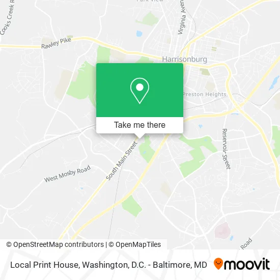
See Local Print House, Harrisonburg, on the map
Public Transit to Local Print House in Harrisonburg
Wondering how to get to Local Print House in Harrisonburg? Moovit helps you find the best way to get to Local Print House with step-by-step directions from the nearest public transit station.
Moovit provides free maps and live directions to help you navigate through your city. View schedules, routes, timetables, and find out how long does it take to get to Local Print House in real time.
Looking for the nearest stop or station to Local Print House? Check out this list of stops closest to your destination: Central Ave. @ Laurel St.; South Main St. @ Rmh South Main Health Center; Pheasant Run (Shelter).
Bus: YELLOW, 3, 3-B, EXT 3, 4, 4-B, EXT 4.
Want to see if there’s another route that gets you there at an earlier time? Moovit helps you find alternative routes or times. Get directions from and directions to Local Print House easily from the Moovit App or Website.
We make riding to Local Print House easy, which is why over 1.5 million users, including users in Harrisonburg, trust Moovit as the best app for public transit. You don’t need to download an individual bus app or train app, Moovit is your all-in-one transit app that helps you find the best bus time or train time available.
For information on prices of bus and train, costs and ride fares to Local Print House, please check the Moovit app.
Use the app to navigate to popular places including to the airport, hospital, stadium, grocery store, mall, coffee shop, school, college, and university.
Local Print House Address: 1592 S Main St Harrisonburg, VA 22801 street in Harrisonburg
Get around Harrisonburg by public transit!
Traveling around Harrisonburg has never been so easy. See step by step directions as you travel to any attraction, street or major public transit station. View bus and train schedules, arrival times, service alerts and detailed routes on a map, so you know exactly how to get to anywhere in Harrisonburg.
When traveling to any destination around Harrisonburg use Moovit's Live Directions with Get Off Notifications to know exactly where and how far to walk, how long to wait for your line, and how many stops are left. Moovit will alert you when it's time to get off — no need to constantly re-check whether yours is the next stop.
Wondering how to use public transit in Harrisonburg or how to pay for public transit in Harrisonburg? Moovit public transit app can help you navigate your way with public transit easily, and at minimum cost. It includes public transit fees, ticket prices, and costs. Looking for a map of Harrisonburg public transit lines? Moovit public transit app shows all public transit maps in Harrisonburg with all Bus, Train, Metro, Light Rail and Ferry routes and stops on an interactive map.
Washington, D.C. - Baltimore, MD has 5 transit type(s), including: Bus, Train, Metro, Light Rail and Ferry, operated by several transit agencies, including WMATA, Montgomery County Ride On, Fairfax Connector, TheBus, PRTC, DASH - Alexandria, Arlington Transit (ART), RTA of Central Maryland, MDOT MTA, MDOT MTA Light RailLink, MDOT MTA Commuter Bus, MDOT MTA Local Bus, FXBGO!, Virginia Railway Express (VRE) and MARC