How to get to Localiza by bus?
Click on the bus route to see step by step directions with maps, line arrival times and updated time schedules.
From Hospital Albert SCHWEITZER, Realengo
37 minFrom Guaratiba, Guaratiba
64 minFrom Praça 1º de Maio, Bangu
45 minFrom Policlínica Manoel Guilherme da Silveira Ap5.1, Bangu
40 minFrom Realengo, Realengo
51 minFrom Hospital Municipal Rocha Faria, Campo Grande
33 minFrom Realengo, Realengo
46 minFrom BRT - Estação Magalhães Bastos, Magalhães Bastos
48 minFrom Universidade Castelo Branco, Realengo
51 minFrom Monte Das Oliveiras, Campo Grande
44 min
Bus stops near Localiza in Campo Grande
Train station near Localiza in Campo Grande
- Santíssimo, 54 min walk,VIEW
Bus lines to Localiza in Campo Grande
- 765, Terminal Deodoro,VIEW
- 850, Mendanha,VIEW
- 895, Campo Grande,VIEW
- SN 895, Campo Grande ↔ Serrinha (via Distrito Industrial / Mendanha),VIEW
- 112B, Itaguaí - Central (Brs I),VIEW
- 113D, Itaguaí - Niterói,VIEW
- 121T, Caxias - Itaguaí (Via Estrada do Campinho / Santa Cruz),VIEW
- 388, Cesarão - Candelária (Brs 5 - Via Santa Cruz - Parador),VIEW
- SN 388, Cesarão - Candelária (BRS 5 - via Terminal Deodoro / Lapa),VIEW
- SR 388, Cesarão - Candelária (Brs 5 - Via Santa Cruz - Expresso),VIEW
- 441B, Seropédica / Santa Sofia - Central (Via Candelária),VIEW
- 442L, Itaguaí - Coelho Neto,VIEW
- 444B, Cabuçu - Central (Brs I - Via Km 32 / Candelária),VIEW
- 451T, Caxias - Campo Grande (Via Éden / Anchieta),VIEW
- SC460S, Itaguaí - Barra da Tijuca (via Transolímpica),VIEW
- VAN M521, Itaguaí - Rio de Janeiro (Central),VIEW
- 712L, Seropédica - Coelho Neto,VIEW
- 713B, Cabuçu - Coelho Neto,VIEW
- 753, Santa Cruz - Coelho Neto (Via Urucânia / Estr. do Tinguí),VIEW
- 754, Santa Cruz - Terminal Deodoro (Via Jardim Palmares),VIEW
What are the closest stations to Localiza?
The closest stations to Localiza are:
- Estrada Do Mendanha, 4445-4473 is 429 meters away, 6 min walk.
- Avenida Brasil - Carobinha is 454 meters away, 6 min walk.
- Estrada Dos Sete Riachos, 2907-2959 is 529 meters away, 7 min walk.
- Estrada Dos Sete Riachos, 2908-2960 is 529 meters away, 7 min walk.
- Estrada Do Mendanha, 4114-4292 is 609 meters away, 8 min walk.
- Santíssimo is 4208 meters away, 54 min walk.
Which bus lines stop near Localiza?
These bus lines stop near Localiza: 2336, 2381*, 451T, 753, 759, SV 853.
What’s the nearest bus station to Localiza in Campo Grande?
The nearest bus stations to Localiza in Campo Grande are Estrada Do Mendanha, 4445-4473 and Avenida Brasil - Carobinha. The closest one is a 6 min walk away.
What time is the first train to Localiza in Campo Grande?
The RAMAL SANTA CRUZ is the first train that goes to Localiza in Campo Grande. It stops nearby at 4:20 AM.
What time is the last train to Localiza in Campo Grande?
The RAMAL SANTA CRUZ is the last train that goes to Localiza in Campo Grande. It stops nearby at 11:32 PM.
What time is the first bus to Localiza in Campo Grande?
The 759 is the first bus that goes to Localiza in Campo Grande. It stops nearby at 3:07 AM.
What time is the last bus to Localiza in Campo Grande?
The 388 is the last bus that goes to Localiza in Campo Grande. It stops nearby at 3:36 AM.
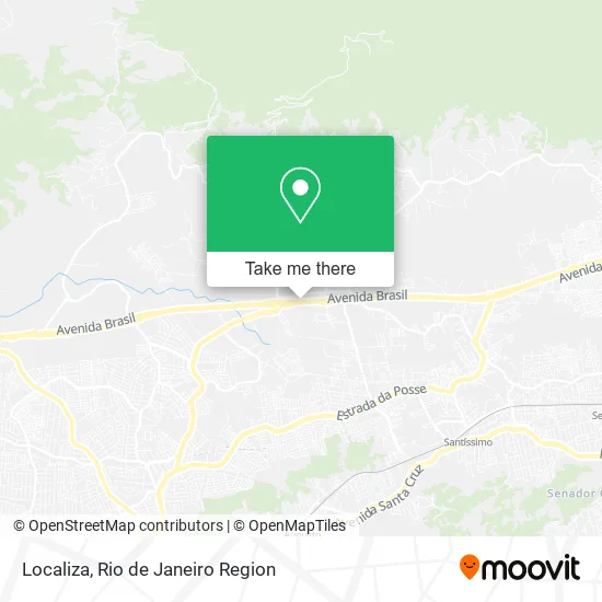
See Localiza, Campo Grande, on the map
Public Transit to Localiza in Campo Grande
Wondering how to get to Localiza in Campo Grande? Moovit helps you find the best way to get to Localiza with step-by-step directions from the nearest public transit station.
Moovit provides free maps and live directions to help you navigate through your city. View schedules, routes, timetables, and find out how long does it take to get to Localiza in real time.
Looking for the nearest stop or station to Localiza? Check out this list of stops closest to your destination: Estrada Do Mendanha; Avenida Brasil - Carobinha; Estrada Dos Sete Riachos; Estrada Dos Sete Riachos; Estrada Do Mendanha; Santíssimo.
Bus: 2336, 2381*, 451T, 753, 759, SV 853, 765, 850, 895, SN 895, 112B, 113D, 121T, 388, SN 388, 826, 812, 564T, 1901T, 2381.Train: RAMAL SANTA CRUZ.
Want to see if there’s another route that gets you there at an earlier time? Moovit helps you find alternative routes or times. Get directions from and directions to Localiza easily from the Moovit App or Website.
We make riding to Localiza easy, which is why over 1.5 million users, including users in Campo Grande, trust Moovit as the best app for public transit. You don’t need to download an individual bus app or train app, Moovit is your all-in-one transit app that helps you find the best bus time or train time available.
For information on prices of bus, costs and ride fares to Localiza, please check the Moovit app.
Use the app to navigate to popular places including to the airport, hospital, stadium, grocery store, mall, coffee shop, school, college, and university.
Localiza Address: Campo Grande Rio de Janeiro-RJ 23078-001 street in Campo Grande
- Serviço Social Regional,
- Fazenda Mineira,
- Paumes Servicos Tecnicos,
- Ludmix,
- Cme Comércio de Máquinas e Equipamentos - Bangu,
- Tereos Açúcar e Energia Brasil,
- V N Progresso Mercearia,
- Reformadora Automotiva Dj,
- Km Portoes,
- Banco Bradesco,
- Banco 24horas,
- Arena Campo Grande,
- Restaurante Fazenda do Mineiro,
- Tdm Transportes,
- Casa de Festa Lelu,
- Ad Ministério Kennedy,
- Avenida Brasil 33.982,
- Paintball da Brasil,
- Auto Class Oeste Caminhoes e Utilitarios,
- Estrada dos Sete Riachos, 1646
Places Near Localiza (Campo Grande)
- Shopping Downtown, Barra Da Tijuca,
- Hospital Federal Do Andaraí, Andaraí,
- Rodoviária Novo Rio (Rodoviária do Rio de Janeiro), Santo Cristo,
- Shopping Rio Sul, Botafogo,
- Rua Ulysses Guimarães 16, Cidade Nova,
- Hospital Pedro Ernesto, Vila Isabel,
- Shopping Nova América, Del Castilho,
- Rio De Janeiro,
- Hospital Federal Cardoso Fontes, Jacarepaguá,
- Feira Livre da Gloria, Glória,
- Niterói, Niterói,
- Norte Shopping, Cachambi,
- Avenida Rio Branco, Centro,
- Rua Licínio Cardoso, São Francisco Xavier,
- Avenida Venezuela 134, Saúde,
- Praia do Arpoador, Ipanema,
- Feirão De Malhas, Duque De Caxias,
- Shopping RioSul, Botafogo,
- Museu Do Amanhã, Centro,
- Hospital Municipal Ronaldo Gazolla, Acari
How to get to popular places in Rio de Janeiro Region with public transit
Get around Campo Grande by public transit!
Traveling around Campo Grande has never been so easy. See step by step directions as you travel to any attraction, street or major public transit station. View bus and train schedules, arrival times, service alerts and detailed routes on a map, so you know exactly how to get to anywhere in Campo Grande.
When traveling to any destination around Campo Grande use Moovit's Live Directions with Get Off Notifications to know exactly where and how far to walk, how long to wait for your line, and how many stops are left. Moovit will alert you when it's time to get off — no need to constantly re-check whether yours is the next stop.
Wondering how to use public transit in Campo Grande or how to pay for public transit in Campo Grande? Moovit public transit app can help you navigate your way with public transit easily, and at minimum cost. It includes public transit fees, ticket prices, and costs. Looking for a map of Campo Grande public transit lines? Moovit public transit app shows all public transit maps in Campo Grande with all Bus, Train, Metro, Light Rail, Ferry, Cable Car, Gondola and Funicular routes and stops on an interactive map.
Rio de Janeiro Region has 8 transit type(s), including: Bus, Train, Metro, Light Rail, Ferry, Cable Car, Gondola and Funicular, operated by several transit agencies, including TrensRJ, Metrô Rio, VLT Carioca, Barcas Rio, BRT MOBI-Rio, Auto Viação Alpha, Auto Viação Tijuca, Gire Transportes, Transurb, Viação Nossa Senhora das Graças, Consórcio INTERSUL, Braso Lisboa (Municipal), Caprichosa Auto Ônibus, Auto Viação Três Amigos and Rodoviária Âncora Matias