How to get to Location and Overview by bus?
Click on the bus route to see step by step directions with maps, line arrival times and updated time schedules.
From Ollie's Bargain Outlet, Boynton Beach-Delray Beach
32 minFrom Tri-Rail-Pompano Beach Station, Pompano Beach
92 minFrom Pretty in Palm Beach, Boynton Beach-Delray Beach
49 minFrom Funky Buddha Brewery And Lounge, Boca Raton
35 minFrom North Area Transportation Terminal, Pompano Beach
119 minFrom Amazon Fulfillment Center-DMF3, Pompano Beach
105 minFrom Butterfly World, Pompano Beach
87 minFrom Intersection : N Andrews Ave & Sample Rd., Pompano Beach
88 min
Bus stops near Location and Overview in Boca Raton
Bus lines to Location and Overview in Boca Raton
What are the closest stations to Location and Overview?
The closest stations to Location and Overview are:
- MILITARY TRL at LENOX DR is 145 yards away, 2 min walk.
- TWN CTR RD at BUTTS RD is 307 yards away, 4 min walk.
Which bus lines stop near Location and Overview?
These bus lines stop near Location and Overview: 2, 3, 92.
What’s the nearest bus station to Location and Overview in Boca Raton?
The nearest bus station to Location and Overview in Boca Raton is MILITARY TRL at LENOX DR. It’s a 2 min walk away.
What time is the first bus to Location and Overview in Boca Raton?
The 3 is the first bus that goes to Location and Overview in Boca Raton. It stops nearby at 5:26 AM.
What time is the last bus to Location and Overview in Boca Raton?
The 2 is the last bus that goes to Location and Overview in Boca Raton. It stops nearby at 9:35 PM.
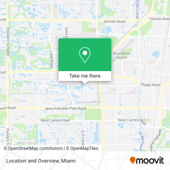
See Location and Overview, Boca Raton, on the map
Public Transit to Location and Overview in Boca Raton
Wondering how to get to Location and Overview in Boca Raton? Moovit helps you find the best way to get to Location and Overview with step-by-step directions from the nearest public transit station.
Moovit provides free maps and live directions to help you navigate through your city. View schedules, routes, timetables, and find out how long does it take to get to Location and Overview in real time.
Looking for the nearest stop or station to Location and Overview? Check out this list of stops closest to your destination: MILITARY TRL at LENOX DR; TWN CTR RD at BUTTS RD.
Bus: 2, 3, 92, 91.
Want to see if there’s another route that gets you there at an earlier time? Moovit helps you find alternative routes or times. Get directions from and directions to Location and Overview easily from the Moovit App or Website.
We make riding to Location and Overview easy, which is why over 1.5 million users, including users in Boca Raton, trust Moovit as the best app for public transit. You don’t need to download an individual bus app or train app, Moovit is your all-in-one transit app that helps you find the best bus time or train time available.
For information on prices of bus and train, costs and ride fares to Location and Overview, please check the Moovit app.
Use the app to navigate to popular places including to the airport, hospital, stadium, grocery store, mall, coffee shop, school, college, and university.
Location and Overview Address: 1 Town Center Rd Boca Raton, FL 33486 street in Boca Raton
- Homes Alarm,
- Securitypricer,
- Bank of America,
- Thomas Tabor,
- ATM,
- Marshall Duane,
- Christopher Bell,
- Mason Liu,
- Rachel Baum,
- Jeffrey Zapoleon,
- Red Pine,
- Encore Wealth Management at Raymond James,
- Falcone Group,
- Laid Law,
- Gardens Wealth Management Wells Fargo Advisors Financial Network,
- The Silverman Group of Raymond James,
- Best French Fries,
- Donald F Heiman MD Pa,
- Brain and Wellness Center,
- Dr. Donna Rhoden MD
Places Near Location and Overview (Boca Raton)
- Wynwood, Miami,
- Richard E. Gerstein Justice Building, Miami,
- Brickell City Centre, Miami,
- Keiser University Flagship Campus, West Palm Beach,
- Bayside Marketplace, Miami,
- Miami VA Hospital, Miami,
- Little Havana, Miami,
- Zoo Miami, Miami,
- Dolphin Mall Bus, Miami,
- Port of Miami Cruise Terminal, Miami,
- Sawgrass Mall, Miami,
- Sawgrass mall ( FL ), Miami Beach,
- Dolphin Mall, Miami,
- Aventura Mall, Miami Beach,
- Hard Rock Stadium, Miami Gardens,
- Miami Design District, Miami,
- Miami Freedom Park, Miami,
- Marlins Park, Miami,
- Aventura Mall, Miami,
- Miami-Dade County Courthouse, Miami
How to get to popular places in Miami with public transit
Get around Boca Raton by public transit!
Traveling around Boca Raton has never been so easy. See step by step directions as you travel to any attraction, street or major public transit station. View bus and train schedules, arrival times, service alerts and detailed routes on a map, so you know exactly how to get to anywhere in Boca Raton.
When traveling to any destination around Boca Raton use Moovit's Live Directions with Get Off Notifications to know exactly where and how far to walk, how long to wait for your line, and how many stops are left. Moovit will alert you when it's time to get off — no need to constantly re-check whether yours is the next stop.
Wondering how to use public transit in Boca Raton or how to pay for public transit in Boca Raton? Moovit public transit app can help you navigate your way with public transit easily, and at minimum cost. It includes public transit fees, ticket prices, and costs. Looking for a map of Boca Raton public transit lines? Moovit public transit app shows all public transit maps in Boca Raton with all Bus, Train, Light Rail and Ferry routes and stops on an interactive map.
Miami has 4 transit type(s), including: Bus, Train, Light Rail and Ferry, operated by several transit agencies, including Broward County Transit, Miami-Dade Transit, Metrorail, Palm Tran, Tri-Rail, Brightline, MARTY, City of Homestead Trolley, Key West Transit, Treasure Coast Connector, GoLine IRT, Amtrak, Greyhound-us, FlixBus-us and Aventura Express Shuttle Bus