How to get to Lock All Secure by bus?
Click on the bus route to see step by step directions with maps, line arrival times and updated time schedules.
From NW 95th St / NW 17th Ave, Miami
56 minFrom Gulfstream Park, Hallandale Beach
75 minFrom Hilton Cabana Miami Beach, Miami Beach
29 minFrom Lorraine Hotel, Miami Beach
50 minFrom Edgewater, Miami
65 minFrom Miami Jackson North Medical Center, Miami
69 minFrom En La Playa, Miami Beach
53 minFrom Mount Sinai Hospital Gumenick Building, Miami Beach
64 minFrom AC Hotel-Miami Wynwood, Miami
44 minFrom NW 27th Ave / NW 79th St, Miami
71 min
Bus stops near Lock All Secure in Miami
Bus lines to Lock All Secure in Miami
What are the closest stations to Lock All Secure?
The closest stations to Lock All Secure are:
- Ne 123 St & # 2206 is 133 yards away, 2 min walk.
- Sans Souci Blvd@# 2100 is 636 yards away, 8 min walk.
Which bus line stops near Lock All Secure?
125 (125 - Surfside 94 St)
What’s the nearest bus station to Lock All Secure in Miami?
The nearest bus station to Lock All Secure in Miami is Ne 123 St & # 2206. It’s a 2 min walk away.
What time is the first bus to Lock All Secure in Miami?
The 125 is the first bus that goes to Lock All Secure in Miami. It stops nearby at 4:44 AM.
What time is the last bus to Lock All Secure in Miami?
The 125 is the last bus that goes to Lock All Secure in Miami. It stops nearby at 12:20 AM.
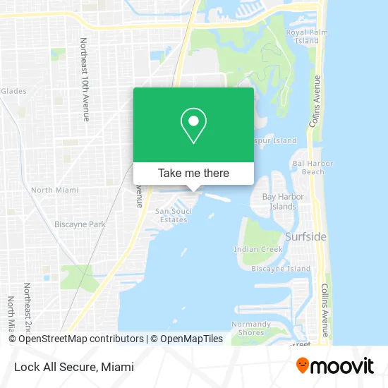
See Lock All Secure, Miami, on the map
Public Transit to Lock All Secure in Miami
Wondering how to get to Lock All Secure in Miami? Moovit helps you find the best way to get to Lock All Secure with step-by-step directions from the nearest public transit station.
Moovit provides free maps and live directions to help you navigate through your city. View schedules, routes, timetables, and find out how long does it take to get to Lock All Secure in real time.
Looking for the nearest stop or station to Lock All Secure? Check out this list of stops closest to your destination: Ne 123 St & # 2206; Sans Souci Blvd@# 2100.
Bus: 125, NOMRED.
Want to see if there’s another route that gets you there at an earlier time? Moovit helps you find alternative routes or times. Get directions from and directions to Lock All Secure easily from the Moovit App or Website.
We make riding to Lock All Secure easy, which is why over 1.5 million users, including users in Miami, trust Moovit as the best app for public transit. You don’t need to download an individual bus app or train app, Moovit is your all-in-one transit app that helps you find the best bus time or train time available.
For information on prices of bus, costs and ride fares to Lock All Secure, please check the Moovit app.
Use the app to navigate to popular places including to the airport, hospital, stadium, grocery store, mall, coffee shop, school, college, and university.
Lock All Secure Address: 2220 NE 123rd St Miami, FL 33181 street in Miami
- Connect Hearing,
- Tempo Music and Dance Academy,
- Uncle Stan's Miami,
- Sofi H. Matz, LMHC,
- Solana Bay Residences by the Kolter Group,
- Bikram Yoga College of India,
- Advanced Technologies,
- Beach Smile Family Dentistry,
- D'Amico Design Associates,
- Inasec,
- Catch Specialty Fish Market,
- Proform MD,
- Miami Foot Ankle,
- General Orthopedics,
- International Orthopaedic Specialists,
- Brad Cohen, MD,
- Aventura Orthopaedics and Sports Medicine: Brad Cohen, MD,
- Simky's Brow Bar,
- Super Anime Store - North Miami,
- Locksmith Jordan
Places Near Lock All Secure (Miami)
- Zoo Miami, Miami,
- Miami Freedom Park, Miami,
- Bayside Marketplace, Miami,
- Marlins Park, Miami,
- Wynwood, Miami,
- Miami Design District, Miami,
- Sawgrass mall ( FL ), Miami Beach,
- Little Havana, Miami,
- Miami-Dade County Courthouse, Miami,
- Dolphin Mall, Miami,
- Richard E. Gerstein Justice Building, Miami,
- Hard Rock Stadium, Miami Gardens,
- Keiser University Flagship Campus, West Palm Beach,
- Dolphin Mall Bus, Miami,
- Aventura Mall, Miami Beach,
- Miami VA Hospital, Miami,
- Brickell City Centre, Miami,
- Aventura Mall, Miami,
- Port of Miami Cruise Terminal, Miami,
- Sawgrass Mall, Miami
How to get to popular places in Miami with public transit
Get around Miami by public transit!
Traveling around Miami has never been so easy. See step by step directions as you travel to any attraction, street or major public transit station. View bus and train schedules, arrival times, service alerts and detailed routes on a map, so you know exactly how to get to anywhere in Miami.
When traveling to any destination around Miami use Moovit's Live Directions with Get Off Notifications to know exactly where and how far to walk, how long to wait for your line, and how many stops are left. Moovit will alert you when it's time to get off — no need to constantly re-check whether yours is the next stop.
Wondering how to use public transit in Miami or how to pay for public transit in Miami? Moovit public transit app can help you navigate your way with public transit easily, and at minimum cost. It includes public transit fees, ticket prices, and costs. Looking for a map of Miami public transit lines? Moovit public transit app shows all public transit maps in Miami with all Bus, Train, Light Rail and Ferry routes and stops on an interactive map.
Miami has 4 transit type(s), including: Bus, Train, Light Rail and Ferry, operated by several transit agencies, including Broward County Transit, Miami-Dade Transit, Metrorail, Palm Tran, Tri-Rail, Brightline, MARTY, City of Homestead Trolley, Key West Transit, Treasure Coast Connector, GoLine IRT, Amtrak, Greyhound-us, FlixBus-us and Aventura Express Shuttle Bus