How to get to Lockout Plus by bus?
Click on the bus route to see step by step directions with maps, line arrival times and updated time schedules.
From Astrazeneca HQ, Montgomery County
27 minFrom HJF, Montgomery County
39 minFrom Albert Einstein High School, Montgomery County
66 minFrom Intelligence Community Campus—Bethesda, Montgomery County
60 minFrom Georgia Ave & Icc Park & Ride Lot, Montgomery County
43 minFrom Glenstone Museum, Montgomery County
53 minFrom Kaiser Permanente - Kensington Medical Center, Montgomery County
66 minFrom Kensington, Maryland, Montgomery County
68 minFrom Wheaton High School, Montgomery County
62 minFrom Bethesda North Marriott Hotel & Conference Center, Montgomery County
49 min
How to get to Lockout Plus by train?
Click on the train route to see step by step directions with maps, line arrival times and updated time schedules.
How to get to Lockout Plus by metro?
Click on the metro route to see step by step directions with maps, line arrival times and updated time schedules.
Bus stops near Lockout Plus in Montgomery County
Metro station near Lockout Plus in Montgomery County
- Shady Grove, 12 min walk,VIEW
Bus lines to Lockout Plus in Montgomery County
What are the closest stations to Lockout Plus?
The closest stations to Lockout Plus are:
- Research Blvd & @1450 is 110 yards away, 2 min walk.
- Hurley Ave & Darnestown Rd is 402 yards away, 5 min walk.
- Shady Grove is 980 yards away, 12 min walk.
Which bus lines stop near Lockout Plus?
These bus lines stop near Lockout Plus: 45, 54, 63.
Which train line stops near Lockout Plus?
MARC (Inbound - Brunswick)
Which metro line stops near Lockout Plus?
RED (Shady Grove)
What’s the nearest metro station to Lockout Plus in Montgomery County?
The nearest metro station to Lockout Plus in Montgomery County is Shady Grove. It’s a 12 min walk away.
What’s the nearest bus station to Lockout Plus in Montgomery County?
The nearest bus station to Lockout Plus in Montgomery County is Research Blvd & @1450. It’s a 2 min walk away.
What time is the first metro to Lockout Plus in Montgomery County?
The RED is the first metro that goes to Lockout Plus in Montgomery County. It stops nearby at 5:00 AM.
What time is the last metro to Lockout Plus in Montgomery County?
The RED is the last metro that goes to Lockout Plus in Montgomery County. It stops nearby at 12:42 AM.
What time is the first train to Lockout Plus in Montgomery County?
The MARC is the first train that goes to Lockout Plus in Montgomery County. It stops nearby at 5:39 AM.
What time is the last train to Lockout Plus in Montgomery County?
The MARC is the last train that goes to Lockout Plus in Montgomery County. It stops nearby at 7:50 PM.
What time is the first bus to Lockout Plus in Montgomery County?
The 54 is the first bus that goes to Lockout Plus in Montgomery County. It stops nearby at 5:15 AM.
What time is the last bus to Lockout Plus in Montgomery County?
The 54 is the last bus that goes to Lockout Plus in Montgomery County. It stops nearby at 12:14 AM.
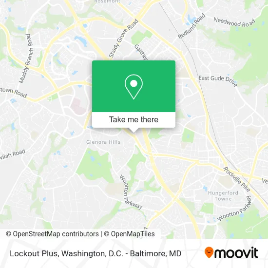
See Lockout Plus, Montgomery County, on the map
Public Transit to Lockout Plus in Montgomery County
Wondering how to get to Lockout Plus in Montgomery County? Moovit helps you find the best way to get to Lockout Plus with step-by-step directions from the nearest public transit station.
Moovit provides free maps and live directions to help you navigate through your city. View schedules, routes, timetables, and find out how long does it take to get to Lockout Plus in real time.
Looking for the nearest stop or station to Lockout Plus? Check out this list of stops closest to your destination: Research Blvd & @1450; Hurley Ave & Darnestown Rd; Shady Grove.
Bus: 45, 54, 63.Train: MARC.Metro: RED.
Want to see if there’s another route that gets you there at an earlier time? Moovit helps you find alternative routes or times. Get directions from and directions to Lockout Plus easily from the Moovit App or Website.
We make riding to Lockout Plus easy, which is why over 1.5 million users, including users in Montgomery County, trust Moovit as the best app for public transit. You don’t need to download an individual bus app or train app, Moovit is your all-in-one transit app that helps you find the best bus time or train time available.
For information on prices of bus, metro and train, costs and ride fares to Lockout Plus, please check the Moovit app.
Use the app to navigate to popular places including to the airport, hospital, stadium, grocery store, mall, coffee shop, school, college, and university.
Lockout Plus Address: 1400 Research Blvd Rockville, MD 20850 street in Montgomery County
- Citi,
- Cooper's Hawk Winery & Restaurant - Rockville,
- Henry Hemmendinger,
- Craig Allen Bricker,
- Family Office Risk Management Hub,
- Rise Therapeutics,
- Pivot,
- FedEx,
- Hub International,
- Builders Design,
- Bayard Rustin Elementary School,
- Blink Charging,
- Research Row,
- Ims Web,
- Hurley Ave and W Montgom,
- Best Western Plus Rockville Hotel & Suites (Best Western Rockville Hotel),
- Darnestown Darnestown Rd MD-28,
- Memories Begin Here,
- Black Belt Spirit and Attitude,
- Erika's Beauty Roo
Places Near Lockout Plus (Montgomery County)
- Rock Creek Tennis Center, Washington,
- Basilica of the National Shrine, Washington,
- National Museum of African American History and Culture, Washington,
- Georgetown, Washington,
- Pennsylvania Ave NW (3rd st and pennsylvania), Washington,
- Washington National Cathedral, Washington,
- Amazon Hq2, Arlington County,
- Museum Of The Bible, Washington,
- The Anthem, Washington,
- National Theatre, Washington,
- Warner Theatre, Washington,
- Sibley Memorial Hospital, Washington,
- Marriott Marquis Washington, DC, Washington,
- Westfield Montgomery Mall, Montgomery County,
- Washington DC VA Medical Center, Washington,
- National Zoo, Washington,
- Capital One Arena, Washington,
- M&T Bank Stadium, Baltimore,
- Camden Yards, Baltimore,
- PG Mall, Prince George's County
How to get to popular places in Washington, D.C. - Baltimore, MD with public transit
Get around Montgomery County by public transit!
Traveling around Montgomery County has never been so easy. See step by step directions as you travel to any attraction, street or major public transit station. View bus and train schedules, arrival times, service alerts and detailed routes on a map, so you know exactly how to get to anywhere in Montgomery County.
When traveling to any destination around Montgomery County use Moovit's Live Directions with Get Off Notifications to know exactly where and how far to walk, how long to wait for your line, and how many stops are left. Moovit will alert you when it's time to get off — no need to constantly re-check whether yours is the next stop.
Wondering how to use public transit in Montgomery County or how to pay for public transit in Montgomery County? Moovit public transit app can help you navigate your way with public transit easily, and at minimum cost. It includes public transit fees, ticket prices, and costs. Looking for a map of Montgomery County public transit lines? Moovit public transit app shows all public transit maps in Montgomery County with all Bus, Train, Metro, Light Rail and Ferry routes and stops on an interactive map.
Washington, D.C. - Baltimore, MD has 5 transit type(s), including: Bus, Train, Metro, Light Rail and Ferry, operated by several transit agencies, including WMATA, Montgomery County Ride On, Fairfax Connector, TheBus, PRTC, DASH - Alexandria, Arlington Transit (ART), RTA of Central Maryland, MDOT MTA, MDOT MTA Light RailLink, MDOT MTA Commuter Bus, MDOT MTA Local Bus, FXBGO!, Virginia Railway Express (VRE) and MARC