How to get to Locks by bus?
Click on the bus route to see step by step directions with maps, line arrival times and updated time schedules.
From Fort Lauderdale Cruise Terminal, Fort Lauderdale
63 minFrom W State Road 84, Fort Lauderdale
51 minFrom State Road 7 & West Sunrise Boulevard, Plantation
51 minFrom Water Taxi Stop - 15th Street Fisheries, Fort Lauderdale
70 minFrom Chase, Fort Lauderdale
46 minFrom Las Olas Beach, Fort Lauderdale
57 minFrom Kamal Singh, Plantation
80 minFrom Port Everglades, Fort Lauderdale
64 minFrom Galleria Mall, Fort Lauderdale
54 minFrom Central Terminal, Fort Lauderdale
28 min
How to get to Locks by train?
Click on the train route to see step by step directions with maps, line arrival times and updated time schedules.
Bus stops near Locks in Fort Lauderdale
Train station near Locks in Fort Lauderdale
- Cypress Creek Station, 27 min walk,VIEW
Bus lines to Locks in Fort Lauderdale
What are the closest stations to Locks?
The closest stations to Locks are:
- Commercial Boulevard/Dixie Highway is 65 yards away, 2 min walk.
- Dixie Highway/Commercial Boulevard is 98 yards away, 2 min walk.
- Cypress Creek Station is 2241 yards away, 27 min walk.
Which bus line stops near Locks?
50 (Hillsboro - SW 3 Av Via Northeast Transit Center)
Which train line stops near Locks?
TRIRAIL (Northbound To Mangonia Park)
What’s the nearest train station to Locks in Fort Lauderdale?
The nearest train station to Locks in Fort Lauderdale is Cypress Creek Station. It’s a 27 min walk away.
What’s the nearest bus station to Locks in Fort Lauderdale?
The nearest bus stations to Locks in Fort Lauderdale are Commercial Boulevard/Dixie Highway and Dixie Highway/Commercial Boulevard. The closest one is a 2 min walk away.
What time is the first train to Locks in Fort Lauderdale?
The TRIRAIL is the first train that goes to Locks in Fort Lauderdale. It stops nearby at 4:38 AM.
What time is the last train to Locks in Fort Lauderdale?
The TRIRAIL is the last train that goes to Locks in Fort Lauderdale. It stops nearby at 10:43 PM.
What time is the first bus to Locks in Fort Lauderdale?
The 55 is the first bus that goes to Locks in Fort Lauderdale. It stops nearby at 4:47 AM.
What time is the last bus to Locks in Fort Lauderdale?
The 50 is the last bus that goes to Locks in Fort Lauderdale. It stops nearby at 11:32 PM.
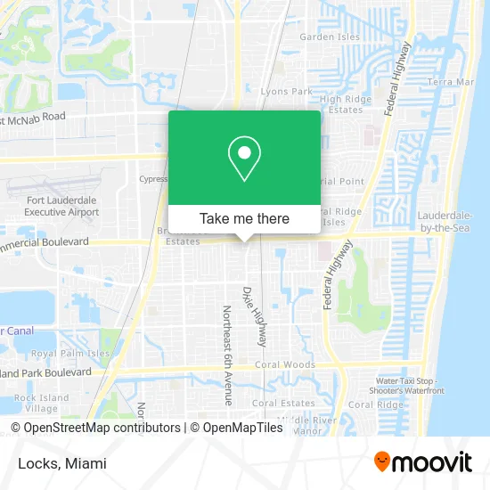
See Locks, Fort Lauderdale, on the map
Public Transit to Locks in Fort Lauderdale
Wondering how to get to Locks in Fort Lauderdale? Moovit helps you find the best way to get to Locks with step-by-step directions from the nearest public transit station.
Moovit provides free maps and live directions to help you navigate through your city. View schedules, routes, timetables, and find out how long does it take to get to Locks in real time.
Looking for the nearest stop or station to Locks? Check out this list of stops closest to your destination: Commercial Boulevard/Dixie Highway; Dixie Highway/Commercial Boulevard; Cypress Creek Station.
Bus: 50, 55.Train: TRIRAIL.
Want to see if there’s another route that gets you there at an earlier time? Moovit helps you find alternative routes or times. Get directions from and directions to Locks easily from the Moovit App or Website.
We make riding to Locks easy, which is why over 1.5 million users, including users in Fort Lauderdale, trust Moovit as the best app for public transit. You don’t need to download an individual bus app or train app, Moovit is your all-in-one transit app that helps you find the best bus time or train time available.
For information on prices of bus and train, costs and ride fares to Locks, please check the Moovit app.
Use the app to navigate to popular places including to the airport, hospital, stadium, grocery store, mall, coffee shop, school, college, and university.
Locks Address: 950 E Commercial Blvd Fort Lauderdale, FL 33334 street in Fort Lauderdale
- STARBUCKS,
- US Bank,
- Presto! ATM,
- Pure Barre,
- Travel Styles and Geta,
- Amherstnational,
- U-Haul,
- The Law Offices of Gary M. Zeidwig,
- Federal Courts,
- Yon Mexican,
- Always Tommy Hair Studio,
- Summit Kitchen & Bath, Inc.,
- Amazon Locker-Organization,
- Youfit Gyms,
- Sozo Medical Group,
- Relaxed Wax Beauty,
- Covid-19 Testing Site: Ft Lauderdale - Commercial Donor Center,
- Vaella Coffee & Tea,
- Simpress Cleaners,
- Bushwick Lounge
Places Near Locks (Fort Lauderdale)
- Miami VA Hospital, Miami,
- Brickell City Centre, Miami,
- Little Havana, Miami,
- Aventura Mall, Miami Beach,
- Aventura Mall, Miami,
- Port of Miami Cruise Terminal, Miami,
- Sawgrass Mall, Miami,
- Bayside Marketplace, Miami,
- Miami-Dade County Courthouse, Miami,
- Miami Design District, Miami,
- Dolphin Mall Bus, Miami,
- Sawgrass mall ( FL ), Miami Beach,
- Miami Freedom Park, Miami,
- Keiser University Flagship Campus, West Palm Beach,
- Dolphin Mall, Miami,
- Zoo Miami, Miami,
- Marlins Park, Miami,
- Hard Rock Stadium, Miami Gardens,
- Wynwood, Miami,
- Richard E. Gerstein Justice Building, Miami
How to get to popular places in Miami with public transit
Get around Fort Lauderdale by public transit!
Traveling around Fort Lauderdale has never been so easy. See step by step directions as you travel to any attraction, street or major public transit station. View bus and train schedules, arrival times, service alerts and detailed routes on a map, so you know exactly how to get to anywhere in Fort Lauderdale.
When traveling to any destination around Fort Lauderdale use Moovit's Live Directions with Get Off Notifications to know exactly where and how far to walk, how long to wait for your line, and how many stops are left. Moovit will alert you when it's time to get off — no need to constantly re-check whether yours is the next stop.
Wondering how to use public transit in Fort Lauderdale or how to pay for public transit in Fort Lauderdale? Moovit public transit app can help you navigate your way with public transit easily, and at minimum cost. It includes public transit fees, ticket prices, and costs. Looking for a map of Fort Lauderdale public transit lines? Moovit public transit app shows all public transit maps in Fort Lauderdale with all Bus, Train, Light Rail and Ferry routes and stops on an interactive map.
Miami has 4 transit type(s), including: Bus, Train, Light Rail and Ferry, operated by several transit agencies, including Broward County Transit, Miami-Dade Transit, Metrorail, Palm Tran, Tri-Rail, Brightline, MARTY, City of Homestead Trolley, Key West Transit, Treasure Coast Connector, GoLine IRT, Amtrak, Greyhound-us, FlixBus-us and Aventura Express Shuttle Bus