How to get to Locks by bus?
Click on the bus route to see step by step directions with maps, line arrival times and updated time schedules.
From Reisterstown Road Plaza, Baltimore
33 minFrom Bwi2 Employee Shuttles, Baltimore
42 minFrom Eastern Ave (eastern avenue and dundalk av), Baltimore
60 minFrom Pimlico Race Course, Baltimore
49 minFrom NSA Friendship Annex (FANX), Anne Arundel County
60 minFrom Randallstown, MD, Baltimore County
42 minFrom Giant Food Stores, Baltimore
39 minFrom Baltimore Greyhound Station, Baltimore
35 minFrom Power Plant Live, Baltimore
32 minFrom Johns Hopkins Bayview Medical Center, Baltimore
60 min
How to get to Locks by train?
Click on the train route to see step by step directions with maps, line arrival times and updated time schedules.
How to get to Locks by metro?
Click on the metro route to see step by step directions with maps, line arrival times and updated time schedules.
Bus stops near Locks in Baltimore
Metro station near Locks in Baltimore
- Mondawmin Metro, 47 min walk,VIEW
Train station near Locks in Baltimore
- West Baltimore Marc Nb, 58 min walk,VIEW
Bus lines to Locks in Baltimore
What are the closest stations to Locks?
The closest stations to Locks are:
- Bloomingdale Rd & Rosedale St Sb is 119 yards away, 2 min walk.
- North Ave & Bloomingdale Rd Eb is 128 yards away, 2 min walk.
- Mondawmin Metro is 3972 yards away, 47 min walk.
- West Baltimore Marc Nb is 4865 yards away, 58 min walk.
Which bus lines stop near Locks?
These bus lines stop near Locks: 29, 79, 80, CITYLINK GOLD.
Which train line stops near Locks?
MARC (Inbound - Penn)
Which metro line stops near Locks?
METRO (Towards Owing Mills)
What’s the nearest bus station to Locks in Baltimore?
The nearest bus stations to Locks in Baltimore are Bloomingdale Rd & Rosedale St Sb and North Ave & Bloomingdale Rd Eb. The closest one is a 2 min walk away.
What time is the first metro to Locks in Baltimore?
The METRO is the first metro that goes to Locks in Baltimore. It stops nearby at 5:01 AM.
What time is the last metro to Locks in Baltimore?
The METRO is the last metro that goes to Locks in Baltimore. It stops nearby at 12:20 AM.
What time is the first train to Locks in Baltimore?
The MARC is the first train that goes to Locks in Baltimore. It stops nearby at 4:39 AM.
What time is the last train to Locks in Baltimore?
The MARC is the last train that goes to Locks in Baltimore. It stops nearby at 10:53 PM.
What time is the first bus to Locks in Baltimore?
The 80 is the first bus that goes to Locks in Baltimore. It stops nearby at 3:11 AM.
What time is the last bus to Locks in Baltimore?
The 80 is the last bus that goes to Locks in Baltimore. It stops nearby at 3:10 AM.
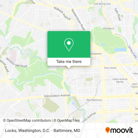
See Locks, Baltimore, on the map
Public Transit to Locks in Baltimore
Wondering how to get to Locks in Baltimore? Moovit helps you find the best way to get to Locks with step-by-step directions from the nearest public transit station.
Moovit provides free maps and live directions to help you navigate through your city. View schedules, routes, timetables, and find out how long does it take to get to Locks in real time.
Looking for the nearest stop or station to Locks? Check out this list of stops closest to your destination: Bloomingdale Rd & Rosedale St Sb; North Ave & Bloomingdale Rd Eb; Mondawmin Metro; West Baltimore Marc Nb.
Bus: 29, 79, 80, CITYLINK GOLD, 38.Train: MARC.Metro: METRO.
Want to see if there’s another route that gets you there at an earlier time? Moovit helps you find alternative routes or times. Get directions from and directions to Locks easily from the Moovit App or Website.
We make riding to Locks easy, which is why over 1.5 million users, including users in Baltimore, trust Moovit as the best app for public transit. You don’t need to download an individual bus app or train app, Moovit is your all-in-one transit app that helps you find the best bus time or train time available.
For information on prices of bus, metro and train, costs and ride fares to Locks, please check the Moovit app.
Use the app to navigate to popular places including to the airport, hospital, stadium, grocery store, mall, coffee shop, school, college, and university.
Locks Address: 1800 Bloomingdale Rd Baltimore, MD 21216 street in Baltimore
- Circle K,
- Bp,
- Pilgrim Temple,
- Blow Dry Bar,
- Get Your Grind on Sportswear,
- Mama Mamie's Corner,
- Big Apple Mart,
- In and Out,
- Star Financial Services,
- Tiffany's Beauty Supply,
- Hip Hop Eats,
- Bah African Hair Braiding,
- Happyafricanhairbraidingbaltimore,
- N Ellamont St and Bloomingdale,
- Kenyanz House of African Braiding and Hair Design,
- Vf Auto Body Shop Inc,
- North Avenue Variety Store,
- True Foundation Baptist Church,
- New York Fried Chicken,
- Independent Taxi Assoc Inc
Places Near Locks (Baltimore)
- Amazon Hq2, Arlington County,
- National Mall, Washington,
- Westfield Montgomery Mall, Montgomery County,
- Georgetown, Washington,
- Capital One Arena, Washington,
- Warner Theatre, Washington,
- The Anthem, Washington,
- M&T Bank Stadium, Baltimore,
- Camden Yards, Baltimore,
- PG Mall, Prince George's County,
- Washington National Cathedral, Washington,
- Basilica of the National Shrine, Washington,
- Museum Of The Bible, Washington,
- Rock Creek Tennis Center, Washington,
- Marriott Marquis Washington, DC, Washington,
- Washington DC VA Medical Center, Washington,
- Pennsylvania Ave NW (3rd st and pennsylvania), Washington,
- National Zoo, Washington,
- Sibley Memorial Hospital, Washington,
- National Museum of African American History and Culture, Washington
How to get to popular places in Washington, D.C. - Baltimore, MD with public transit
Get around Baltimore by public transit!
Traveling around Baltimore has never been so easy. See step by step directions as you travel to any attraction, street or major public transit station. View bus and train schedules, arrival times, service alerts and detailed routes on a map, so you know exactly how to get to anywhere in Baltimore.
When traveling to any destination around Baltimore use Moovit's Live Directions with Get Off Notifications to know exactly where and how far to walk, how long to wait for your line, and how many stops are left. Moovit will alert you when it's time to get off — no need to constantly re-check whether yours is the next stop.
Wondering how to use public transit in Baltimore or how to pay for public transit in Baltimore? Moovit public transit app can help you navigate your way with public transit easily, and at minimum cost. It includes public transit fees, ticket prices, and costs. Looking for a map of Baltimore public transit lines? Moovit public transit app shows all public transit maps in Baltimore with all Bus, Train, Metro, Light Rail and Ferry routes and stops on an interactive map.
Washington, D.C. - Baltimore, MD has 5 transit type(s), including: Bus, Train, Metro, Light Rail and Ferry, operated by several transit agencies, including WMATA, Montgomery County Ride On, Fairfax Connector, TheBus, PRTC, DASH - Alexandria, Arlington Transit (ART), RTA of Central Maryland, MDOT MTA, MDOT MTA Light RailLink, MDOT MTA Commuter Bus, MDOT MTA Local Bus, FXBGO!, Virginia Railway Express (VRE) and MARC