How to get to Locksmith by bus?
Click on the bus route to see step by step directions with maps, line arrival times and updated time schedules.
From The Howard Theatre, Washington
98 minFrom The Hamilton, Washington
79 minFrom Union Station Bus Terminal, Washington
94 minFrom Capitol Hill, Washington
92 minFrom Smithsonian National Museum of Natural History, Washington
86 minFrom Sibley Memorial Hospital, Washington
96 minFrom Washington Plaza Hotel, Washington
77 minFrom Black Cat, Washington
86 minFrom Dunbar High School, Washington
91 minFrom Howard Theater, Washington
98 min
How to get to Locksmith by metro?
Click on the metro route to see step by step directions with maps, line arrival times and updated time schedules.
From The Howard Theatre, Washington
84 minFrom The Hamilton, Washington
69 minFrom Union Station Bus Terminal, Washington
75 minFrom Capitol Hill, Washington
77 minFrom Smithsonian National Museum of Natural History, Washington
71 minFrom Washington Plaza Hotel, Washington
69 minFrom Black Cat, Washington
87 minFrom Dunbar High School, Washington
88 minFrom Howard Theater, Washington
84 min
Bus stops near Locksmith in Arlington County
Metro station near Locksmith in Arlington County
- Clarendon, 15 min walk,VIEW
Bus lines to Locksmith in Arlington County
What are the closest stations to Locksmith?
The closest stations to Locksmith are:
- Columbia Pk & S Four Mile Run Dr(W) is 43 yards away, 1 min walk.
- Columbia Pike Eb @ S Four Mile Run Dr Ns is 83 yards away, 2 min walk.
- Columbia Pi & S Four Mile Run Dr is 133 yards away, 2 min walk.
- S Dinwiddie St Sb @ Columbia Pike Ns is 399 yards away, 5 min walk.
- Clarendon is 1281 yards away, 15 min walk.
Which bus lines stop near Locksmith?
These bus lines stop near Locksmith: 41, A40, A71.
Which metro lines stop near Locksmith?
These metro lines stop near Locksmith: ORANGE, SILVER.
What’s the nearest metro station to Locksmith in Arlington County?
The nearest metro station to Locksmith in Arlington County is Clarendon. It’s a 15 min walk away.
What’s the nearest bus station to Locksmith in Arlington County?
The nearest bus station to Locksmith in Arlington County is Columbia Pk & S Four Mile Run Dr(W). It’s a 1 min walk away.
What time is the first metro to Locksmith in Arlington County?
The ORANGE is the first metro that goes to Locksmith in Arlington County. It stops nearby at 5:14 AM.
What time is the last metro to Locksmith in Arlington County?
The ORANGE is the last metro that goes to Locksmith in Arlington County. It stops nearby at 12:18 AM.
What time is the first bus to Locksmith in Arlington County?
The A40 is the first bus that goes to Locksmith in Arlington County. It stops nearby at 5:25 AM.
What time is the last bus to Locksmith in Arlington County?
The A40 is the last bus that goes to Locksmith in Arlington County. It stops nearby at 2:33 AM.
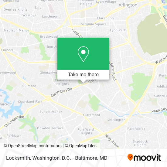
See Locksmith, Arlington County, on the map
Public Transit to Locksmith in Arlington County
Wondering how to get to Locksmith in Arlington County? Moovit helps you find the best way to get to Locksmith with step-by-step directions from the nearest public transit station.
Moovit provides free maps and live directions to help you navigate through your city. View schedules, routes, timetables, and find out how long does it take to get to Locksmith in real time.
Looking for the nearest stop or station to Locksmith? Check out this list of stops closest to your destination: Columbia Pk & S Four Mile Run Dr(W); Columbia Pike Eb @ S Four Mile Run Dr Ns; Columbia Pi & S Four Mile Run Dr; S Dinwiddie St Sb @ Columbia Pike Ns; Clarendon.
Bus: 41, A40, A71, F44, A49, 45, 75.Metro: ORANGE, SILVER.
Want to see if there’s another route that gets you there at an earlier time? Moovit helps you find alternative routes or times. Get directions from and directions to Locksmith easily from the Moovit App or Website.
We make riding to Locksmith easy, which is why over 1.5 million users, including users in Arlington County, trust Moovit as the best app for public transit. You don’t need to download an individual bus app or train app, Moovit is your all-in-one transit app that helps you find the best bus time or train time available.
For information on prices of bus and metro, costs and ride fares to Locksmith, please check the Moovit app.
Use the app to navigate to popular places including to the airport, hospital, stadium, grocery store, mall, coffee shop, school, college, and university.
Locksmith Address: 4811 Columbia Pike Arlington, VA 22204 street in Arlington County
- Cabaña Restaurant,
- Calestis Financial Services,
- W&OD Trail Columbia Pike Entrance,
- Studio Pause,
- K&C Ventures Moving,
- Arlington Lock and Key Services,
- Taqueria la Ceibita,
- bp,
- Arlington Mill Community Center,
- Wakefield St Locksmith Inc,
- Your Insurance Brokerage,
- Nordland Cleaning Service,
- Wakefield VA-244,
- Vienna Dermatology,
- Dermatology Barcroft,
- 909 S Dinwiddie St ,
- SP+ Parking,
- Columbia Forest, Virginia,
- Jordan Christian Church,
- Green Maidworks
Places Near Locksmith (Arlington County)
- National Zoo, Washington,
- Warner Theatre, Washington,
- National Theatre, Washington,
- Washington National Cathedral, Washington,
- Sibley Memorial Hospital, Washington,
- Rock Creek Tennis Center, Washington,
- Basilica of the National Shrine, Washington,
- Amazon Hq2, Arlington County,
- Museum Of The Bible, Washington,
- Camden Yards, Baltimore,
- PG Mall, Prince George's County,
- Georgetown, Washington,
- Washington DC VA Medical Center, Washington,
- Pennsylvania Ave NW (3rd st and pennsylvania), Washington,
- Westfield Montgomery Mall, Montgomery County,
- M&T Bank Stadium, Baltimore,
- Marriott Marquis Washington, DC, Washington,
- Capital One Arena, Washington,
- The Anthem, Washington,
- National Museum of African American History and Culture, Washington
How to get to popular places in Washington, D.C. - Baltimore, MD with public transit
Get around Arlington County by public transit!
Traveling around Arlington County has never been so easy. See step by step directions as you travel to any attraction, street or major public transit station. View bus and train schedules, arrival times, service alerts and detailed routes on a map, so you know exactly how to get to anywhere in Arlington County.
When traveling to any destination around Arlington County use Moovit's Live Directions with Get Off Notifications to know exactly where and how far to walk, how long to wait for your line, and how many stops are left. Moovit will alert you when it's time to get off — no need to constantly re-check whether yours is the next stop.
Wondering how to use public transit in Arlington County or how to pay for public transit in Arlington County? Moovit public transit app can help you navigate your way with public transit easily, and at minimum cost. It includes public transit fees, ticket prices, and costs. Looking for a map of Arlington County public transit lines? Moovit public transit app shows all public transit maps in Arlington County with all Bus, Train, Metro, Light Rail and Ferry routes and stops on an interactive map.
Washington, D.C. - Baltimore, MD has 5 transit type(s), including: Bus, Train, Metro, Light Rail and Ferry, operated by several transit agencies, including WMATA, Montgomery County Ride On, Fairfax Connector, TheBus, PRTC, DASH - Alexandria, Arlington Transit (ART), RTA of Central Maryland, MDOT MTA, MDOT MTA Light RailLink, MDOT MTA Commuter Bus, MDOT MTA Local Bus, FXBGO!, Virginia Railway Express (VRE) and MARC