How to get to Locksmith New Locks Installation Miami by bus?
Click on the bus route to see step by step directions with maps, line arrival times and updated time schedules.
How to get to Locksmith New Locks Installation Miami by train?
Click on the train route to see step by step directions with maps, line arrival times and updated time schedules.
Bus stops near Locksmith New Locks Installation Miami
Train stations near Locksmith New Locks Installation Miami
Light Rail stations near Locksmith New Locks Installation Miami
Bus lines to Locksmith New Locks Installation Miami
What are the closest stations to Locksmith New Locks Installation Miami?
The closest stations to Locksmith New Locks Installation Miami are:
- Sw 12 Av @ Sw 4 St is 150 yards away, 2 min walk.
- Sw 1 St @ Sw 12 Av is 395 yards away, 5 min walk.
- Sw 7 St @ Sw 12 Av is 503 yards away, 7 min walk.
- W Flagler St @ Nw 12 Av is 537 yards away, 7 min walk.
- MiamiCentral Station is 2817 yards away, 34 min walk.
- Brickell is 2966 yards away, 36 min walk.
- Government Center Station is 3545 yards away, 43 min walk.
Which bus lines stop near Locksmith New Locks Installation Miami?
These bus lines stop near Locksmith New Locks Installation Miami: 11, 12, 208, 8.
Which train line stops near Locksmith New Locks Installation Miami?
ORANGE (MIA Southbound→Dadeland South Stat.rail Southbound)
What’s the nearest bus station to Locksmith New Locks Installation Miami?
The nearest bus station to Locksmith New Locks Installation Miami is Sw 12 Av @ Sw 4 St. It’s a 2 min walk away.
What time is the first light rail to Locksmith New Locks Installation Miami?
The MMI is the first light rail that goes to Locksmith New Locks Installation Miami. It stops nearby at 5:30 AM.
What time is the last light rail to Locksmith New Locks Installation Miami?
The MMO is the last light rail that goes to Locksmith New Locks Installation Miami. It stops nearby at 10:12 PM.
What time is the first train to Locksmith New Locks Installation Miami?
The GREEN is the first train that goes to Locksmith New Locks Installation Miami. It stops nearby at 5:17 AM.
What time is the last train to Locksmith New Locks Installation Miami?
The GREEN is the last train that goes to Locksmith New Locks Installation Miami. It stops nearby at 12:47 AM.
What time is the first bus to Locksmith New Locks Installation Miami?
The 11 is the first bus that goes to Locksmith New Locks Installation Miami. It stops nearby at 3:05 AM.
What time is the last bus to Locksmith New Locks Installation Miami?
The 11 is the last bus that goes to Locksmith New Locks Installation Miami. It stops nearby at 2:40 AM.
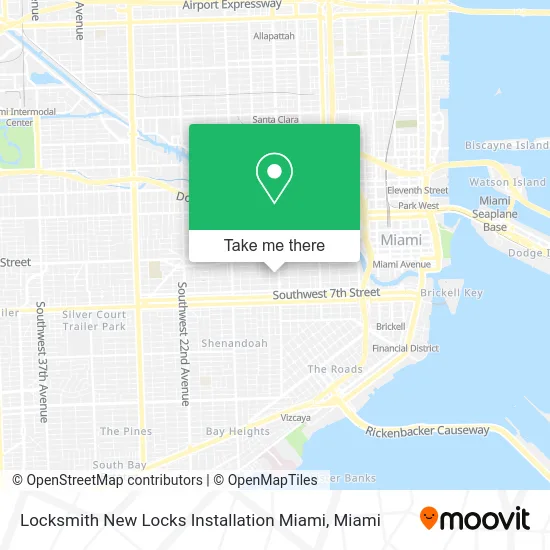
See Locksmith New Locks Installation Miami on the map
Public Transportation to Locksmith New Locks Installation Miami
Wondering how to get to Locksmith New Locks Installation Miami? Moovit helps you find the best way to get to Locksmith New Locks Installation Miami with step-by-step directions from the nearest public transit station.
Moovit provides free maps and live directions to help you navigate through your city. View schedules, routes, timetables, and find out how long does it take to get to Locksmith New Locks Installation Miami in real time.
Looking for the nearest stop or station to Locksmith New Locks Installation Miami? Check out this list of stops closest to your destination: Sw 12 Av @ Sw 4 St; Sw 1 St @ Sw 12 Av; Sw 7 St @ Sw 12 Av; W Flagler St @ Nw 12 Av; MiamiCentral Station; Brickell; Government Center Station.
Bus: 11, 12, 208, 8, 207, 211, MIAHAVA, MIASTA.Train: ORANGE, TRIRAIL, TRIRAIL, GREEN.
Want to see if there’s another route that gets you there at an earlier time? Moovit helps you find alternative routes or times. Get directions from and directions to Locksmith New Locks Installation Miami easily from the Moovit App or Website.
We make riding to Locksmith New Locks Installation Miami easy, which is why over 1.5 million users, including users in Miami, trust Moovit as the best app for public transit. You don’t need to download an individual bus app or train app, Moovit is your all-in-one transit app that helps you find the best bus time or train time available.
For information on prices of bus, train and light rail, costs and ride fares to Locksmith New Locks Installation Miami, please check the Moovit app.
Use the app to navigate to popular places including to the airport, hospital, stadium, grocery store, mall, coffee shop, school, college, and university.
Locksmith New Locks Installation Miami Address: 300 SW 12th Ave Miami, FL 33130 street in Miami
- Health Mart Pharmacy,
- KeyMe,
- B & D Barber Shop,
- Vicky's Spa,
- Six To Twelve Supermarket,
- Ministerio International Hossana,
- Navy Federal Credit Union,
- 7-Eleven,
- Amazon Locker-Antecedent,
- J Granandos,
- R&R Cuts Specialist,
- Don Freddy Envios,
- Botanica,
- Little Apple Learning Center 2,
- National Immigration Service,
- Adc Dental Care,
- Variety Repair & Electronics,
- Carparc Studios,
- World Harvest Ministries,
- Fernando Canada, MD
Places Near Locksmith New Locks Installation Miami
- Hard Rock Stadium, Miami Gardens,
- Port of Miami Cruise Terminal, Miami,
- Miami-Dade County Courthouse, Miami,
- Sawgrass Mall, Miami,
- Aventura Mall, Miami Beach,
- Miami Design District, Miami,
- Richard E. Gerstein Justice Building, Miami,
- Little Havana, Miami,
- Keiser University Flagship Campus, West Palm Beach,
- Brickell City Centre, Miami,
- Miami VA Hospital, Miami,
- Marlins Park, Miami,
- Zoo Miami, Miami,
- Wynwood, Miami,
- Miami Freedom Park, Miami,
- Dolphin Mall Bus, Miami,
- Bayside Marketplace, Miami,
- Aventura Mall, Miami,
- Sawgrass mall ( FL ), Miami Beach,
- Dolphin Mall, Miami
How to get to popular places in Miami with public transit
Get around Miami by public transit!
Traveling around Miami has never been so easy. See step by step directions as you travel to any attraction, street or major public transit station. View bus and train schedules, arrival times, service alerts and detailed routes on a map, so you know exactly how to get to anywhere in Miami.
When traveling to any destination around Miami use Moovit's Live Directions with Get Off Notifications to know exactly where and how far to walk, how long to wait for your line, and how many stops are left. Moovit will alert you when it's time to get off — no need to constantly re-check whether yours is the next stop.
Wondering how to use public transit in Miami or how to pay for public transit in Miami? Moovit public transit app can help you navigate your way with public transit easily, and at minimum cost. It includes public transit fees, ticket prices, and costs. Looking for a map of Miami public transit lines? Moovit public transit app shows all public transit maps in Miami with all Bus, Train, Light Rail and Ferry routes and stops on an interactive map.
Miami has 4 transit type(s), including: Bus, Train, Light Rail and Ferry, operated by several transit agencies, including Broward County Transit, Miami-Dade Transit, Metrorail, Palm Tran, Tri-Rail, Brightline, MARTY, City of Homestead Trolley, Key West Transit, Treasure Coast Connector, GoLine IRT, Amtrak, Greyhound-us, FlixBus-us and Aventura Express Shuttle Bus