How to get to Locksmith for Miami Dade LP by bus?
Click on the bus route to see step by step directions with maps, line arrival times and updated time schedules.
From The Salvation Army, Miami
48 minFrom Institute of Contemporary Art, Miami
61 minFrom NW 183rd St / NW 47th Ave, Miami Gardens
61 minFrom Northwest 12th Avenue & Northwest 12th Street, Miami
71 minFrom Bascom Palmer Eye Institute, Miami
69 minFrom The Wynwood Walls, Miami
81 minFrom Wynwood Walls, Miami
81 minFrom Social Security Office, Miami
57 minFrom Explorer 96 Mav, North Westside
70 minFrom Miami Design District, Miami
63 min
How to get to Locksmith for Miami Dade LP by train?
Click on the train route to see step by step directions with maps, line arrival times and updated time schedules.
Bus stops near Locksmith for Miami Dade LP in Hialeah
Train stations near Locksmith for Miami Dade LP in Hialeah
Bus lines to Locksmith for Miami Dade LP in Hialeah
What are the closest stations to Locksmith for Miami Dade LP?
The closest stations to Locksmith for Miami Dade LP are:
- Palm Av & W 32 St is 69 yards away, 2 min walk.
- Palm Av & W 29 St is 407 yards away, 6 min walk.
- Okeechobee is 2976 yards away, 35 min walk.
- Metrorail Transfer Station is 3470 yards away, 41 min walk.
- Miami Amtrak Station is 4297 yards away, 51 min walk.
Which bus lines stop near Locksmith for Miami Dade LP?
These bus lines stop near Locksmith for Miami Dade LP: 37, HIAFLA, HIAMAR.
Which train line stops near Locksmith for Miami Dade LP?
GREEN (Dadeland South Stat.rail Northbound→Palmetto Station Rail Northbound)
What’s the nearest bus station to Locksmith for Miami Dade LP in Hialeah?
The nearest bus station to Locksmith for Miami Dade LP in Hialeah is Palm Av & W 32 St. It’s a 2 min walk away.
What time is the first train to Locksmith for Miami Dade LP in Hialeah?
The TRIRAIL is the first train that goes to Locksmith for Miami Dade LP in Hialeah. It stops nearby at 3:56 AM.
What time is the last train to Locksmith for Miami Dade LP in Hialeah?
The FLORIDIAN is the last train that goes to Locksmith for Miami Dade LP in Hialeah. It stops nearby at 5:48 PM.
What time is the first bus to Locksmith for Miami Dade LP in Hialeah?
The 37 is the first bus that goes to Locksmith for Miami Dade LP in Hialeah. It stops nearby at 4:20 AM.
What time is the last bus to Locksmith for Miami Dade LP in Hialeah?
The 37 is the last bus that goes to Locksmith for Miami Dade LP in Hialeah. It stops nearby at 1:27 AM.
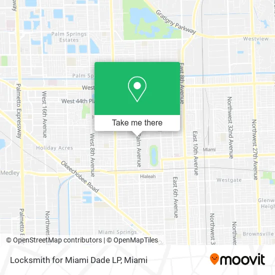
See Locksmith for Miami Dade LP, Hialeah, on the map
Public Transit to Locksmith for Miami Dade LP in Hialeah
Wondering how to get to Locksmith for Miami Dade LP in Hialeah? Moovit helps you find the best way to get to Locksmith for Miami Dade LP with step-by-step directions from the nearest public transit station.
Moovit provides free maps and live directions to help you navigate through your city. View schedules, routes, timetables, and find out how long does it take to get to Locksmith for Miami Dade LP in real time.
Looking for the nearest stop or station to Locksmith for Miami Dade LP? Check out this list of stops closest to your destination: Palm Av & W 32 St; Palm Av & W 29 St; Okeechobee; Metrorail Transfer Station; Miami Amtrak Station.
Bus: 37, HIAFLA, HIAMAR.Train: GREEN, TRIRAIL, TRIRAIL, FLORIDIAN, SILVER METEOR.
Want to see if there’s another route that gets you there at an earlier time? Moovit helps you find alternative routes or times. Get directions from and directions to Locksmith for Miami Dade LP easily from the Moovit App or Website.
We make riding to Locksmith for Miami Dade LP easy, which is why over 1.5 million users, including users in Hialeah, trust Moovit as the best app for public transit. You don’t need to download an individual bus app or train app, Moovit is your all-in-one transit app that helps you find the best bus time or train time available.
For information on prices of bus and train, costs and ride fares to Locksmith for Miami Dade LP, please check the Moovit app.
Use the app to navigate to popular places including to the airport, hospital, stadium, grocery store, mall, coffee shop, school, college, and university.
Locksmith for Miami Dade LP Address: 3230 Palm Ave Hialeah, FL 33012 street in Hialeah
- Amazon Locker-Malvolio,
- Hialeah Park Casino,
- Hialeah Park,
- Westland Congregtn of JHVH's Witness,
- Post Office,
- Lucas Roof Repair,
- City of Hialeah Parks,
- Otura Niko Botanica Pe,
- La Farandula Pizzeria,
- Sport Bar Grill GRG's,
- Hialeah Fl Locksmiths,
- Cono Pizza,
- Direct Appliances,
- Estrella Insurance,
- Quisqueya Appliances,
- Furniture Zone,
- Bedrooms 2 Go,
- Americacell USA,
- Coffee Shop Rainbow,
- Lockschangehialeah
Places Near Locksmith for Miami Dade LP (Hialeah)
- Sawgrass mall ( FL ), Miami Beach,
- Hard Rock Stadium, Miami Gardens,
- Marlins Park, Miami,
- Sawgrass Mall, Miami,
- Dolphin Mall Bus, Miami,
- Zoo Miami, Miami,
- Dolphin Mall, Miami,
- Aventura Mall, Miami Beach,
- Miami Freedom Park, Miami,
- Wynwood, Miami,
- Bayside Marketplace, Miami,
- Miami VA Hospital, Miami,
- Port of Miami Cruise Terminal, Miami,
- Miami-Dade County Courthouse, Miami,
- Richard E. Gerstein Justice Building, Miami,
- Keiser University Flagship Campus, West Palm Beach,
- Brickell City Centre, Miami,
- Little Havana, Miami,
- Miami Design District, Miami,
- Aventura Mall, Miami
How to get to popular places in Miami with public transit
Get around Hialeah by public transit!
Traveling around Hialeah has never been so easy. See step by step directions as you travel to any attraction, street or major public transit station. View bus and train schedules, arrival times, service alerts and detailed routes on a map, so you know exactly how to get to anywhere in Hialeah.
When traveling to any destination around Hialeah use Moovit's Live Directions with Get Off Notifications to know exactly where and how far to walk, how long to wait for your line, and how many stops are left. Moovit will alert you when it's time to get off — no need to constantly re-check whether yours is the next stop.
Wondering how to use public transit in Hialeah or how to pay for public transit in Hialeah? Moovit public transit app can help you navigate your way with public transit easily, and at minimum cost. It includes public transit fees, ticket prices, and costs. Looking for a map of Hialeah public transit lines? Moovit public transit app shows all public transit maps in Hialeah with all Bus, Train, Light Rail and Ferry routes and stops on an interactive map.
Miami has 4 transit type(s), including: Bus, Train, Light Rail and Ferry, operated by several transit agencies, including Broward County Transit, Miami-Dade Transit, Metrorail, Palm Tran, Tri-Rail, Brightline, MARTY, City of Homestead Trolley, Key West Transit, Treasure Coast Connector, GoLine IRT, Amtrak, Greyhound-us, FlixBus-us and Aventura Express Shuttle Bus