How to get to Locksmithinminute by bus?
Click on the bus route to see step by step directions with maps, line arrival times and updated time schedules.
From Suncoast High School, Riviera Beach
66 minFrom Tri-Rail-West Palm Beach Station, West Palm Beach
27 minFrom JFK Medical Center, West Palm Beach
52 minFrom Palm Beach Outlets, West Palm Beach
38 minFrom Kennedy Space Center, West Palm Beach
56 minFrom Suncoast Community High School, Riviera Beach
70 minFrom Brightline West Palm Beach, West Palm Beach
35 minFrom Good Samaritan Hospital, West Palm Beach
44 minFrom Forest Hill Community High School, West Palm Beach
60 minFrom Saint Marys Hospital, West Palm Beach
64 min
Bus stops near Locksmithinminute in Royal Palm Beach-West Jupiter
Bus lines to Locksmithinminute in Royal Palm Beach-West Jupiter
What are the closest stations to Locksmithinminute?
The closest stations to Locksmithinminute are:
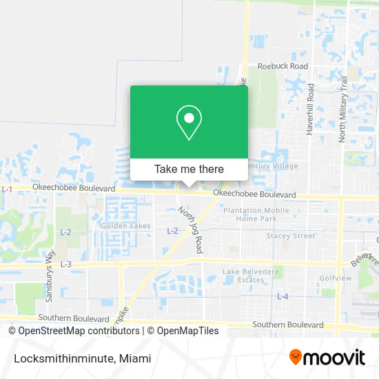
- OKEECHOBEE BLVD at BLD6339 is 115 yards away, 2 min walk.
- JOG RD at OKEECHOBEE BLVD is 367 yards away, 5 min walk.
Which bus line stops near Locksmithinminute?
43 (Rt 43 Westbound)
What’s the nearest bus station to Locksmithinminute in Royal Palm Beach-West Jupiter?
The nearest bus station to Locksmithinminute in Royal Palm Beach-West Jupiter is OKEECHOBEE BLVD at BLD6339. It’s a 2 min walk away.
What time is the first bus to Locksmithinminute in Royal Palm Beach-West Jupiter?
The 43 is the first bus that goes to Locksmithinminute in Royal Palm Beach-West Jupiter. It stops nearby at 5:27 AM.
What time is the last bus to Locksmithinminute in Royal Palm Beach-West Jupiter?
The 43 is the last bus that goes to Locksmithinminute in Royal Palm Beach-West Jupiter. It stops nearby at 10:22 PM.
See Locksmithinminute, Royal Palm Beach-West Jupiter, on the map
Public Transit to Locksmithinminute in Royal Palm Beach-West Jupiter
Wondering how to get to Locksmithinminute in Royal Palm Beach-West Jupiter? Moovit helps you find the best way to get to Locksmithinminute with step-by-step directions from the nearest public transit station.
Moovit provides free maps and live directions to help you navigate through your city. View schedules, routes, timetables, and find out how long does it take to get to Locksmithinminute in real time.
Looking for the nearest stop or station to Locksmithinminute? Check out this list of stops closest to your destination: OKEECHOBEE BLVD at BLD6339; JOG RD at OKEECHOBEE BLVD.
Bus: 43, 40, 44, 63.
Want to see if there’s another route that gets you there at an earlier time? Moovit helps you find alternative routes or times. Get directions from and directions to Locksmithinminute easily from the Moovit App or Website.
We make riding to Locksmithinminute easy, which is why over 1.5 million users, including users in Royal Palm Beach-West Jupiter, trust Moovit as the best app for public transit. You don’t need to download an individual bus app or train app, Moovit is your all-in-one transit app that helps you find the best bus time or train time available.
For information on prices of bus, costs and ride fares to Locksmithinminute, please check the Moovit app.
Use the app to navigate to popular places including to the airport, hospital, stadium, grocery store, mall, coffee shop, school, college, and university.
Locksmithinminute Address: 6841 Okeechobee Blvd West Palm Beach, FL 33411 street in Royal Palm Beach-West Jupiter
- American Youth Soccer Organization,
- All County Insurance,
- Hampton Inn-Hampton Inn West Palm Beach Florida Turnpike,
- Liberty Tax Service,
- Palm Beach Pizza,
- Total Wireless,
- Jairam Anubha MD,
- WING STOP,
- Swiftentry United,
- ANYTIME FITNESS,
- Cricket Wireless,
- Keller Williams Realty,
- Harvest Realty Group,
- Rocket Flood,
- The Velez Group,
- Utterly Financial,
- Upward Wealth Group,
- Fairfield Inn & Suites by Marriott West Palm Beach,
- Redbox,
- Sasser, Cestero & Roy, P.A.
Places Near Locksmithinminute (Royal Palm Beach-West Jupiter)
- Sawgrass Mall, Miami,
- Miami Freedom Park, Miami,
- Dolphin Mall Bus, Miami,
- Miami Design District, Miami,
- Miami VA Hospital, Miami,
- Port of Miami Cruise Terminal, Miami,
- Keiser University Flagship Campus, West Palm Beach,
- Hard Rock Stadium, Miami Gardens,
- Aventura Mall, Miami Beach,
- Richard E. Gerstein Justice Building, Miami,
- Little Havana, Miami,
- Marlins Park, Miami,
- Miami-Dade County Courthouse, Miami,
- Sawgrass mall ( FL ), Miami Beach,
- Zoo Miami, Miami,
- Aventura Mall, Miami,
- Wynwood, Miami,
- Bayside Marketplace, Miami,
- Brickell City Centre, Miami,
- Dolphin Mall, Miami
How to get to popular places in Miami with public transit
Get around Royal Palm Beach-West Jupiter by public transit!
Traveling around Royal Palm Beach-West Jupiter has never been so easy. See step by step directions as you travel to any attraction, street or major public transit station. View bus and train schedules, arrival times, service alerts and detailed routes on a map, so you know exactly how to get to anywhere in Royal Palm Beach-West Jupiter.
When traveling to any destination around Royal Palm Beach-West Jupiter use Moovit's Live Directions with Get Off Notifications to know exactly where and how far to walk, how long to wait for your line, and how many stops are left. Moovit will alert you when it's time to get off — no need to constantly re-check whether yours is the next stop.
Wondering how to use public transit in Royal Palm Beach-West Jupiter or how to pay for public transit in Royal Palm Beach-West Jupiter? Moovit public transit app can help you navigate your way with public transit easily, and at minimum cost. It includes public transit fees, ticket prices, and costs. Looking for a map of Royal Palm Beach-West Jupiter public transit lines? Moovit public transit app shows all public transit maps in Royal Palm Beach-West Jupiter with all Bus, Train, Light Rail and Ferry routes and stops on an interactive map.
Miami has 4 transit type(s), including: Bus, Train, Light Rail and Ferry, operated by several transit agencies, including Broward County Transit, Miami-Dade Transit, Metrorail, Palm Tran, Tri-Rail, Brightline, MARTY, City of Homestead Trolley, Key West Transit, Treasure Coast Connector, GoLine IRT, Amtrak, Greyhound-us, FlixBus-us and Aventura Express Shuttle Bus