How to get to Locksmiths Express by bus?
Click on the bus route to see step by step directions with maps, line arrival times and updated time schedules.
From Cathedral Of Faith Christian Life Center, Indianapolis City (Balance)
41 minFrom Beacon Health Group, Indianapolis City (Balance)
52 minFrom Bishop Chatard High School Baseball Field, Indianapolis City (Balance)
58 minFrom Chef Dan's Food Truck, Indianapolis City (Balance)
57 minFrom Urgent Dental Center Linwood, Indianapolis City (Balance)
59 minFrom Blue Rhino, Indianapolis City (Balance)
55 minFrom Castleton Square Mall, Indianapolis
86 minFrom H Spa, Indianapolis City (Balance)
61 minFrom Amazon Locker Tambo, Indianapolis City (Balance)
59 minFrom Warren Central High School, Indianapolis City (Balance)
43 min
Bus stops near Locksmiths Express in Lawrence
What are the closest stations to Locksmiths Express?
The closest stations to Locksmiths Express are:
- Post & Pendleton Pike Station Nb is 404 yards away, 5 min walk.
- 42nd St & Post Rd is 566 yards away, 7 min walk.
Which bus line stops near Locksmiths Express?
92 (Ft. Harrison)
What’s the nearest bus station to Locksmiths Express in Lawrence?
The nearest bus station to Locksmiths Express in Lawrence is Post & Pendleton Pike Station Nb. It’s a 5 min walk away.
What time is the first bus to Locksmiths Express in Lawrence?
The 92 is the first bus that goes to Locksmiths Express in Lawrence. It stops nearby at 4:14 AM.
What time is the last bus to Locksmiths Express in Lawrence?
The 92 is the last bus that goes to Locksmiths Express in Lawrence. It stops nearby at 1:04 AM.
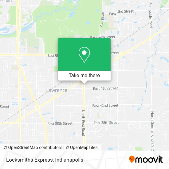
See Locksmiths Express, Lawrence, on the map
Public Transit to Locksmiths Express in Lawrence
Wondering how to get to Locksmiths Express in Lawrence? Moovit helps you find the best way to get to Locksmiths Express with step-by-step directions from the nearest public transit station.
Moovit provides free maps and live directions to help you navigate through your city. View schedules, routes, timetables, and find out how long does it take to get to Locksmiths Express in real time.
Looking for the nearest stop or station to Locksmiths Express? Check out this list of stops closest to your destination: Post & Pendleton Pike Station Nb; 42nd St & Post Rd.
Bus: 92, 30.
Want to see if there’s another route that gets you there at an earlier time? Moovit helps you find alternative routes or times. Get directions from and directions to Locksmiths Express easily from the Moovit App or Website.
We make riding to Locksmiths Express easy, which is why over 1.5 million users, including users in Lawrence, trust Moovit as the best app for public transit. You don’t need to download an individual bus app or train app, Moovit is your all-in-one transit app that helps you find the best bus time or train time available.
For information on prices of bus, costs and ride fares to Locksmiths Express, please check the Moovit app.
Use the app to navigate to popular places including to the airport, hospital, stadium, grocery store, mall, coffee shop, school, college, and university.
Locksmiths Express Address: 4741 N Post Rd Indianapolis, IN 46226 street in Lawrence
- Restaurant & Tortilleria la Mega Baleada,
- Locksmith Lawrence,
- Garage Door Repair Lawrence in,
- Deportes Torres,
- Estética Emmi Ale Beauty Salon,
- ATM,
- King's Cleaners & Alteration,
- Pupuseria Y Restaurante Cuscatlan,
- Regio's Taqueria,
- Ria Money Transfer,
- Fortaleza,
- Mi Pueblo,
- Coin Laundry,
- Restaurant Y Taqueria Don Marcos,
- Pike Laundromat (Pike Laundry Mat),
- Oxygen II,
- Oxygen II Smoke Shop,
- Big Boy Hobbies,
- Tienda Number Four,
- MoneyGram
Places Near Locksmiths Express (Lawrence)
- Indiana, Indianapolis City (Balance),
- Gainbridge Fieldhouse, Indianapolis City (Balance),
- Methodist Hospital of Indianapolis, Indianapolis City (Balance),
- Indianapolis Motor Speedway, Speedway,
- St. Vincent entrance #1, Indianapolis City (Balance),
- Castleton Square Mall, Indianapolis,
- Train Ride At Castleton Mall, Indianapolis City (Balance),
- Indiana Convention Center, Indianapolis City (Balance),
- Plainfield, IN, Plainfield,
- Eskenazi Hospital, Indianapolis City (Balance),
- I-465 / I-65 Interchange, Indianapolis City (Balance),
- Lucas Oil Stadium, Indianapolis City (Balance),
- 119 W 19th St Parking, Indianapolis City (Balance),
- Cotter's Massage Parlor With Happy Endings, Indianapolis City (Balance),
- THE BALT, Indianapolis City (Balance),
- Lilly Corporate Center (Eli Lilly & Co), Indianapolis City (Balance),
- St. Vincent Hospital - Indianapolis, Indianapolis City (Balance),
- I U Health Methodist Hospital, Indianapolis City (Balance),
- Indianapolis Airport Zone 2, Indianapolis City (Balance),
- Jersey Barn, Indianapolis City (Balance)
How to get to popular places in Indianapolis with public transit
Get around Lawrence by public transit!
Traveling around Lawrence has never been so easy. See step by step directions as you travel to any attraction, street or major public transit station. View bus and train schedules, arrival times, service alerts and detailed routes on a map, so you know exactly how to get to anywhere in Lawrence.
When traveling to any destination around Lawrence use Moovit's Live Directions with Get Off Notifications to know exactly where and how far to walk, how long to wait for your line, and how many stops are left. Moovit will alert you when it's time to get off — no need to constantly re-check whether yours is the next stop.
Wondering how to use public transit in Lawrence or how to pay for public transit in Lawrence? Moovit public transit app can help you navigate your way with public transit easily, and at minimum cost. It includes public transit fees, ticket prices, and costs. Looking for a map of Lawrence public transit lines? Moovit public transit app shows all public transit maps in Lawrence with all bus routes and stops on an interactive map.
Indianapolis has 1 transit type(s), including: bus, operated by several transit agencies, including IndyGo, FlixBus-us and Greyhound-us