How to get to Locksmiths Pro by bus?
Click on the bus route to see step by step directions with maps, line arrival times and updated time schedules.
From Glasshouse, Manhattan
51 minFrom Chinese Embassy, Manhattan
33 minFrom Secaucus Junction, Secaucus
65 minFrom Jacob K. Javits Convention Center, Manhattan
40 minFrom Ink 48 Hotel, Manhattan
43 minFrom North Bergen, NJ, North Bergen
46 minFrom Passaic, NJ, Passaic
37 minFrom Mountainside Hospital, Glen Ridge
74 minFrom Pier 78, Manhattan
47 minFrom Terminal 5, Manhattan
48 min
How to get to Locksmiths Pro by train?
Click on the train route to see step by step directions with maps, line arrival times and updated time schedules.
Bus stops near Locksmiths Pro in Lyndhurst
Train station near Locksmiths Pro in Lyndhurst
- Rutherford, 16 min walk,VIEW
Bus lines to Locksmiths Pro in Lyndhurst
- 76, P Newark Penn Station Via Lyndhrst Office Park,VIEW
- 192, New York Via Nutley,VIEW
- 199, Clifton Via Nutley,VIEW
- 109, New York,VIEW
- 191, Little Falls Willowbrook Via Montclair Hts,VIEW
- 195, Cedar Grove Little Falls,VIEW
- 190, E New York Exp Via Delawanna & Passaic Ave,VIEW
- 163, Ridgewood Terminal Via Murray Hill Parkway,VIEW
What are the closest stations to Locksmiths Pro?
The closest stations to Locksmiths Pro are:
- Wall St West at Garland Way is 119 yards away, 2 min walk.
- Rutherford Ave at Polito Ave is 554 yards away, 7 min walk.
- Rutherford is 1312 yards away, 16 min walk.
- Veterans Blvd 800's Of Borough St is 2314 yards away, 27 min walk.
Which bus lines stop near Locksmiths Pro?
These bus lines stop near Locksmiths Pro: 190, 192, 76.
Which train line stops near Locksmiths Pro?
MCL (Suffern)
What’s the nearest train station to Locksmiths Pro in Lyndhurst?
The nearest train station to Locksmiths Pro in Lyndhurst is Rutherford. It’s a 16 min walk away.
What’s the nearest bus station to Locksmiths Pro in Lyndhurst?
The nearest bus station to Locksmiths Pro in Lyndhurst is Wall St West at Garland Way. It’s a 2 min walk away.
What time is the first train to Locksmiths Pro in Lyndhurst?
The MCL is the first train that goes to Locksmiths Pro in Lyndhurst. It stops nearby at 5:40 AM.
What time is the last train to Locksmiths Pro in Lyndhurst?
The MCL is the last train that goes to Locksmiths Pro in Lyndhurst. It stops nearby at 1:49 AM.
What time is the first bus to Locksmiths Pro in Lyndhurst?
The 190 is the first bus that goes to Locksmiths Pro in Lyndhurst. It stops nearby at 3:06 AM.
What time is the last bus to Locksmiths Pro in Lyndhurst?
The 190 is the last bus that goes to Locksmiths Pro in Lyndhurst. It stops nearby at 3:02 AM.
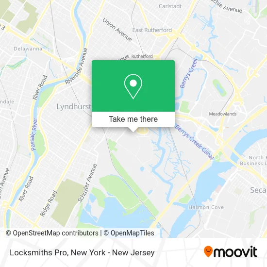
See Locksmiths Pro, Lyndhurst, on the map
Public Transit to Locksmiths Pro in Lyndhurst
Wondering how to get to Locksmiths Pro in Lyndhurst? Moovit helps you find the best way to get to Locksmiths Pro with step-by-step directions from the nearest public transit station.
Moovit provides free maps and live directions to help you navigate through your city. View schedules, routes, timetables, and find out how long does it take to get to Locksmiths Pro in real time.
Looking for the nearest stop or station to Locksmiths Pro? Check out this list of stops closest to your destination: Wall St West at Garland Way; Rutherford Ave at Polito Ave; Rutherford; Veterans Blvd 800's Of Borough St.
Bus: 190, 192, 76, 199, 109, 191, 195, 163.Train: MCL, PJL.
Want to see if there’s another route that gets you there at an earlier time? Moovit helps you find alternative routes or times. Get directions from and directions to Locksmiths Pro easily from the Moovit App or Website.
We make riding to Locksmiths Pro easy, which is why over 1.5 million users, including users in Lyndhurst, trust Moovit as the best app for public transit. You don’t need to download an individual bus app or train app, Moovit is your all-in-one transit app that helps you find the best bus time or train time available.
For information on prices of bus, train and subway, costs and ride fares to Locksmiths Pro, please check the Moovit app.
Use the app to navigate to popular places including to the airport, hospital, stadium, grocery store, mall, coffee shop, school, college, and university.
Locksmiths Pro Address: 1099 Wall St W street in Lyndhurst
- Ever Trust Insurance Co,
- Derrick Dixon: Primerica - Financial Services,
- Ykk (U.S.A.) Inc.,
- Zhejiang Tea Group Co.,
- Preferred Plastics,
- Cooper Pest Solutions,
- Phoenix Group,
- Steven Kanoc: Primerica - Financial Services,
- Lizza & Carullo Cpas & Advisors,
- Meadowlands Live Cvb,
- Suarezbaldomero, P.A.,
- Erbach Communications Group,
- Ralph La Testa,
- Blickman,
- Cedrus Managment,
- Com Tek Workplace Solutions,
- Real Estate Team Resources,
- Team Resources, Inc.,
- Njbh - Affiliate Of Lifestance Therapists & Psychiatrists Lyndhurst,
- House Of Keys Locksmith
Places Near Locksmiths Pro (Lyndhurst)
- 911 Memorial, Manhattan,
- 111 Centre New York City Supreme Court, Manhattan,
- Katz's Deli, Manhattan,
- Mountainside Hospital, Glen Ridge,
- Queens Center Mall, Queens,
- 26 Federal Plaza, Manhattan,
- qqqq, Manhattan,
- SoHo, Manhattan,
- Chinatown, Manhattan,
- Hudson Yards, Manhattan,
- 3 Stone St, Manhattan,
- Wall Street, Manhattan,
- Times Square, Manhattan,
- 1 Police Plaza, Manhattan,
- 376 Hudson Street, Manhattan,
- 66 John Street, Manhattan,
- Rockefeller Center, Manhattan,
- Bellevue Hospital, Manhattan,
- San Gennaro Feast, Manhattan,
- Pier 83, Manhattan
How to get to popular places in New York - New Jersey with public transit
Get around Lyndhurst by public transit!
Traveling around Lyndhurst has never been so easy. See step by step directions as you travel to any attraction, street or major public transit station. View bus and train schedules, arrival times, service alerts and detailed routes on a map, so you know exactly how to get to anywhere in Lyndhurst.
When traveling to any destination around Lyndhurst use Moovit's Live Directions with Get Off Notifications to know exactly where and how far to walk, how long to wait for your line, and how many stops are left. Moovit will alert you when it's time to get off — no need to constantly re-check whether yours is the next stop.
Wondering how to use public transit in Lyndhurst or how to pay for public transit in Lyndhurst? Moovit public transit app can help you navigate your way with public transit easily, and at minimum cost. It includes public transit fees, ticket prices, and costs. Looking for a map of Lyndhurst public transit lines? Moovit public transit app shows all public transit maps in Lyndhurst with all Bus, Train, Subway, Light Rail, Ferry and Cable Car routes and stops on an interactive map.
New York - New Jersey has 6 transit type(s), including: Bus, Train, Subway, Light Rail, Ferry and Cable Car, operated by several transit agencies, including MTA Subway, Metro-North Railroad, LIRR, PATH, MTA New York City Transit - Express routes, MTA Bus, NJ Transit, NYC Ferry, NICE bus, Bee-Line Bus, NJ Transit Rail, Norwalk Transit District, Hartford Line, River Valley Transit and HART