How to get to Lockstep Realty by bus?
Click on the bus route to see step by step directions with maps, line arrival times and updated time schedules.
From DAD'S ROOT BEER, Indianapolis City (Balance)
110 minFrom Black Orchid Barbers, Indianapolis City (Balance)
60 minFrom It Expense VS Roi Analysis, Indianapolis City (Balance)
113 minFrom Community Hospital North, Indianapolis City (Balance)
25 minFrom Messiah Cares Child Development Center, Indianapolis City (Balance)
39 minFrom 71st Street and Michigan Road, Indianapolis City (Balance)
99 minFrom Midtown Indiana Polis, Indianapolis City (Balance)
44 minFrom Reetu Bachhawat, Indianapolis City (Balance)
28 minFrom I-465 Exit 27 & Michigan Rd, Indianapolis City (Balance)
112 min
Bus stops near Lockstep Realty in Indianapolis City (Balance)
Bus lines to Lockstep Realty in Indianapolis City (Balance)
What are the closest stations to Lockstep Realty?
The closest stations to Lockstep Realty are:
- Keystone Crossing - 8464 N is 56 yards away, 2 min walk.
- Keystone Crossing - 8700 N is 706 yards away, 9 min walk.
Which bus lines stop near Lockstep Realty?
These bus lines stop near Lockstep Realty: 26, 82.
What’s the nearest bus station to Lockstep Realty in Indianapolis City (Balance)?
The nearest bus station to Lockstep Realty in Indianapolis City (Balance) is Keystone Crossing - 8464 N. It’s a 2 min walk away.
What time is the first bus to Lockstep Realty in Indianapolis City (Balance)?
The 82 is the first bus that goes to Lockstep Realty in Indianapolis City (Balance). It stops nearby at 5:14 AM.
What time is the last bus to Lockstep Realty in Indianapolis City (Balance)?
The 26 is the last bus that goes to Lockstep Realty in Indianapolis City (Balance). It stops nearby at 11:29 PM.
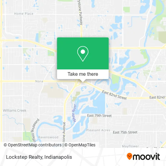
See Lockstep Realty, Indianapolis City (Balance), on the map
Public Transit to Lockstep Realty in Indianapolis City (Balance)
Wondering how to get to Lockstep Realty in Indianapolis City (Balance)? Moovit helps you find the best way to get to Lockstep Realty with step-by-step directions from the nearest public transit station.
Moovit provides free maps and live directions to help you navigate through your city. View schedules, routes, timetables, and find out how long does it take to get to Lockstep Realty in real time.
Looking for the nearest stop or station to Lockstep Realty? Check out this list of stops closest to your destination: Keystone Crossing - 8464 N; Keystone Crossing - 8700 N.
Bus: 26, 82.
Want to see if there’s another route that gets you there at an earlier time? Moovit helps you find alternative routes or times. Get directions from and directions to Lockstep Realty easily from the Moovit App or Website.
We make riding to Lockstep Realty easy, which is why over 1.5 million users, including users in Indianapolis City (Balance), trust Moovit as the best app for public transit. You don’t need to download an individual bus app or train app, Moovit is your all-in-one transit app that helps you find the best bus time or train time available.
For information on prices of bus, costs and ride fares to Lockstep Realty, please check the Moovit app.
Use the app to navigate to popular places including to the airport, hospital, stadium, grocery store, mall, coffee shop, school, college, and university.
Lockstep Realty Address: 8500 Keystone Xing Indianapolis, IN 46240 street in Indianapolis City (Balance)
- High Garden Realty,
- The Marine Realtor,
- Easystreet Realty / Hi,
- Highgarden Real Estate Indiana,
- Via Lawrence Commons Small Shop,
- Lauren Anthony, Realtor,
- Envara Woodfired G,
- US Gov Gsa,
- ABC Lock & Key,
- 8500 Keystone Crossing Building,
- Noblesville Schools,
- True North Realty Group,
- The Hawkins & Kressley Agency,
- Champs Keystone Indiana,
- Locks Tech Indianapolis,
- Teas Me Cafe & Gifts,
- Keystone at the Crossing,
- Faith Boutique Collections,
- Bellon Magic Locksmith,
- At Home Wellness Group
Places Near Lockstep Realty (Indianapolis City (Balance))
- Cotter's Massage Parlor With Happy Endings, Indianapolis City (Balance),
- I U Health Methodist Hospital, Indianapolis City (Balance),
- Lilly Corporate Center (Eli Lilly & Co), Indianapolis City (Balance),
- THE BALT, Indianapolis City (Balance),
- Indianapolis Motor Speedway, Speedway,
- Indiana, Indianapolis City (Balance),
- Plainfield, IN, Plainfield,
- St. Vincent Hospital - Indianapolis, Indianapolis City (Balance),
- Eskenazi Hospital, Indianapolis City (Balance),
- Gainbridge Fieldhouse, Indianapolis City (Balance),
- Lucas Oil Stadium, Indianapolis City (Balance),
- Castleton Square Mall, Indianapolis,
- Train Ride At Castleton Mall, Indianapolis City (Balance),
- Indiana Convention Center, Indianapolis City (Balance),
- Indianapolis Airport Zone 2, Indianapolis City (Balance),
- Jersey Barn, Indianapolis City (Balance),
- St. Vincent entrance #1, Indianapolis City (Balance),
- 119 W 19th St Parking, Indianapolis City (Balance),
- I-465 / I-65 Interchange, Indianapolis City (Balance),
- Methodist Hospital of Indianapolis, Indianapolis City (Balance)
How to get to popular places in Indianapolis with public transit
Get around Indianapolis City (Balance) by public transit!
Traveling around Indianapolis City (Balance) has never been so easy. See step by step directions as you travel to any attraction, street or major public transit station. View bus and train schedules, arrival times, service alerts and detailed routes on a map, so you know exactly how to get to anywhere in Indianapolis City (Balance).
When traveling to any destination around Indianapolis City (Balance) use Moovit's Live Directions with Get Off Notifications to know exactly where and how far to walk, how long to wait for your line, and how many stops are left. Moovit will alert you when it's time to get off — no need to constantly re-check whether yours is the next stop.
Wondering how to use public transit in Indianapolis City (Balance) or how to pay for public transit in Indianapolis City (Balance)? Moovit public transit app can help you navigate your way with public transit easily, and at minimum cost. It includes public transit fees, ticket prices, and costs. Looking for a map of Indianapolis City (Balance) public transit lines? Moovit public transit app shows all public transit maps in Indianapolis City (Balance) with all bus routes and stops on an interactive map.
Indianapolis has 1 transit type(s), including: bus, operated by several transit agencies, including IndyGo, FlixBus-us and Greyhound-us