How to get to Logra Metas Financieras by bus?
Click on the bus route to see step by step directions with maps, line arrival times and updated time schedules.
From 150 E Broadway (Broadway), Manhattan
51 minFrom Casa Cipriani New York, Manhattan
68 minFrom George Washington Bridge, Manhattan
75 minFrom United Palace Theatre, Manhattan
60 minFrom 177th Fort Washington Ave, Manhattan
63 minFrom The Beekman, Manhattan
58 minFrom Church Street, Manhattan
53 minFrom Greyhound NYC To Foxwoods Casino, Bronx
99 minFrom Community Lines, Jersey City
75 minFrom King Spa, Palisades Park
52 min
How to get to Logra Metas Financieras by train?
Click on the train route to see step by step directions with maps, line arrival times and updated time schedules.
How to get to Logra Metas Financieras by subway?
Click on the subway route to see step by step directions with maps, line arrival times and updated time schedules.
From 150 E Broadway (Broadway), Manhattan
19 minFrom Casa Cipriani New York, Manhattan
28 minFrom George Washington Bridge, Manhattan
36 minFrom United Palace Theatre, Manhattan
29 minFrom 177th Fort Washington Ave, Manhattan
27 minFrom The Beekman, Manhattan
27 minFrom Church Street, Manhattan
23 minFrom Greyhound NYC To Foxwoods Casino, Bronx
41 min
Bus stops near Logra Metas Financieras in Manhattan
Subway stations near Logra Metas Financieras in Manhattan
Bus lines to Logra Metas Financieras in Manhattan
- M7, 14 St Via Columbus Via 7 Av,VIEW
- M104, 41 St Via Broadway/7 Av,VIEW
- M20, South Ferry Via 7 Av Via Bat Pk City,VIEW
- W44, W44/59th St,VIEW
- 59TH ST, Midtown / W 39th Street - Midtown / W 39th Street,VIEW
- HAMPTON JITNEY MONTAUK, Amagansett,VIEW
- M5, Broadway-135 St,VIEW
- 50TH ST, E 50th St & 2nd Ave,VIEW
- BXM2, West Midtown Penn Sta-34 St Via Kappock St,VIEW
- M50, East Side 49 St-1 Av Crosstown,VIEW
What are the closest stations to Logra Metas Financieras?
The closest stations to Logra Metas Financieras are:
- 7 Av/W 52 St is 28 yards away, 1 min walk.
- 7 Av/W 53 St is 56 yards away, 1 min walk.
- 55th St & 7th Westsider is 142 yards away, 2 min walk.
- 6 Av/W 51 St is 147 yards away, 3 min walk.
- W 50th St & 7th Ave is 214 yards away, 3 min walk.
- 7 Av/W 50 St is 261 yards away, 4 min walk.
- W 50 St/7 Av is 261 yards away, 4 min walk.
- 49 St is 292 yards away, 4 min walk.
- 7 Av is 372 yards away, 5 min walk.
- 50 St is 453 yards away, 6 min walk.
Which bus lines stop near Logra Metas Financieras?
These bus lines stop near Logra Metas Financieras: M104, M20, M5, M50, M7.
Which train line stops near Logra Metas Financieras?
YEL (Journal Square - 33rd Street)
Which subway lines stop near Logra Metas Financieras?
These subway lines stop near Logra Metas Financieras: 1, B, D, E, W.
What’s the nearest subway station to Logra Metas Financieras in Manhattan?
The nearest subway station to Logra Metas Financieras in Manhattan is 49 St. It’s a 4 min walk away.
What’s the nearest bus station to Logra Metas Financieras in Manhattan?
The nearest bus stations to Logra Metas Financieras in Manhattan are 7 Av/W 52 St and 7 Av/W 53 St. The closest one is a 1 min walk away.
What time is the first subway to Logra Metas Financieras in Manhattan?
The 1 is the first subway that goes to Logra Metas Financieras in Manhattan. It stops nearby at 3:01 AM.
What time is the last subway to Logra Metas Financieras in Manhattan?
The A is the last subway that goes to Logra Metas Financieras in Manhattan. It stops nearby at 3:59 AM.
What time is the first bus to Logra Metas Financieras in Manhattan?
The M104 is the first bus that goes to Logra Metas Financieras in Manhattan. It stops nearby at 3:05 AM.
What time is the last bus to Logra Metas Financieras in Manhattan?
The M7 is the last bus that goes to Logra Metas Financieras in Manhattan. It stops nearby at 3:10 AM.
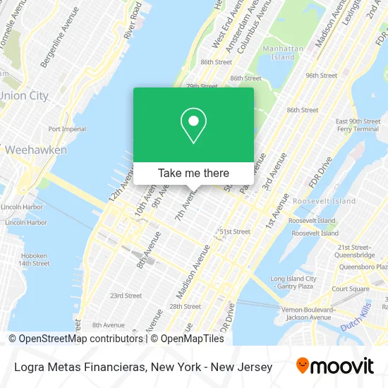
See Logra Metas Financieras, Manhattan, on the map
Public Transit to Logra Metas Financieras in Manhattan
Wondering how to get to Logra Metas Financieras in Manhattan? Moovit helps you find the best way to get to Logra Metas Financieras with step-by-step directions from the nearest public transit station.
Moovit provides free maps and live directions to help you navigate through your city. View schedules, routes, timetables, and find out how long does it take to get to Logra Metas Financieras in real time.
Looking for the nearest stop or station to Logra Metas Financieras? Check out this list of stops closest to your destination: 7 Av/W 52 St; 7 Av/W 53 St; 55th St & 7th Westsider; 6 Av/W 51 St; W 50th St & 7th Ave; 7 Av/W 50 St; W 50 St/7 Av; 49 St; 7 Av; 50 St.
Bus: M104, M20, M5, M50, M7.Train: YEL.Subway: 1, B, D, E, W, N, Q, R, A, C, 2.
Want to see if there’s another route that gets you there at an earlier time? Moovit helps you find alternative routes or times. Get directions from and directions to Logra Metas Financieras easily from the Moovit App or Website.
We make riding to Logra Metas Financieras easy, which is why over 1.5 million users, including users in Manhattan, trust Moovit as the best app for public transit. You don’t need to download an individual bus app or train app, Moovit is your all-in-one transit app that helps you find the best bus time or train time available.
For information on prices of subway, bus and train, costs and ride fares to Logra Metas Financieras, please check the Moovit app.
Use the app to navigate to popular places including to the airport, hospital, stadium, grocery store, mall, coffee shop, school, college, and university.
Logra Metas Financieras Address: 811 7th Ave street in Manhattan
- Flame Con,
- Lek Spa,
- Sheraton New York Hotel And Towers,
- Rushmypassport In Fedex Office,
- 811 7th Avenue,
- Ballon Stoll P.C.,
- New York City Sheraton,
- MTA Bus - 7th Ave & W 53rd St (X1 / X7 / X9),
- Brg Capital Advisors,
- 7th Avenue and 53rd Street Subway Station,
- Sheraton New York Times Square Hotel,
- 7th Ave (7th at W 53rd St),
- 7th Ave (53rd street 7th ave),
- 7th Ave / W 53rd St,
- Rosie O'Grady's Time Square,
- Ion Media Networks,
- Samuel Humphrey,
- 7th Ave (7th avenue corner W 52nd St),
- 7th Ave and 52nd St,
- Law Office Of Marc Fernich
Places Near Logra Metas Financieras (Manhattan)
- 1 Police Plaza, Manhattan,
- Pier 83, Manhattan,
- Chinatown, Manhattan,
- Hudson Yards, Manhattan,
- 911 Memorial, Manhattan,
- 66 John Street, Manhattan,
- Times Square, Manhattan,
- Rockefeller Center, Manhattan,
- Katz's Deli, Manhattan,
- 3 Stone St, Manhattan,
- 26 Federal Plaza, Manhattan,
- qqqq, Manhattan,
- Mountainside Hospital, Glen Ridge,
- SoHo, Manhattan,
- Queens Center Mall, Queens,
- 111 Centre New York City Supreme Court, Manhattan,
- 376 Hudson Street, Manhattan,
- Wall Street, Manhattan,
- Bellevue Hospital, Manhattan,
- San Gennaro Feast, Manhattan
How to get to popular places in New York - New Jersey with public transit
Get around Manhattan by public transit!
Traveling around Manhattan has never been so easy. See step by step directions as you travel to any attraction, street or major public transit station. View bus and train schedules, arrival times, service alerts and detailed routes on a map, so you know exactly how to get to anywhere in Manhattan.
When traveling to any destination around Manhattan use Moovit's Live Directions with Get Off Notifications to know exactly where and how far to walk, how long to wait for your line, and how many stops are left. Moovit will alert you when it's time to get off — no need to constantly re-check whether yours is the next stop.
Wondering how to use public transit in Manhattan or how to pay for public transit in Manhattan? Moovit public transit app can help you navigate your way with public transit easily, and at minimum cost. It includes public transit fees, ticket prices, and costs. Looking for a map of Manhattan public transit lines? Moovit public transit app shows all public transit maps in Manhattan with all Bus, Train, Subway, Light Rail, Ferry and Cable Car routes and stops on an interactive map.
New York - New Jersey has 6 transit type(s), including: Bus, Train, Subway, Light Rail, Ferry and Cable Car, operated by several transit agencies, including MTA Subway, Metro-North Railroad, LIRR, PATH, MTA New York City Transit - Express routes, MTA Bus, NJ Transit, NYC Ferry, NICE bus, Bee-Line Bus, NJ Transit Rail, Norwalk Transit District, Hartford Line, River Valley Transit and HART