How to get to Lomas de Collique by bus?
Click on the bus route to see step by step directions with maps, line arrival times and updated time schedules.
From Cementerio Parque del Recuerdo - Oquendo/Callao, Ventanilla
74 minFrom San Juan De Lurigancho, San Juan D
66 minFrom ovalo huandoy, Los Olivos
37 minFrom Av Angélica gamarra cuadra 14, Los Olivos
44 minFrom Centro Comercial Plaza Norte, Independen
37 minFrom Palacio de la Juventud de Los Olivos, San Martin
40 minFrom LA ENSENADA PUENTE PIEDRA, Puente Pie
31 minFrom km 22 1/2 Tupac Amaru, Carabayllo
32 minFrom Centro Comercial Plaza Norte, Independen
38 minFrom Puente Piedra, Puente Pie
62 min
Bus stops near Lomas de Collique in Comas
Bus lines to Lomas de Collique in Comas
- 1013, Jesús María - Carabayllo,VIEW
- 1015, Carabayllo - Lince - Carabayllo,VIEW
- 1182, San Juan de Miraflores - Carabayllo,VIEW
- 1337, Villa Club (Carabayllo) - La Marina (San Miguel),VIEW
- 1021, Mercado (Magdalena Del Mar) - Torre Blanca (Carabayllo),VIEW
- 1235, Manchay (Pachacamac) - Santo Domingo (Carabayllo),VIEW
- 1237, Santo Domingo (Carabayllo) - Velasco Alvarado (Villa El Salvador),VIEW
- 1336, Torreblanca (Carabayllo) - Universitaria (San Miguel),VIEW
- B, Estación Chimpu Ocllo (Carabayllo) - Estación Central (Cercado de Lima) ,VIEW
- EX11, Estacion Central (Lima) - Estacion Los Incas (Comas) ,VIEW
- EX13, Estación Central (Cercado De Lima) - Chimpu Ocllo (Carabayllo) ,VIEW
- AN04, Estación Los Incas (Comas) - Collique (Comas),VIEW
- 1005, Huánuco (La Victoria) - Punchauca (Carabayllo),VIEW
- 1008, Sucre (Magdalena Del Mar) - Villa Club (Carabayllo),VIEW
- 1011, Carabayllo - Pueblo Libre,VIEW
- 1462, Carabayllo - Universitaria - Brasil - Carabayllo,VIEW
What are the closest stations to Lomas de Collique?
The closest stations to Lomas de Collique are:
- Los Incas is 229 meters away, 4 min walk.
- Sangarará is 289 meters away, 5 min walk.
- Estación Los Incas is 312 meters away, 5 min walk.
Which bus lines stop near Lomas de Collique?
These bus lines stop near Lomas de Collique: 1005, 1013, 1237, 1336, 1337.
What’s the nearest bus station to Lomas de Collique in Comas?
The nearest bus station to Lomas de Collique in Comas is Los Incas. It’s a 4 min walk away.
What time is the first bus to Lomas de Collique in Comas?
The 1237 is the first bus that goes to Lomas de Collique in Comas. It stops nearby at 3:44 AM.
What time is the last bus to Lomas de Collique in Comas?
The 1021 is the last bus that goes to Lomas de Collique in Comas. It stops nearby at 12:46 AM.
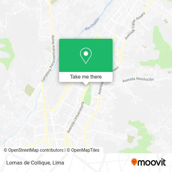
See Lomas de Collique, Comas, on the map
Public Transit to Lomas de Collique in Comas
Wondering how to get to Lomas de Collique in Comas? Moovit helps you find the best way to get to Lomas de Collique with step-by-step directions from the nearest public transit station.
Moovit provides free maps and live directions to help you navigate through your city. View schedules, routes, timetables, and find out how long does it take to get to Lomas de Collique in real time.
Looking for the nearest stop or station to Lomas de Collique? Check out this list of stops closest to your destination: Los Incas; Sangarará; Estación Los Incas.
Bus: 1005, 1013, 1237, 1336, 1337, 1015, 1182, 1021, 1235, B, EX11, EX13, AN04, 1008, 1011, 1462.
Want to see if there’s another route that gets you there at an earlier time? Moovit helps you find alternative routes or times. Get directions from and directions to Lomas de Collique easily from the Moovit App or Website.
We make riding to Lomas de Collique easy, which is why over 1.5 million users, including users in Comas, trust Moovit as the best app for public transit. You don’t need to download an individual bus app or train app, Moovit is your all-in-one transit app that helps you find the best bus time or train time available.
For information on prices of bus, costs and ride fares to Lomas de Collique, please check the Moovit app.
Use the app to navigate to popular places including to the airport, hospital, stadium, grocery store, mall, coffee shop, school, college, and university.
Lomas de Collique Address: Calle 53 Popular Ciudad de Lima, 15316 Comas street in Comas
- El Rincon de Coco,
- Avenida Universitaria Norte,
- Bazar San Antonio,
- Pollería La Fogata,
- Iglesia Adventista Del Septimo Dia,
- Helados Artika,
- AV LOS INCAS C AV UNIVERSITARIA COMAS,
- Av Micaela Bastidas cruce con Calle Manuel Gonzales ,
- Show Infantil Patrulla Canina,Show Infantil Paw Patrol,
- Restaurante KFC,
- Librería Cristiana Semillas de Fe,
- Sharon,
- Rubén Pérez & Madam Karla,
- Confecciones Arantza Ysabella,
- Javi,
- Chavez Saenz Lilia Lizzett,
- MZ G LOTE 8 por la Urb Alameda del Pinar distrito Comas,
- Avenida Universitaria Norte,
- Británico,
- Avenida Universitaria
Places Near Lomas de Collique (Comas)
- Parque Kennedy, Miraflores,
- Mall Del Sur,
- Jockey Plaza, Santiago D,
- Plaza San Miguel, San Miguel,
- Larcomar, Miraflores,
- Miraflores, Miraflores,
- Hospital Edgardo Rebagliati Martins, Jesus Mari,
- av arequipa, Lima,
- Centro Comercial Plaza Norte, Independen,
- Gamarra,
- Av. Abancay, Lima,
- Av. La Marina, San Miguel,
- Real Plaza Puruchuco, Ate,
- Parque de las Leyendas, San Miguel,
- Aeropuerto Internacional Jorge Chávez, Ventanilla,
- Circuito Mágico Del Agua, Lima,
- Av. Salaverry, Jesus Mari,
- Barranco, Barranco,
- Pontificia Universidad Católica del Perú - PUCP, San Miguel,
- Paradero Av.Brasil
How to get to popular places in Lima with public transit
Get around Comas by public transit!
Traveling around Comas has never been so easy. See step by step directions as you travel to any attraction, street or major public transit station. View bus and train schedules, arrival times, service alerts and detailed routes on a map, so you know exactly how to get to anywhere in Comas.
When traveling to any destination around Comas use Moovit's Live Directions with Get Off Notifications to know exactly where and how far to walk, how long to wait for your line, and how many stops are left. Moovit will alert you when it's time to get off — no need to constantly re-check whether yours is the next stop.
Wondering how to use public transit in Comas or how to pay for public transit in Comas? Moovit public transit app can help you navigate your way with public transit easily, and at minimum cost. It includes public transit fees, ticket prices, and costs. Looking for a map of Comas public transit lines? Moovit public transit app shows all public transit maps in Comas with all Bus, Metro and Ferry routes and stops on an interactive map.
Lima has 3 transit type(s), including: Bus, Metro and Ferry, operated by several transit agencies, including Metro de Lima Línea 2 , Metro de Lima, Corredor Rojo, Metropolitano, Metropolitano - Alimentadores, Corredor Morado, Corredor Azul, Rutas Tradicionales, Transportes y Servicios La Esperanza S.A., Las Flores S.A., Virgen de la Asunción S.A., Consorcio HAM, Transportes y Service Canadá S.A., ETUL4SA and ETUCHISA