Directions to Long & Foster (Staunton) with public transportation
The following transit lines have routes that pass near Long & Foster
 Bus: 250 CONNECTOR, BRCC SOUTH, WEST / NORTH LOOP.
- Train: CARDINAL.
How to get to Long & Foster by bus?
Click on the bus route to see step by step directions with maps, line arrival times and updated time schedules.
Bus stop near Long & Foster in Staunton
- Peck St / Montgomery Ave, 7 min walk,VIEW
Train station near Long & Foster in Staunton
- Staunton Amtrak Station, 21 min walk,VIEW
Bus lines to Long & Foster in Staunton
- WEST / NORTH LOOP, West / North Loop,VIEW
What are the closest stations to Long & Foster?
The closest stations to Long & Foster are:
- Peck St / Montgomery Ave is 575 yards away, 7 min walk.
- Staunton Amtrak Station is 1727 yards away, 21 min walk.
Which bus lines stop near Long & Foster?
These bus lines stop near Long & Foster: 250 CONNECTOR, BRCC SOUTH.
What’s the nearest train station to Long & Foster in Staunton?
The nearest train station to Long & Foster in Staunton is Staunton Amtrak Station. It’s a 21 min walk away.
What’s the nearest bus station to Long & Foster in Staunton?
The nearest bus station to Long & Foster in Staunton is Peck St / Montgomery Ave. It’s a 7 min walk away.
What time is the first bus to Long & Foster in Staunton?
The WEST / NORTH LOOP is the first bus that goes to Long & Foster in Staunton. It stops nearby at 6:36 AM.
What time is the last bus to Long & Foster in Staunton?
The WEST / NORTH LOOP is the last bus that goes to Long & Foster in Staunton. It stops nearby at 6:43 PM.
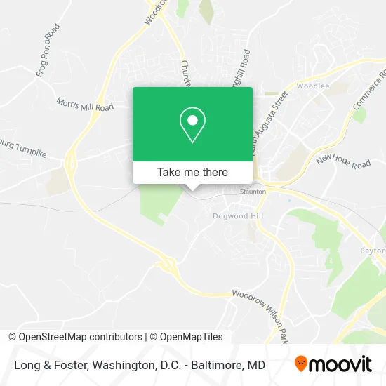
See Long & Foster, Staunton, on the map
Public Transit to Long & Foster in Staunton
Wondering how to get to Long & Foster in Staunton? Moovit helps you find the best way to get to Long & Foster with step-by-step directions from the nearest public transit station.
Moovit provides free maps and live directions to help you navigate through your city. View schedules, routes, timetables, and find out how long does it take to get to Long & Foster in real time.
Looking for the nearest stop or station to Long & Foster? Check out this list of stops closest to your destination: Peck St / Montgomery Ave; Staunton Amtrak Station.
Bus: 250 CONNECTOR, BRCC SOUTH, WEST / NORTH LOOP.Train: CARDINAL.
Want to see if there’s another route that gets you there at an earlier time? Moovit helps you find alternative routes or times. Get directions from and directions to Long & Foster easily from the Moovit App or Website.
We make riding to Long & Foster easy, which is why over 1.5 million users, including users in Staunton, trust Moovit as the best app for public transit. You don’t need to download an individual bus app or train app, Moovit is your all-in-one transit app that helps you find the best bus time or train time available.
For information on prices of bus, costs and ride fares to Long & Foster, please check the Moovit app.
Use the app to navigate to popular places including to the airport, hospital, stadium, grocery store, mall, coffee shop, school, college, and university.
Long & Foster Address: 450 Jersey St Staunton, VA 24401 street in Staunton
- T & A Cleaning,
- Basic Witz (No Subdivision),
- Richardson Ext,
- Kennedy Ja,
- Kravitz Phllip and Kelly,
- Aw Hanger,
- Skylark Hammocks,
- Beulah Park,
- Mount Salem Baptist Church,
- Queen City Silviculture,
- Garber Manor,
- Allen Chapel Staunton African Methodist Episcopal Church,
- Tannehill-Wheat,
- Shenandoah Handyman Service,
- Allen Chapel Ame Church,
- Brandi's 5.00 Candy,
- Kinzley,
- Shenandoah Valley Juvenile Detention Home,
- Staunton-Augusta-Waynesboro Habitat For Humanity,
- Trout Ph
Places Near Long & Foster (Staunton)
- M&T Bank Stadium, Baltimore,
- Sibley Memorial Hospital, Washington,
- Marriott Marquis Washington, DC, Washington,
- PG Mall, Prince George's County,
- Capital One Arena, Washington,
- Washington DC VA Medical Center, Washington,
- National Zoo, Washington,
- Warner Theatre, Washington,
- Camden Yards, Baltimore,
- Georgetown, Washington,
- Pennsylvania Ave NW (3rd st and pennsylvania), Washington,
- Amazon Hq2, Arlington County,
- The Anthem, Washington,
- Basilica of the National Shrine, Washington,
- National Museum of African American History and Culture, Washington,
- National Mall, Washington,
- Rock Creek Tennis Center, Washington,
- Westfield Montgomery Mall, Montgomery County,
- Museum Of The Bible, Washington,
- Washington National Cathedral, Washington
How to get to popular places in Washington, D.C. - Baltimore, MD with public transit
Get around Staunton by public transit!
Traveling around Staunton has never been so easy. See step by step directions as you travel to any attraction, street or major public transit station. View bus and train schedules, arrival times, service alerts and detailed routes on a map, so you know exactly how to get to anywhere in Staunton.
When traveling to any destination around Staunton use Moovit's Live Directions with Get Off Notifications to know exactly where and how far to walk, how long to wait for your line, and how many stops are left. Moovit will alert you when it's time to get off — no need to constantly re-check whether yours is the next stop.
Wondering how to use public transit in Staunton or how to pay for public transit in Staunton? Moovit public transit app can help you navigate your way with public transit easily, and at minimum cost. It includes public transit fees, ticket prices, and costs. Looking for a map of Staunton public transit lines? Moovit public transit app shows all public transit maps in Staunton with all Bus, Train, Metro, Light Rail and Ferry routes and stops on an interactive map.
Washington, D.C. - Baltimore, MD has 5 transit type(s), including: Bus, Train, Metro, Light Rail and Ferry, operated by several transit agencies, including WMATA, Montgomery County Ride On, Fairfax Connector, TheBus, PRTC, DASH - Alexandria, Arlington Transit (ART), RTA of Central Maryland, MDOT MTA, MDOT MTA Light RailLink, MDOT MTA Commuter Bus, MDOT MTA Local Bus, FXBGO!, Virginia Railway Express (VRE) and MARC