How to get to Lot P87 by bus?
Click on the bus route to see step by step directions with maps, line arrival times and updated time schedules.
From Royal Caribbean Cruises Ltd., Miami
77 minFrom Beach Outlet, Miami Beach
36 minFrom Dolphin Mall Bus, Miami
61 minFrom Hotel Riu Plaza Miami Beach, Miami Beach
22 minFrom Hampton Inn Suites Miami Wynwood Design District FL, Miami
42 minFrom Miami-Dade County School Board Administration Building, Miami
55 minFrom Miami Heat Media Center, Miami
59 minFrom Lincoln Road, Miami Beach (South Beach), Miami Beach
36 minFrom FTX Arena, Miami
60 minFrom Lotus House Women's Shelter, Miami
62 min
Bus stops near Lot P87 in Miami Beach
Bus lines to Lot P87 in Miami Beach
What are the closest stations to Lot P87?
The closest stations to Lot P87 are:
- 71 St & Bay Dr is 131 yards away, 2 min walk.
- 71 St & Rue Versailles is 201 yards away, 3 min walk.
- 69 St & Abbott Ave is 825 yards away, 10 min walk.
Which bus lines stop near Lot P87?
These bus lines stop near Lot P87: 279, 79.
What’s the nearest bus station to Lot P87 in Miami Beach?
The nearest bus station to Lot P87 in Miami Beach is 71 St & Bay Dr. It’s a 2 min walk away.
What time is the first bus to Lot P87 in Miami Beach?
The 100 is the first bus that goes to Lot P87 in Miami Beach. It stops nearby at 3:02 AM.
What time is the last bus to Lot P87 in Miami Beach?
The 100 is the last bus that goes to Lot P87 in Miami Beach. It stops nearby at 3:16 AM.
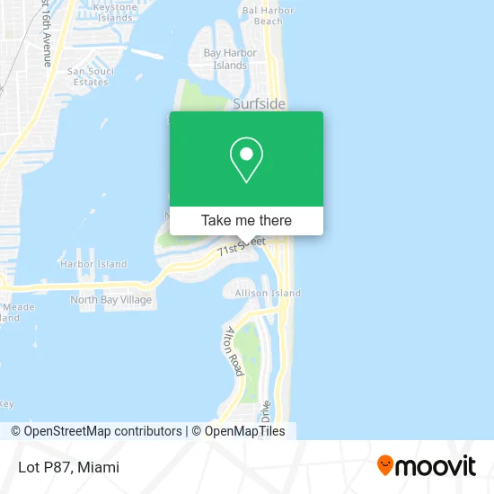
See Lot P87, Miami Beach, on the map
Public Transit to Lot P87 in Miami Beach
Wondering how to get to Lot P87 in Miami Beach? Moovit helps you find the best way to get to Lot P87 with step-by-step directions from the nearest public transit station.
Moovit provides free maps and live directions to help you navigate through your city. View schedules, routes, timetables, and find out how long does it take to get to Lot P87 in real time.
Looking for the nearest stop or station to Lot P87? Check out this list of stops closest to your destination: 71 St & Bay Dr; 71 St & Rue Versailles; 69 St & Abbott Ave.
Bus: 279, 79, 100.
Want to see if there’s another route that gets you there at an earlier time? Moovit helps you find alternative routes or times. Get directions from and directions to Lot P87 easily from the Moovit App or Website.
We make riding to Lot P87 easy, which is why over 1.5 million users, including users in Miami Beach, trust Moovit as the best app for public transit. You don’t need to download an individual bus app or train app, Moovit is your all-in-one transit app that helps you find the best bus time or train time available.
For information on prices of bus, costs and ride fares to Lot P87, please check the Moovit app.
Use the app to navigate to popular places including to the airport, hospital, stadium, grocery store, mall, coffee shop, school, college, and university.
Lot P87 Address: Miami Beach, FL 33141 street in Miami Beach
- Black Cat Lounge,
- Black Cat Cigar Lounge,
- Sumak,
- Normandy Gourmandy,
- Cet Store,
- Bodywork Studio,
- Tune My Body,
- Gordon Jeffrey H DMD Pa,
- USPS Collection Box - Blue Box,
- Miami Capoeira Sol,
- JM Services,
- Centro Envios,
- Vatito Taqueria,
- Karnitas 71st,
- Muchaaachos,
- La Divina Comedia Trattoria,
- Delhi Woks,
- Kinder Supplies,
- Artistas Latinos,
- Versilles Ct Parking
Places Near Lot P87 (Miami Beach)
- Marlins Park, Miami,
- Hard Rock Stadium, Miami Gardens,
- Miami-Dade County Courthouse, Miami,
- Bayside Marketplace, Miami,
- Little Havana, Miami,
- Sawgrass mall ( FL ), Miami Beach,
- Keiser University Flagship Campus, West Palm Beach,
- 1351 NW 12th St, Miami,
- Brickell City Centre, Miami,
- Miami Design District, Miami,
- Sawgrass Mall, Miami,
- Miami Freedom Park, Miami,
- Wynwood, Miami,
- Zoo Miami, Miami,
- Aventura Mall, Miami Beach,
- Richard E. Gerstein Justice Building, Miami,
- Port of Miami Cruise Terminal, Miami,
- Dolphin Mall Bus, Miami,
- Dolphin Mall, Miami,
- Aventura Mall, Miami
How to get to popular places in Miami with public transit
Get around Miami Beach by public transit!
Traveling around Miami Beach has never been so easy. See step by step directions as you travel to any attraction, street or major public transit station. View bus and train schedules, arrival times, service alerts and detailed routes on a map, so you know exactly how to get to anywhere in Miami Beach.
When traveling to any destination around Miami Beach use Moovit's Live Directions with Get Off Notifications to know exactly where and how far to walk, how long to wait for your line, and how many stops are left. Moovit will alert you when it's time to get off — no need to constantly re-check whether yours is the next stop.
Wondering how to use public transit in Miami Beach or how to pay for public transit in Miami Beach? Moovit public transit app can help you navigate your way with public transit easily, and at minimum cost. It includes public transit fees, ticket prices, and costs. Looking for a map of Miami Beach public transit lines? Moovit public transit app shows all public transit maps in Miami Beach with all Bus, Train, Light Rail and Ferry routes and stops on an interactive map.
Miami has 4 transit type(s), including: Bus, Train, Light Rail and Ferry, operated by several transit agencies, including Broward County Transit, Miami-Dade Transit, Metrorail, Palm Tran, Tri-Rail, Brightline, MARTY, City of Homestead Trolley, Key West Transit, Treasure Coast Connector, GoLine IRT, Amtrak, Greyhound-us, FlixBus-us and Aventura Express Shuttle Bus