Directions to Love at First Sight (Baltimore County) with public transportation
The following transit lines have routes that pass near Love at First Sight
 Bus: 93, CITYLINK RED.
- Light Rail: LIGHT RAILLINK.
How to get to Love at First Sight by bus?
Click on the bus route to see step by step directions with maps, line arrival times and updated time schedules.
From Sinai Hospital, Baltimore
57 minFrom I-695 Exit 29 (Loch Raven Blvd (MD 542)/Cromwell Bridge Rd), Baltimore County
51 minFrom Good Samaritan Hospital, Baltimore
42 minFrom Loyola University Maryland, Baltimore
47 minFrom Baltimore Polytechnic Institute, Baltimore
57 minFrom Morgan State University, Baltimore
60 minFrom Western High School, Baltimore
58 minFrom Pimlico Race Course, Baltimore
72 minFrom Reisterstown Road Plaza, Baltimore
73 minFrom Baltimore Poly Tech High School, Baltimore
59 min
Bus stops near Love at First Sight in Baltimore County
Light Rail stations near Love at First Sight in Baltimore County
- Fairgrounds, 29 min walk,VIEW
Bus lines to Love at First Sight in Baltimore County
What are the closest stations to Love at First Sight?
The closest stations to Love at First Sight are:
- York Rd & Crowther Ave Mid Sb is 61 yards away, 1 min walk.
- York Rd & Ridgely Plaza Shopping Center Sb is 900 yards away, 11 min walk.
- Fairgrounds is 2442 yards away, 29 min walk.
Which bus lines stop near Love at First Sight?
These bus lines stop near Love at First Sight: 93, CITYLINK RED.
Which light rail line stops near Love at First Sight?
LIGHT RAILLINK (Northbound)
What’s the nearest light rail station to Love at First Sight in Baltimore County?
The nearest light rail station to Love at First Sight in Baltimore County is Fairgrounds. It’s a 29 min walk away.
What’s the nearest bus station to Love at First Sight in Baltimore County?
The nearest bus station to Love at First Sight in Baltimore County is York Rd & Crowther Ave Mid Sb. It’s a 1 min walk away.
What time is the first light rail to Love at First Sight in Baltimore County?
The LIGHT RAILLINK is the first light rail that goes to Love at First Sight in Baltimore County. It stops nearby at 4:40 AM.
What time is the last light rail to Love at First Sight in Baltimore County?
The LIGHT RAILLINK is the last light rail that goes to Love at First Sight in Baltimore County. It stops nearby at 1:02 AM.
What time is the first bus to Love at First Sight in Baltimore County?
The 93 is the first bus that goes to Love at First Sight in Baltimore County. It stops nearby at 4:12 AM.
What time is the last bus to Love at First Sight in Baltimore County?
The CITYLINK RED is the last bus that goes to Love at First Sight in Baltimore County. It stops nearby at 2:38 AM.
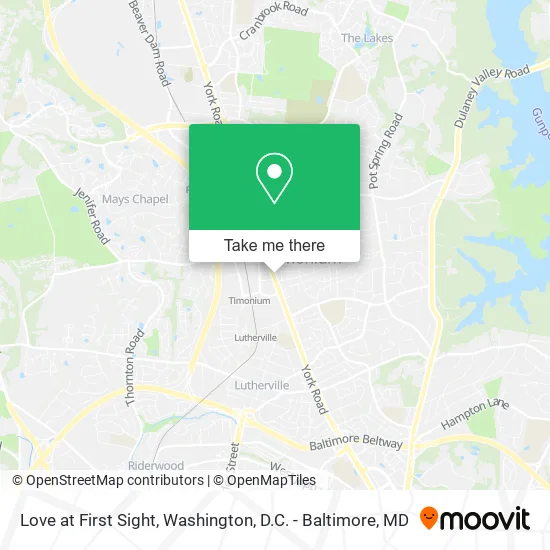
See Love at First Sight, Baltimore County, on the map
Public Transit to Love at First Sight in Baltimore County
Wondering how to get to Love at First Sight in Baltimore County? Moovit helps you find the best way to get to Love at First Sight with step-by-step directions from the nearest public transit station.
Moovit provides free maps and live directions to help you navigate through your city. View schedules, routes, timetables, and find out how long does it take to get to Love at First Sight in real time.
Looking for the nearest stop or station to Love at First Sight? Check out this list of stops closest to your destination: York Rd & Crowther Ave Mid Sb; York Rd & Ridgely Plaza Shopping Center Sb; Fairgrounds.
Bus: 93, CITYLINK RED.Light Rail: LIGHT RAILLINK.
Want to see if there’s another route that gets you there at an earlier time? Moovit helps you find alternative routes or times. Get directions from and directions to Love at First Sight easily from the Moovit App or Website.
We make riding to Love at First Sight easy, which is why over 1.5 million users, including users in Baltimore County, trust Moovit as the best app for public transit. You don’t need to download an individual bus app or train app, Moovit is your all-in-one transit app that helps you find the best bus time or train time available.
For information on prices of bus and light rail, costs and ride fares to Love at First Sight, please check the Moovit app.
Use the app to navigate to popular places including to the airport, hospital, stadium, grocery store, mall, coffee shop, school, college, and university.
Love at First Sight Address: 1925 York Rd Lutherville Timonium, MD 21093 street in Baltimore County
- The Brushing Bride,
- Artcomp & Design,
- Goosehead Insurance - Jay Northway,
- Slice Solutions, Inc.,
- Loewen Window Center T,
- Dara Lewis, Realtor,
- American Freight (Sears Outlet) - Appliance, Furniture, Mattress Closed,
- Amazon Counter-Smyth Jewelers,
- The Advertising Specialty Institute,
- Lutherville Law Group,
- Pandora,
- Snowball Queen,
- Glass Health - Timoniu,
- Sky Zone Trampoline Park,
- Gramophone Experience Center,
- FX Physical Therapy,
- Fhit Factory,
- Amazon Locker-Laraway,
- Wolverine World Wide,
- USPS Collection Box - Blue Box
Places Near Love at First Sight (Baltimore County)
- National Mall, Washington,
- Warner Theatre, Washington,
- Pennsylvania Ave NW (3rd st and pennsylvania), Washington,
- National Museum of African American History and Culture, Washington,
- Museum Of The Bible, Washington,
- Basilica of the National Shrine, Washington,
- Sibley Memorial Hospital, Washington,
- M&T Bank Stadium, Baltimore,
- PG Mall, Prince George's County,
- Georgetown, Washington,
- Washington DC VA Medical Center, Washington,
- The Anthem, Washington,
- Marriott Marquis Washington, DC, Washington,
- Capital One Arena, Washington,
- Westfield Montgomery Mall, Montgomery County,
- Washington National Cathedral, Washington,
- National Zoo, Washington,
- Rock Creek Tennis Center, Washington,
- Camden Yards, Baltimore,
- Amazon Hq2, Arlington County
How to get to popular places in Washington, D.C. - Baltimore, MD with public transit
Get around Baltimore County by public transit!
Traveling around Baltimore County has never been so easy. See step by step directions as you travel to any attraction, street or major public transit station. View bus and train schedules, arrival times, service alerts and detailed routes on a map, so you know exactly how to get to anywhere in Baltimore County.
When traveling to any destination around Baltimore County use Moovit's Live Directions with Get Off Notifications to know exactly where and how far to walk, how long to wait for your line, and how many stops are left. Moovit will alert you when it's time to get off — no need to constantly re-check whether yours is the next stop.
Wondering how to use public transit in Baltimore County or how to pay for public transit in Baltimore County? Moovit public transit app can help you navigate your way with public transit easily, and at minimum cost. It includes public transit fees, ticket prices, and costs. Looking for a map of Baltimore County public transit lines? Moovit public transit app shows all public transit maps in Baltimore County with all Bus, Train, Metro, Light Rail and Ferry routes and stops on an interactive map.
Washington, D.C. - Baltimore, MD has 5 transit type(s), including: Bus, Train, Metro, Light Rail and Ferry, operated by several transit agencies, including WMATA, Montgomery County Ride On, Fairfax Connector, TheBus, PRTC, DASH - Alexandria, Arlington Transit (ART), RTA of Central Maryland, MDOT MTA, MDOT MTA Light RailLink, MDOT MTA Commuter Bus, MDOT MTA Local Bus, FXBGO!, Virginia Railway Express (VRE) and MARC