Directions to Lowden (Wichita) with public transportation
The following transit lines have routes that pass near Lowden
 Bus: Q-LINE CLIFTON T, SOUTHEAST HIGH, 202: OLIVE.
How to get to Lowden by bus?
Click on the bus route to see step by step directions with maps, line arrival times and updated time schedules.
From TACO BELL, Wichita
89 minFrom Foot Spa & Massage Therapy, Wichita
40 minFrom Central Steel, Wichita
39 minFrom Jerarms, Wichita
40 minFrom Carnitas Morelia, Wichita
48 minFrom Dollar General, Wichita
50 minFrom Midway Oil, Wichita
41 minFrom Wichita Greenhouse, Wichita
77 minFrom Brothers That Just do Gutters, Wichita
41 min
Bus stops near Lowden in Wichita
Bus lines to Lowden in Wichita
What are the closest stations to Lowden?
The closest stations to Lowden are:
- Va Hospital Ib is 657 yards away, 8 min walk.
- Oliver And Gilbert Outbound is 662 yards away, 8 min walk.
- Oliver And Douglas Nb is 713 yards away, 9 min walk.
Which bus line stops near Lowden?
Q-LINE CLIFTON T (Q Eastbound)
What’s the nearest bus station to Lowden in Wichita?
The nearest bus stations to Lowden in Wichita are Va Hospital Ib and Oliver And Gilbert Outbound. The closest one is a 8 min walk away.
What time is the first bus to Lowden in Wichita?
The Q-LINE CLIFTON T is the first bus that goes to Lowden in Wichita. It stops nearby at 6:18 AM.
What time is the last bus to Lowden in Wichita?
The Q-LINE CLIFTON T is the last bus that goes to Lowden in Wichita. It stops nearby at 10:10 PM.
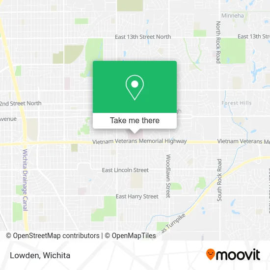
See Lowden, Wichita, on the map
Public Transit to Lowden in Wichita
Wondering how to get to Lowden in Wichita? Moovit helps you find the best way to get to Lowden with step-by-step directions from the nearest public transit station.
Moovit provides free maps and live directions to help you navigate through your city. View schedules, routes, timetables, and find out how long does it take to get to Lowden in real time.
Looking for the nearest stop or station to Lowden? Check out this list of stops closest to your destination: Va Hospital Ib; Oliver And Gilbert Outbound; Oliver And Douglas Nb.
Bus: Q-LINE CLIFTON T, SOUTHEAST HIGH, 202: OLIVE.
Want to see if there’s another route that gets you there at an earlier time? Moovit helps you find alternative routes or times. Get directions from and directions to Lowden easily from the Moovit App or Website.
We make riding to Lowden easy, which is why over 1.5 million users, including users in Wichita, trust Moovit as the best app for public transit. You don’t need to download an individual bus app or train app, Moovit is your all-in-one transit app that helps you find the best bus time or train time available.
For information on prices of bus, costs and ride fares to Lowden, please check the Moovit app.
Use the app to navigate to popular places including to the airport, hospital, stadium, grocery store, mall, coffee shop, school, college, and university.
Lowden Address: 5500 E Kellogg Dr Wichita, KS 67218 street in Wichita
- Dr. Manirul Hoq Khan MD,
- Tarraf Bashir D Od - Tarraf, Bashir D Od,
- Nola, Linda Walim,
- Flaming, Samuel J,
- VA,
- Stamps, Karmen Kaye,
- Robert J. Dole, Wichita VA Medical Center,
- VA Hospital,
- S Edgemoor St / E Kellogg Dr N,
- Milton E Dowty DC,
- Encore Restaurant & Club,
- Sedgwick County Tag Office Kellogg,
- Charles F Harris Attorney at Law,
- My Bakery,
- True Lawn Care,
- Bush Security & Investigations,
- Core Cremation,
- Oberheiden P.C.,
- U-Haul,
- Progressive Legal Process Services, LLC
Places Near Lowden (Wichita)
- Sena African Hair Braiding LLC, Wichita,
- Towne East Mall, Wichita,
- Wichita Dwight D. Eisenhower National Airport (ICT) (Wichita Eisenhower National Airport), Wichita,
- Four Corners Cafe @ Wesley Medical Center, Wichita,
- McConnell Air Force Base, Mcconnell Afb,
- Ascencion Via Christi Hospital St Francis, Wichita,
- Afghan Halal Market, Wichita,
- Hubb's glory hole, Wichita,
- Spirit Aerosystems,
- Bmer Tech Automotive, Wichita,
- East 21st Street North and Webb Road, Wichita,
- 21st & Maize, Wichita,
- Paige Place Apartments, Wichita,
- Total Card Solutions, Wichita,
- Ratcliff Auto and Truck Repair, Wichita,
- Lopez Services, Wichita,
- Westside Athletic Field (Friends University Baseball Field), Wichita,
- North High School, Wichita,
- Spirit AeroSystems, Bldg 2-280J (Section 9),
- Spirit Aerosystems Inc, Building 1-198D
How to get to popular places in Wichita with public transit
Get around Wichita by public transit!
Traveling around Wichita has never been so easy. See step by step directions as you travel to any attraction, street or major public transit station. View bus and train schedules, arrival times, service alerts and detailed routes on a map, so you know exactly how to get to anywhere in Wichita.
When traveling to any destination around Wichita use Moovit's Live Directions with Get Off Notifications to know exactly where and how far to walk, how long to wait for your line, and how many stops are left. Moovit will alert you when it's time to get off — no need to constantly re-check whether yours is the next stop.
Wondering how to use public transit in Wichita or how to pay for public transit in Wichita? Moovit public transit app can help you navigate your way with public transit easily, and at minimum cost. It includes public transit fees, ticket prices, and costs. Looking for a map of Wichita public transit lines? Moovit public transit app shows all public transit maps in Wichita with all bus routes and stops on an interactive map.
Wichita has 1 transit type(s), including: bus, operated by several transit agencies, including Wichita Transit, Greyhound-us and FlixBus-us