Directions to Lower Bay Station (Toronto) with public transportation
The following transit lines have routes that pass near Lower Bay Station
 Bus: 19, 97C, 300A, 300B, 300S.
- Subway: 1, 2.
How to get to Lower Bay Station by bus?
Click on the bus route to see step by step directions with maps, line arrival times and updated time schedules.
How to get to Lower Bay Station by subway?
Click on the subway route to see step by step directions with maps, line arrival times and updated time schedules.
Subway station near Lower Bay Station in Toronto
- Bloor, 2 min walk,
Bus stops near Lower Bay Station in Toronto
- Bloor St East at Yonge St East Side, 3 min walk,
- Yonge St at Charles St West, 4 min walk,
- Yonge St at Charles St East, 4 min walk,
- Bay St at Charles St West, 7 min walk,
Bus lines to Lower Bay Station in Toronto
- 300A, Pearson Airport Terminal 1 - Ground Level Column R4,
- 300B, Kennedy Station - Platform B,
- 300S, Kipling Station,
- 97C, Front St West at Bay St,
- 320, Yonge St at Queens Quay East North Side,
- 320A, Steeles Ave East Loop,
- 320B, York Mills Rd at Yonge St East Side,
- 320S, Eglinton Station,
- 19, Davenport Rd at Dupont St,
What are the closest stations to Lower Bay Station?
The closest stations to Lower Bay Station are:
- Bloor is 104 meters away, 2 min walk.
- Bloor St East at Yonge St East Side is 194 meters away, 3 min walk.
- Yonge St at Charles St West is 238 meters away, 4 min walk.
- Yonge St at Charles St East is 251 meters away, 4 min walk.
- Bay St at Charles St West is 462 meters away, 7 min walk.
Which bus lines stop near Lower Bay Station?
These bus lines stop near Lower Bay Station: 19, 97C.
Which subway lines stop near Lower Bay Station?
These subway lines stop near Lower Bay Station: 1, 2.
What’s the nearest subway station to Lower Bay Station in Toronto?
The nearest subway station to Lower Bay Station in Toronto is Bloor. It’s a 2 min walk away.
What’s the nearest bus station to Lower Bay Station in Toronto?
The nearest bus station to Lower Bay Station in Toronto is Bloor St East at Yonge St East Side. It’s a 3 min walk away.
What time is the first subway to Lower Bay Station in Toronto?
The 1 is the first subway that goes to Lower Bay Station in Toronto. It stops nearby at 5:51 AM.
What time is the last subway to Lower Bay Station in Toronto?
The 1 is the last subway that goes to Lower Bay Station in Toronto. It stops nearby at 1:58 AM.
What time is the first bus to Lower Bay Station in Toronto?
The 320A is the first bus that goes to Lower Bay Station in Toronto. It stops nearby at 3:00 AM.
What time is the last bus to Lower Bay Station in Toronto?
The 300A is the last bus that goes to Lower Bay Station in Toronto. It stops nearby at 3:48 AM.
See Lower Bay Station, Toronto, on the map
Public Transit to Lower Bay Station in Toronto
Wondering how to get to Lower Bay Station in Toronto? Moovit helps you find the best way to get to Lower Bay Station with step-by-step directions from the nearest public transit station.
Moovit provides free maps and live directions to help you navigate through your city. View schedules, routes, timetables, and find out how long does it take to get to Lower Bay Station in real time.
Looking for the nearest stop or station to Lower Bay Station? Check out this list of stops closest to your destination: Bloor; Bloor St East at Yonge St East Side; Yonge St at Charles St West; Yonge St at Charles St East; Bay St at Charles St West.
Bus: 19, 97C, 300A, 300B, 300S, 320, 320A, 320B, 320S.Subway: 1, 2.
Want to see if there’s another route that gets you there at an earlier time? Moovit helps you find alternative routes or times. Get directions from and directions to Lower Bay Station easily from the Moovit App or Website.
We make riding to Lower Bay Station easy, which is why over 1.5 million users, including users in Toronto, trust Moovit as the best app for public transit. You don’t need to download an individual bus app or train app, Moovit is your all-in-one transit app that helps you find the best bus time or train time available.
For information on prices of bus and subway, costs and ride fares to Lower Bay Station, please check the Moovit app.
Use the app to navigate to popular places including to the airport, hospital, stadium, grocery store, mall, coffee shop, school, college, and university.
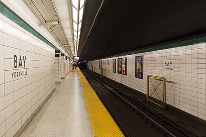
Lower Bay Station Address: Bay Street street in Toronto
- Bassel Sullivan Assoc,
- Sabai Sabai,
- 121 Bloor Street East,
- Longo's,
- Humber International Graduate School,
- Bloor & Ted Rogers Way,
- Seniors for Seniors,
- 45 Charles st,
- 35 Hayden Street,
- Bloor-Yonge Station,
- Hudson's Bay,
- Chick-Fil-A,
- WeWork 33 Bloor Street,
- Hollywood Escorts,
- Brass Rail Tavern,
- One Bloor,
- The Charles at Church,
- Yuk Yuk's,
- 160 Bloor St. East,
- Nordstrom Rack
Places Near Lower Bay Station (Toronto)
- Rogers Centre, Toronto,
- Canadian National Exhibition, Toronto,
- Vaughan Mills Shopping Centre, Vaughan,
- St Michael s Hospital, Toronto,
- Enercare Centre, Toronto,
- Scarborough Town Centre, Toronto,
- Great Canadian Casino Resort, Toronto,
- Toronto Eaton Centre, Toronto,
- St Lawrence Market, Toronto,
- Toronto General Hospital, Toronto,
- Budweiser Stage, Toronto,
- St. Michael's Hospital, Toronto,
- Toronto Courthouse, Toronto,
- Exhibition Place, Toronto,
- Medieval Times, Toronto,
- Meridian Hall, Toronto,
- Distillery District Map, Toronto,
- Toronto Western Hospital, Toronto,
- Sunnybrook Hospital, Toronto,
- Scotiabank Arena, Toronto
How to get to popular places in Toronto with public transit
Get around Toronto by public transit!
Traveling around Toronto has never been so easy. See step by step directions as you travel to any attraction, street or major public transit station. View bus and train schedules, arrival times, service alerts and detailed routes on a map, so you know exactly how to get to anywhere in Toronto.
When traveling to any destination around Toronto use Moovit's Live Directions with Get Off Notifications to know exactly where and how far to walk, how long to wait for your line, and how many stops are left. Moovit will alert you when it's time to get off — no need to constantly re-check whether yours is the next stop.
Wondering how to use public transit in Toronto or how to pay for public transit in Toronto? Moovit public transit app can help you navigate your way with public transit easily, and at minimum cost. It includes public transit fees, ticket prices, and costs. Looking for a map of Toronto public transit lines? Moovit public transit app shows all public transit maps in Toronto with all Bus, Train, Subway, Streetcar and Ferry routes and stops on an interactive map.
Toronto has 5 transit type(s), including: Bus, Train, Subway, Streetcar and Ferry, operated by several transit agencies, including TTC, TTC Streetcar, Toronto Subway, Brampton Transit, MiWay, York Region Transit, GO Transit Bus, GO Transit, Durham Region Transit, UP Express, Grand River Transit, Guelph Transit, Hamilton Street Railway, Burlington Transit and Oakville Transit