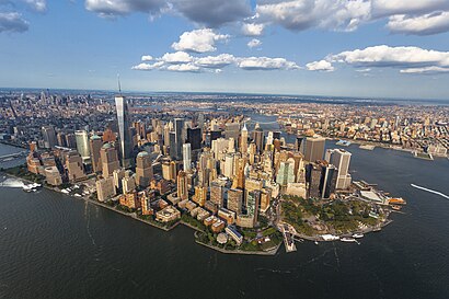
Directions to Lower Mahnattan (Manhattan) with public transportation
The following transit lines have routes that pass near Lower Mahnattan
How to get to Lower Mahnattan by bus?
Click on the bus route to see step by step directions with maps, line arrival times and updated time schedules.
How to get to Lower Mahnattan by train?
Click on the train route to see step by step directions with maps, line arrival times and updated time schedules.
How to get to Lower Mahnattan by subway?
Click on the subway route to see step by step directions with maps, line arrival times and updated time schedules.
Bus stops near Lower Mahnattan in Manhattan
- New York - Broadway @ Cortlandt St (Northbound), 1 min walk,
- Broadway/Cortlandt St, 1 min walk,
- Broadway At Cortlandt & Liberty Sts, 1 min walk,
- Broadway Between Fulton & Dey St, 1 min walk,
- Park Row/Beekman St, 3 min walk,
- Broadway @ Vessey St., 3 min walk,
- Park Row/Spruce St, 4 min walk,
- Broadway/Barclay St, 4 min walk,
Subway stations near Lower Mahnattan in Manhattan
- Fulton St, 1 min walk,
- World Trade Center, 2 min walk,
- Cortlandt St, 2 min walk,
Bus lines to Lower Mahnattan in Manhattan
- 206, Parkway Express - Wall Street Via Jersey City,
- 314, Parkway Express to Wall Street-Starts Monmouth,
- 404, Route 9 to Wall Street,
- BXM18, Downtown Wall St Via 5 Av Via Broadway,
- SIM2, Tottenville Via Huguenot Av Via Hylan Bl,
- SIM34, Mariners Harbor Via Watchogue Rd,
- SIM1, Eltngvlle Trans Ctr Via Hylan Via Rich,
- SIM1C, Eltngvlle Trans Ctr Via Hylan Via Rich,
- SIM3C, Pt Rchmnd Via Narrows Rd N Via Watchogue,
- SIM33C, Mariners Harbor Via N Gannon Av,
- SUBURBAN TRANSIT, New York,
- SIM4, Annadale Via Richmond Av,
- SIM4C, Huguenot Via Richmond Av Via Arthur Kill,
- SIM32, Travis Via N Gannon Av Via Victory Bl,
- M55, South Ferry,
- SIM15, Eltingville Transit Center Via Richmond,
- QM65, Downtown Via Laurelton,
- 604, Route 36 to Wall Street - Highlands Middle Road,
- 720, Exit 5 to Port Authority - Wall Street,
- BM1, Mill Basin - Downtown/Midtown,
What are the closest stations to Lower Mahnattan?
The closest stations to Lower Mahnattan are:
- New York - Broadway @ Cortlandt St (Northbound) is 1 yards away, 1 min walk.
- Fulton St is 1 yards away, 1 min walk.
- Broadway/Cortlandt St is 5 yards away, 1 min walk.
- Broadway At Cortlandt & Liberty Sts is 30 yards away, 1 min walk.
- Broadway Between Fulton & Dey St is 43 yards away, 1 min walk.
- World Trade Center is 79 yards away, 2 min walk.
- Cortlandt St is 152 yards away, 2 min walk.
- Park Row/Beekman St is 240 yards away, 3 min walk.
- Broadway @ Vessey St. is 243 yards away, 3 min walk.
- Park Row/Spruce St is 278 yards away, 4 min walk.
- Broadway/Barclay St is 284 yards away, 4 min walk.
Which bus lines stop near Lower Mahnattan?
These bus lines stop near Lower Mahnattan: 120, BXM18, QM11.
Which train line stops near Lower Mahnattan?
PATH (World Trade Center)
Which subway lines stop near Lower Mahnattan?
These subway lines stop near Lower Mahnattan: 3, 4, 5, A.
What’s the nearest subway station to Lower Mahnattan in Manhattan?
The nearest subway station to Lower Mahnattan in Manhattan is Fulton St. It’s a 1 min walk away.
What’s the nearest bus station to Lower Mahnattan in Manhattan?
The nearest bus stations to Lower Mahnattan in Manhattan are New York - Broadway @ Cortlandt St (Northbound), Broadway/Cortlandt St, Broadway At Cortlandt & Liberty Sts and Broadway Between Fulton & Dey St. The closest one is a 1 min walk away.
What time is the first subway to Lower Mahnattan in Manhattan?
The J is the first subway that goes to Lower Mahnattan in Manhattan. It stops nearby at 3:00 AM.
What time is the last subway to Lower Mahnattan in Manhattan?
The 2 is the last subway that goes to Lower Mahnattan in Manhattan. It stops nearby at 4:10 AM.
What time is the first bus to Lower Mahnattan in Manhattan?
The M103 is the first bus that goes to Lower Mahnattan in Manhattan. It stops nearby at 3:35 AM.
What time is the last bus to Lower Mahnattan in Manhattan?
The M103 is the last bus that goes to Lower Mahnattan in Manhattan. It stops nearby at 3:35 AM.
See Lower Mahnattan, Manhattan, on the map
Public Transit to Lower Mahnattan in Manhattan
Wondering how to get to Lower Mahnattan in Manhattan? Moovit helps you find the best way to get to Lower Mahnattan with step-by-step directions from the nearest public transit station.
Moovit provides free maps and live directions to help you navigate through your city. View schedules, routes, timetables, and find out how long does it take to get to Lower Mahnattan in real time.
Looking for the nearest stop or station to Lower Mahnattan? Check out this list of stops closest to your destination: New York - Broadway @ Cortlandt St (Northbound); Fulton St; Broadway/Cortlandt St; Broadway At Cortlandt & Liberty Sts; Broadway Between Fulton & Dey St; World Trade Center; Cortlandt St; Park Row/Beekman St; Broadway @ Vessey St.; Park Row/Spruce St; Broadway/Barclay St.
Bus: 120, BXM18, QM11, 206, 314, 404, SIM2, SIM34.Train: PATH.Subway: 3, 4, 5, A, C, J, Z, 2, E, N, R, W.
Want to see if there’s another route that gets you there at an earlier time? Moovit helps you find alternative routes or times. Get directions from and directions to Lower Mahnattan easily from the Moovit App or Website.
We make riding to Lower Mahnattan easy, which is why over 1.5 million users, including users in Manhattan, trust Moovit as the best app for public transit. You don’t need to download an individual bus app or train app, Moovit is your all-in-one transit app that helps you find the best bus time or train time available.
For information on prices of subway, bus and train, costs and ride fares to Lower Mahnattan, please check the Moovit app.
Use the app to navigate to popular places including to the airport, hospital, stadium, grocery store, mall, coffee shop, school, college, and university.
Location: Manhattan, New York - New Jersey
Popular routes to Lower Mahnattan, Manhattan
Places Near Lower Mahnattan (Manhattan)
How to get to popular places in New York - New Jersey with public transit
Get around Manhattan by public transit!
Traveling around Manhattan has never been so easy. See step by step directions as you travel to any attraction, street or major public transit station. View bus and train schedules, arrival times, service alerts and detailed routes on a map, so you know exactly how to get to anywhere in Manhattan.
When traveling to any destination around Manhattan use Moovit's Live Directions with Get Off Notifications to know exactly where and how far to walk, how long to wait for your line, and how many stops are left. Moovit will alert you when it's time to get off — no need to constantly re-check whether yours is the next stop.
Wondering how to use public transit in Manhattan or how to pay for public transit in Manhattan? Moovit public transit app can help you navigate your way with public transit easily, and at minimum cost. It includes public transit fees, ticket prices, and costs. Looking for a map of Manhattan public transit lines? Moovit public transit app shows all public transit maps in Manhattan with all Bus, Train, Subway, Light Rail, Ferry and Cable Car routes and stops on an interactive map.
New York - New Jersey has 6 transit type(s), including: Bus, Train, Subway, Light Rail, Ferry and Cable Car, operated by several transit agencies, including MTA Subway, Metro-North Railroad, LIRR, PATH, MTA New York City Transit - Express routes, MTA Bus, NJ Transit, NYC Ferry, NICE bus, Bee-Line Bus, NJ Transit Rail, Norwalk Transit District, CTTransit - Waterbury, Hartford Line and River Valley Transit