Directions to Luarflex (Angra Dos Reis) with public transportation
The following transit lines have routes that pass near Luarflex
 Bus: 104, 106, 230, T11, T21.
- Ferry: ANGRA DOS REIS - ILHA GRANDE, ANGRA DOS REIS - ILHA GRANDE.
How to get to Luarflex by bus?
Click on the bus route to see step by step directions with maps, line arrival times and updated time schedules.
From Pousada do Engenho de Bracuhy, Cunhambebe
82 minFrom Praça da Monsuaba, Jacuecanga
58 minFrom Rua Bahia - Bracuí, Cunhambebe
74 minFrom Ponta Leste, Jacuecanga
90 minFrom BR-101 KM 469.5, Jacuecanga
40 minFrom Ciep 302 Charles Dickens, Jacuecanga
39 minFrom Ponta Do Partido, Cunhambebe
65 minFrom Samba Angra dos Reis, Cunhambebe
82 minFrom Instituto Médico Legal - Angra dos Reis, Cunhambebe
73 min
Bus stops near Luarflex in Angra Dos Reis
- Ponto De Embarque 07 - Praça Do Porto, 2 min walk,VIEW
- Centro / Largo Da Lapa, 2 min walk,VIEW
- Ponto De Embarque 06 - Praça Do Porto, 2 min walk,VIEW
- Centro / Praça Do Porto, 2 min walk,VIEW
- Ponto De Embarque 04 - Praça Do Porto, 3 min walk,VIEW
- Centro / Largo Da Lapa II, 3 min walk,VIEW
- Desembarque Centro / Largo Da Lapa, 3 min walk,VIEW
- Ponto De Embarque 11 - Lapa, 3 min walk,VIEW
- Ponto 01 - Santa Luzia, 5 min walk,VIEW
- Avenida Júlio Maria, 289-385, 5 min walk,VIEW
Ferry station near Luarflex in Angra Dos Reis
- Estação Santa Luzia (Angra Dos Reis) ⛴, 28 min walk,VIEW
Bus lines to Luarflex in Angra Dos Reis
- 203, Serra D'Água (Via Zungu),VIEW
- B203, Serra D'Agua (Túnel),VIEW
- 204, Centro,VIEW
- B206, Centro (via Balneário),VIEW
- C206, Centro (Saída Vale da Banqueta),VIEW
- C01, Centro (Circular),VIEW
- C01B, Circular (via Pestalozzi),VIEW
- C03, Marinas,VIEW
- C03B, Marinas (via Balneário),VIEW
- C04, Vila Velha,VIEW
- 207, Centro (Via Morro Da Cruz),VIEW
- B207, Japuíba (via Rio-Santos),VIEW
- 221, Nova Angra,VIEW
- B221, Nova Angra (via Gamboa / Ribeira),VIEW
- 208, Belém (Circular),VIEW
- A220, Japuíba (Via Gamboa - Circular),VIEW
- B220, Japuíba (Via Balneário / Ribeira - Circular),VIEW
- C05, Centro (via Morro da Cruz),VIEW
- C05B, Centro (via Balneário),VIEW
- 205, Areal,VIEW
What are the closest stations to Luarflex?
The closest stations to Luarflex are:
- Ponto De Embarque 07 - Praça Do Porto is 102 meters away, 2 min walk.
- Centro / Largo Da Lapa is 109 meters away, 2 min walk.
- Ponto De Embarque 06 - Praça Do Porto is 114 meters away, 2 min walk.
- Centro / Praça Do Porto is 129 meters away, 2 min walk.
- Ponto De Embarque 04 - Praça Do Porto is 141 meters away, 3 min walk.
- Centro / Largo Da Lapa II is 145 meters away, 3 min walk.
- Desembarque Centro / Largo Da Lapa is 150 meters away, 3 min walk.
- Ponto De Embarque 11 - Lapa is 165 meters away, 3 min walk.
- Ponto 01 - Santa Luzia is 326 meters away, 5 min walk.
- Avenida Júlio Maria, 289-385 is 369 meters away, 5 min walk.
- Estação Santa Luzia (Angra Dos Reis) ⛴ is 2155 meters away, 28 min walk.
Which bus lines stop near Luarflex?
These bus lines stop near Luarflex: 104, 106, 230, T11, T21.
What’s the nearest bus station to Luarflex in Angra Dos Reis?
The nearest bus stations to Luarflex in Angra Dos Reis are Ponto De Embarque 07 - Praça Do Porto, Centro / Largo Da Lapa, Ponto De Embarque 06 - Praça Do Porto and Centro / Praça Do Porto. The closest one is a 2 min walk away.
What’s the nearest ferry station to Luarflex in Angra Dos Reis?
The nearest ferry station to Luarflex in Angra Dos Reis is Estação Santa Luzia (Angra Dos Reis) ⛴. It’s a 28 min walk away.
What time is the first bus to Luarflex in Angra Dos Reis?
The T20 is the first bus that goes to Luarflex in Angra Dos Reis. It stops nearby at 4:50 AM.
What time is the last bus to Luarflex in Angra Dos Reis?
The T11 is the last bus that goes to Luarflex in Angra Dos Reis. It stops nearby at 2:01 AM.
What time is the first ferry to Luarflex in Angra Dos Reis?
The ANGRA DOS REIS - ILHA GRANDE is the first ferry that goes to Luarflex in Angra Dos Reis. It stops nearby at 8:35 AM.
What time is the last ferry to Luarflex in Angra Dos Reis?
The ANGRA DOS REIS - ILHA GRANDE is the last ferry that goes to Luarflex in Angra Dos Reis. It stops nearby at 6:30 PM.
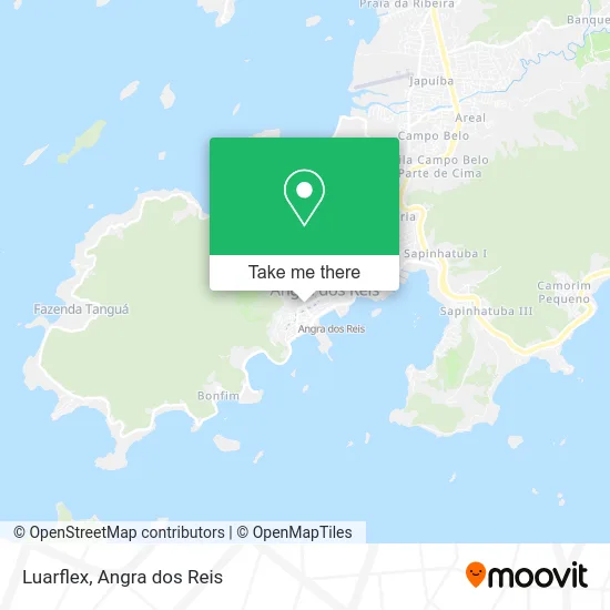
See Luarflex, Angra Dos Reis, on the map
Public Transit to Luarflex in Angra Dos Reis
Wondering how to get to Luarflex in Angra Dos Reis? Moovit helps you find the best way to get to Luarflex with step-by-step directions from the nearest public transit station.
Moovit provides free maps and live directions to help you navigate through your city. View schedules, routes, timetables, and find out how long does it take to get to Luarflex in real time.
Looking for the nearest stop or station to Luarflex? Check out this list of stops closest to your destination: Ponto De Embarque 07 - Praça Do Porto; Centro / Largo Da Lapa; Ponto De Embarque 06 - Praça Do Porto; Centro / Praça Do Porto; Ponto De Embarque 04 - Praça Do Porto; Centro / Largo Da Lapa II; Desembarque Centro / Largo Da Lapa; Ponto De Embarque 11 - Lapa; Ponto 01 - Santa Luzia; Avenida Júlio Maria; Estação Santa Luzia (Angra Dos Reis) ⛴.
Bus: 104, 106, 230, T11, T21, 203, B203, 204, B206, C206, C01, C01B, C03, C03B, C04, 207, B207, 221, B221, 208, A220, B220, C05, C05B, 205.Ferry: ANGRA DOS REIS - ILHA GRANDE, ANGRA DOS REIS - ILHA GRANDE.
Want to see if there’s another route that gets you there at an earlier time? Moovit helps you find alternative routes or times. Get directions from and directions to Luarflex easily from the Moovit App or Website.
We make riding to Luarflex easy, which is why over 1.5 million users, including users in Angra Dos Reis, trust Moovit as the best app for public transit. You don’t need to download an individual bus app or train app, Moovit is your all-in-one transit app that helps you find the best bus time or train time available.
For information on prices of bus, costs and ride fares to Luarflex, please check the Moovit app.
Use the app to navigate to popular places including to the airport, hospital, stadium, grocery store, mall, coffee shop, school, college, and university.
Luarflex Address: Rua Coronel Carvalho, 404 Morro do Santo Antônio Angra dos Reis-RJ 23900-310 street in Angra Dos Reis
- Espaço Rayssa Leão,
- Tedtech,
- Pt-Partido dos Trabalhadores,
- S.I.F.C.,
- Fp Surf Shop,
- Santa Bellezza,
- Living Curso de Idiomas,
- Fanny Personal Cares,
- Ótica Nova,
- Escritório do Chopp Angra,
- Donna Flor,
- Bammbú,
- Ótica Costa Verde,
- d'Souza Moveis e Decoracoes,
- Sushi Fenix,
- Samurai Sushi Angra,
- Pronto Atendimento Infantil,
- Master TV,
- Atendo Participacoes e Serviços Medicos,
- Filial Angra
Places Near Luarflex (Angra Dos Reis)
- Praia do Laboratório, Angra Dos Reis,
- Verolme, Jacuecanga,
- Alambique Engenho D'Ouro, Parati,
- Rodovia Procurador Haroldo Fernandes Duarte, Km 513,5 s / n, Cunhambebe,
- BR 101, Km 508 s/n, Cunhambebe,
- Avenida Almirante Jair Carneiro Toscano de Brito 110, Angra Dos Reis,
- praia jabaquara - parati, Parati,
- Condominio Laranjeiras, Parati Mirim,
- Rodovia BR 101, Km 533 s/n, Mambucaba,
- Garatucaia, Angra Dos Reis,
- Avenida Antônio Bertholdo da Silva Jordão 7346, Jacuecanga,
- Centro Histórico de Paraty, Parati,
- Mambucaba, Mambucaba,
- Praia de Paraty Mirim, Parati,
- Rua Cônegos Bittencourt, Angra Dos Reis,
- Vila Residencial De Mambucaba, Mambucaba,
- Rua Prefeito João Gregório Galindo 2487, Angra Dos Reis,
- Rua Prefeito João Gregório Galindo, Cunhambebe,
- Vila Galé Eco Resort De Angra, Angra Dos Reis,
- Cachoeira do Tobogã, Parati
How to get to popular places in Angra dos Reis with public transit
Get around Angra Dos Reis by public transit!
Traveling around Angra Dos Reis has never been so easy. See step by step directions as you travel to any attraction, street or major public transit station. View bus and train schedules, arrival times, service alerts and detailed routes on a map, so you know exactly how to get to anywhere in Angra Dos Reis.
When traveling to any destination around Angra Dos Reis use Moovit's Live Directions with Get Off Notifications to know exactly where and how far to walk, how long to wait for your line, and how many stops are left. Moovit will alert you when it's time to get off — no need to constantly re-check whether yours is the next stop.
Wondering how to use public transit in Angra Dos Reis or how to pay for public transit in Angra Dos Reis? Moovit public transit app can help you navigate your way with public transit easily, and at minimum cost. It includes public transit fees, ticket prices, and costs. Looking for a map of Angra Dos Reis public transit lines? Moovit public transit app shows all public transit maps in Angra Dos Reis with all Bus and Ferry routes and stops on an interactive map.
Angra dos Reis has 2 transit type(s), including: Bus and Ferry, operated by several transit agencies, including Viação Senhor do Bonfim, Colitur Transportes Rodoviários, Cooparatyense (Vans), Costa Verde Transportes, Barcas Rio, Objetiva Tour, Vilanova Tour, Rodoviário Oceano, BusUFF and Colitur (Tarifa Zero - Paraty)