How to get to Lucky Chu by bus?
Click on the bus route to see step by step directions with maps, line arrival times and updated time schedules.
Bus stops near Lucky Chu in Port St. Lucie
Bus lines to Lucky Chu in Port St. Lucie
What are the closest stations to Lucky Chu?
The closest stations to Lucky Chu are:
- SE Civic Center Pl & Walton Rd is 1062 yards away, 13 min walk.
- Veteran's Memorial Pkwy & US Hwy 1 is 1651 yards away, 20 min walk.
Which bus line stops near Lucky Chu?
1 (Treasure Coast Mall)
What’s the nearest bus station to Lucky Chu in Port St. Lucie?
The nearest bus station to Lucky Chu in Port St. Lucie is SE Civic Center Pl & Walton Rd. It’s a 13 min walk away.
What time is the first bus to Lucky Chu in Port St. Lucie?
The 1 is the first bus that goes to Lucky Chu in Port St. Lucie. It stops nearby at 6:13 AM.
What time is the last bus to Lucky Chu in Port St. Lucie?
The 1 is the last bus that goes to Lucky Chu in Port St. Lucie. It stops nearby at 7:34 PM.
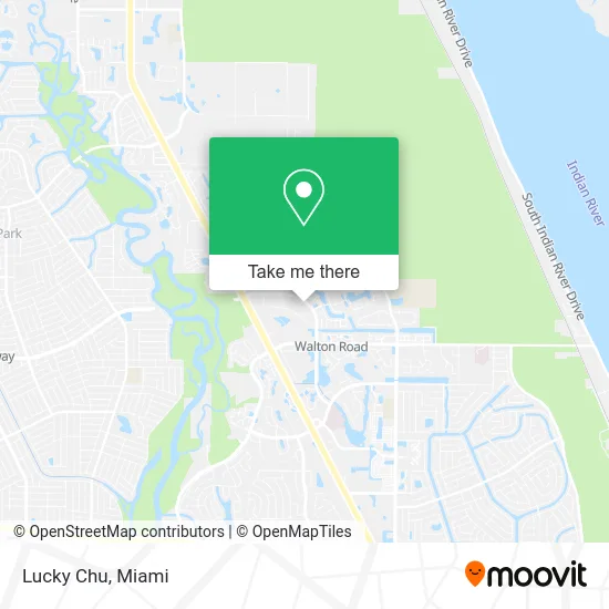
See Lucky Chu, Port St. Lucie, on the map
Public Transit to Lucky Chu in Port St. Lucie
Wondering how to get to Lucky Chu in Port St. Lucie? Moovit helps you find the best way to get to Lucky Chu with step-by-step directions from the nearest public transit station.
Moovit provides free maps and live directions to help you navigate through your city. View schedules, routes, timetables, and find out how long does it take to get to Lucky Chu in real time.
Looking for the nearest stop or station to Lucky Chu? Check out this list of stops closest to your destination: SE Civic Center Pl & Walton Rd; Veteran's Memorial Pkwy & US Hwy 1.
Bus: 1, 4.
Want to see if there’s another route that gets you there at an earlier time? Moovit helps you find alternative routes or times. Get directions from and directions to Lucky Chu easily from the Moovit App or Website.
We make riding to Lucky Chu easy, which is why over 1.5 million users, including users in Port St. Lucie, trust Moovit as the best app for public transit. You don’t need to download an individual bus app or train app, Moovit is your all-in-one transit app that helps you find the best bus time or train time available.
For information on prices of bus, costs and ride fares to Lucky Chu, please check the Moovit app.
Use the app to navigate to popular places including to the airport, hospital, stadium, grocery store, mall, coffee shop, school, college, and university.
Lucky Chu Address: 1690 SE Village Green Dr Port St Lucie, FL 34952 street in Port St. Lucie
- New York Style,
- Chick Cuisine,
- Perez and Ramos Associates,
- Sweet Lou's Dogs,
- Henry's Kitchen,
- Retta's,
- Hawker Trays,
- Tavos Tacos,
- Island Jams,
- Bangers BBQ,
- Mr Softee South Florida,
- T & L Quality Garage,
- PSL Spiritist Center,
- Viviano Property Management Group,
- TB Square Investment,
- Treasure Coast Aluminum Products,
- Fratelli Contractors,
- Gradum Gswing Port St,
- Carib Essentials,
- Josh Mobile Auto Detailing
Places Near Lucky Chu (Port St. Lucie)
- Dolphin Mall, Miami,
- Little Havana, Miami,
- Miami VA Hospital, Miami,
- Port of Miami Cruise Terminal, Miami,
- Keiser University Flagship Campus, West Palm Beach,
- Marlins Park, Miami,
- Wynwood, Miami,
- Aventura Mall, Miami,
- Miami Design District, Miami,
- Miami-Dade County Courthouse, Miami,
- Dolphin Mall Bus, Miami,
- Aventura Mall, Miami Beach,
- Hard Rock Stadium, Miami Gardens,
- Richard E. Gerstein Justice Building, Miami,
- Sawgrass Mall, Miami,
- Miami Freedom Park, Miami,
- Zoo Miami, Miami,
- Bayside Marketplace, Miami,
- Sawgrass mall ( FL ), Miami Beach,
- Brickell City Centre, Miami
How to get to popular places in Miami with public transit
Get around Port St. Lucie by public transit!
Traveling around Port St. Lucie has never been so easy. See step by step directions as you travel to any attraction, street or major public transit station. View bus and train schedules, arrival times, service alerts and detailed routes on a map, so you know exactly how to get to anywhere in Port St. Lucie.
When traveling to any destination around Port St. Lucie use Moovit's Live Directions with Get Off Notifications to know exactly where and how far to walk, how long to wait for your line, and how many stops are left. Moovit will alert you when it's time to get off — no need to constantly re-check whether yours is the next stop.
Wondering how to use public transit in Port St. Lucie or how to pay for public transit in Port St. Lucie? Moovit public transit app can help you navigate your way with public transit easily, and at minimum cost. It includes public transit fees, ticket prices, and costs. Looking for a map of Port St. Lucie public transit lines? Moovit public transit app shows all public transit maps in Port St. Lucie with all Bus, Train, Light Rail and Ferry routes and stops on an interactive map.
Miami has 4 transit type(s), including: Bus, Train, Light Rail and Ferry, operated by several transit agencies, including Broward County Transit, Miami-Dade Transit, Metrorail, Palm Tran, Tri-Rail, Brightline, MARTY, City of Homestead Trolley, Key West Transit, Treasure Coast Connector, GoLine IRT, Amtrak, Greyhound-us, FlixBus-us and Aventura Express Shuttle Bus