Directions to Lumar (Paulista) with public transportation
The following transit lines have routes that pass near Lumar
How to get to Lumar by bus?
Click on the bus route to see step by step directions with maps, line arrival times and updated time schedules.
From Alto da Conquista, Olinda
60 minFrom Olinda, Olinda
52 minFrom Hospital Esperança, Olinda
27 minFrom Terminal Integrado Pelópidas Silveira, Paulista
28 minFrom Imepe, Olinda
63 minFrom Jardim Paulista Baixo, Paulista
42 minFrom tuuuuu, Olinda
51 minFrom Praia De Mangue Seco, Igarassu
100 minFrom Patteo Shopping, Olinda
30 minFrom Avenida Doutor Joaquim Nabuco, Olinda
45 min
Bus stops near Lumar in Paulista
Bus lines to Lumar in Paulista
- 1955 CONJUNTO PRAIA DO JANGA (ENGENHO MARANGUAPE) / TI PELÓPIDAS, Via Tururu,VIEW
- 1950 ENGENHO MARANGUAPE / VARADOURO, Engenho Maranguape / Varadouro,VIEW
- 1960 TI RIO DOCE / MARIA FARINHA (CASA CAIADA), Ti Rio Doce / Maria Farinha (Casa Caiada),VIEW
- 1982 CONJUNTO BEIRA MAR / DERBY, Conjunto Beira Mar / Derby,VIEW
- 1992 PAU AMARELO, Pau Amarelo,VIEW
- 1994 CONJUNTO BEIRA MAR, Via Prefeitura Do Recife,VIEW
- 1995 PAU AMARELO (BACURAU), Pau Amarelo (Bacurau),VIEW
- 1922 PAU AMARELO / TI PELÓPIDAS, Pau Amarelo / Ti Pelópidas,VIEW
What are the closest stations to Lumar?
The closest stations to Lumar are:
- 160435 - Rua Severino Monteiro De Jesus 616 is 147 meters away, 3 min walk.
- Av. Dr. Cláudio José Gueiros Leite (Pe-001), 312 | Drogaria São Paulo is 172 meters away, 3 min walk.
- Av. Dr. Cláudio José Gueiros Leite, 342 | Janga Medical Center is 270 meters away, 4 min walk.
Which bus lines stop near Lumar?
These bus lines stop near Lumar: 1922 PAU AMARELO / TI PELÓPIDAS, 1992 PAU AMARELO.
What’s the nearest bus station to Lumar in Paulista?
The nearest bus stations to Lumar in Paulista are 160435 - Rua Severino Monteiro De Jesus 616 and Av. Dr. Cláudio José Gueiros Leite (Pe-001), 312 | Drogaria São Paulo. The closest one is a 3 min walk away.
What time is the first bus to Lumar in Paulista?
The 1995 PAU AMARELO (BACURAU) is the first bus that goes to Lumar in Paulista. It stops nearby at 3:33 AM.
What time is the last bus to Lumar in Paulista?
The 1995 PAU AMARELO (BACURAU) is the last bus that goes to Lumar in Paulista. It stops nearby at 3:34 AM.
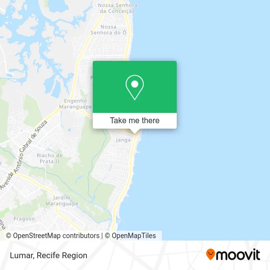
See Lumar, Paulista, on the map
Public Transit to Lumar in Paulista
Wondering how to get to Lumar in Paulista? Moovit helps you find the best way to get to Lumar with step-by-step directions from the nearest public transit station.
Moovit provides free maps and live directions to help you navigate through your city. View schedules, routes, timetables, and find out how long does it take to get to Lumar in real time.
Looking for the nearest stop or station to Lumar? Check out this list of stops closest to your destination: 160435 - Rua Severino Monteiro De Jesus 616; Av. Dr. Cláudio José Gueiros Leite (Pe-001); Av. Dr. Cláudio José Gueiros Leite.
Bus: 1922 PAU AMARELO / TI PELÓPIDAS, 1992 PAU AMARELO, 1955 CONJUNTO PRAIA DO JANGA (ENGENHO MARANGUAPE) / TI PELÓPIDAS, 1950 ENGENHO MARANGUAPE / VARADOURO, 1960 TI RIO DOCE / MARIA FARINHA (CASA CAIADA), 1982 CONJUNTO BEIRA MAR / DERBY, 1994 CONJUNTO BEIRA MAR.
Want to see if there’s another route that gets you there at an earlier time? Moovit helps you find alternative routes or times. Get directions from and directions to Lumar easily from the Moovit App or Website.
We make riding to Lumar easy, which is why over 1.5 million users, including users in Paulista, trust Moovit as the best app for public transit. You don’t need to download an individual bus app or train app, Moovit is your all-in-one transit app that helps you find the best bus time or train time available.
For information on prices of bus, costs and ride fares to Lumar, please check the Moovit app.
Use the app to navigate to popular places including to the airport, hospital, stadium, grocery store, mall, coffee shop, school, college, and university.
Lumar Address: Rua Poeta João Neves, 15 Janga Paulista-PE 53437-490 street in Paulista
- Mercadinho Tem Tem II,
- Verdão Hortifruti Janga,
- Academia Move,
- Petmuleke - Pet Shop,
- Acarajé da Simone,
- Nl Bar,
- Big Zoo,
- Grupo Htr,
- Studio Ação Pilates,
- Poly-Box Comercio e Servicos,
- Adalberto de Oliveira Barbosa,
- Central Descartaveis,
- CONDOMINIO DO EDIFICIO AVANCA,
- Delikata,
- Luana Seabra,
- Edificio Jangamar,
- F F Estofados,
- Eletrônica Yakamura,
- Condominio do Edificio Corsário,
- Associacao Pernambucana de Boxe
Places Near Lumar (Paulista)
- Arena de Pernambuco, São Lourenço Da Mata,
- Shopping RioMar Recife, Pina,
- Hospital Altino Ventura, Iputinga,
- Hospital Agamenon Magalhães, Tamarineira,
- Imip (Instituto Materno-Infantil De Pernambuco), Coelhos,
- Shopping Recife, Boa Viagem,
- llll, Fundão,
- Imbiribeira, Imbiribeira,
- Shopping Patteo Olinda, Olinda,
- SHOPPING GUARARAPES, Jaboatão Dos Guararapes,
- Centro de Convenções de Pernambuco, Olinda,
- Hospital Eduardo Campus Da Pessoa Idosa, Areias,
- Hospital Universitário Oswaldo Cruz, Santo Amaro,
- Parque da Jaqueira, Jaqueira,
- Hospital Maria Lucinda, Parnamirim,
- hospital otavio de freitas - UTI, Tejipió,
- Marco Zero, Bairro Do Recife,
- SHOPPING TACARUNA, Santo Amaro,
- Hospital Geral De Areias, Areias,
- tuuuuu, Olinda
How to get to popular places in Recife Region with public transit
Get around Paulista by public transit!
Traveling around Paulista has never been so easy. See step by step directions as you travel to any attraction, street or major public transit station. View bus and train schedules, arrival times, service alerts and detailed routes on a map, so you know exactly how to get to anywhere in Paulista.
When traveling to any destination around Paulista use Moovit's Live Directions with Get Off Notifications to know exactly where and how far to walk, how long to wait for your line, and how many stops are left. Moovit will alert you when it's time to get off — no need to constantly re-check whether yours is the next stop.
Wondering how to use public transit in Paulista or how to pay for public transit in Paulista? Moovit public transit app can help you navigate your way with public transit easily, and at minimum cost. It includes public transit fees, ticket prices, and costs. Looking for a map of Paulista public transit lines? Moovit public transit app shows all public transit maps in Paulista with all Bus, Train and Subway routes and stops on an interactive map.
Recife Region has 3 transit type(s), including: Bus, Train and Subway, operated by several transit agencies, including CBTU (Metrorec), BRT (Via Livre), Grande Recife, BORBOREMA IMPERIAL (TIP), BORBOREMA IMPERIAL (B.V), RODOVIÁRIA POTENGY, EMPRESA METROPOLITANA, CONSÓRCIO RECIFE, SÃO JUDAS TADEU, Expresso 1002, Rodotur Turismo, Complementar Recife, Sistema Municipal - Jaboatão, Sistema Municipal - Cabo and Sistema Municipal - Ipojuca