Directions to Lungotevere Flaminio Riverfront (Roma) with public transportation
The following transit lines have routes that pass near Lungotevere Flaminio Riverfront
 Bus: 280, 69, 911, C3, 200.
- Train: FL3.
- Metro: A.
How to get to Lungotevere Flaminio Riverfront by bus?
Click on the bus route to see step by step directions with maps, line arrival times and updated time schedules.
How to get to Lungotevere Flaminio Riverfront by train?
Click on the train route to see step by step directions with maps, line arrival times and updated time schedules.
How to get to Lungotevere Flaminio Riverfront by metro?
Click on the metro route to see step by step directions with maps, line arrival times and updated time schedules.
Bus stops near Lungotevere Flaminio Riverfront in Roma
- Thaon Di Revel Waterfront/Duca D'Aosta, 4 min walk,
- Lungotevere Thaon Di Revel/Foro Italico, 4 min walk,
- Mancini, 7 min walk,
- De Bosis/Tennis Stadium, 7 min walk,
Light Rail stations near Lungotevere Flaminio Riverfront in Roma
- Carracci, 4 min walk,
Bus lines to Lungotevere Flaminio Riverfront in Roma
- 200, Mancini Square - Prima Porta (RV),
- N200, Prima Porta - Piazza Mancini,
- N201, Torrione Cerquetta - Venice Square,
- 280, Mancini Square - Trastevere - Ostiense (MB-RL-FS),
- 446, Piazza Mancini - Cornelia (Metro A),
- 911, Piazza Mancini - San Filippo Neri Hospital,
- 226, Tomba di Nerone - Piazza Mancini,
- C2, Termini (Metro A-Metro B-Railway),
- 168, Largo Marshal Diaz,
- 910, Independence,
- C3, Tiburtina Station (Metro B),
- 32, Saxa Rubra Station,
- 69, Largo Pugliese,
- 301, Giulio Cesare/Lepanto (Metro A),
- 628, Baronio,
- G05, Mancini,
What are the closest stations to Lungotevere Flaminio Riverfront?
The closest stations to Lungotevere Flaminio Riverfront are:
- Thaon Di Revel Waterfront/Duca D'Aosta is 241 meters away, 4 min walk.
- Carracci is 241 meters away, 4 min walk.
- Lungotevere Thaon Di Revel/Foro Italico is 256 meters away, 4 min walk.
- Mancini is 471 meters away, 7 min walk.
- De Bosis/Tennis Stadium is 476 meters away, 7 min walk.
Which bus lines stop near Lungotevere Flaminio Riverfront?
These bus lines stop near Lungotevere Flaminio Riverfront: 280, 69, 911, C3.
Which train line stops near Lungotevere Flaminio Riverfront?
FL3 (Viterbo)
Which metro line stops near Lungotevere Flaminio Riverfront?
A (Battistini)
What’s the nearest light rail station to Lungotevere Flaminio Riverfront in Roma?
The nearest light rail station to Lungotevere Flaminio Riverfront in Roma is Carracci. It’s a 4 min walk away.
What’s the nearest bus station to Lungotevere Flaminio Riverfront in Roma?
The nearest bus stations to Lungotevere Flaminio Riverfront in Roma are Thaon Di Revel Waterfront/Duca D'Aosta and Lungotevere Thaon Di Revel/Foro Italico. The closest one is a 4 min walk away.
What time is the first light rail to Lungotevere Flaminio Riverfront in Roma?
The 2 is the first light rail that goes to Lungotevere Flaminio Riverfront in Roma. It stops nearby at 5:14 AM.
What time is the last light rail to Lungotevere Flaminio Riverfront in Roma?
The 2 is the last light rail that goes to Lungotevere Flaminio Riverfront in Roma. It stops nearby at 12:16 AM.
What time is the first bus to Lungotevere Flaminio Riverfront in Roma?
The N200 is the first bus that goes to Lungotevere Flaminio Riverfront in Roma. It stops nearby at 3:01 AM.
What time is the last bus to Lungotevere Flaminio Riverfront in Roma?
The N201 is the last bus that goes to Lungotevere Flaminio Riverfront in Roma. It stops nearby at 3:13 AM.
See Lungotevere Flaminio Riverfront, Roma, on the map
Public Transit to Lungotevere Flaminio Riverfront in Roma
How to get to Lungotevere Flaminio Riverfront in Roma, Italy?
It’s easy with Moovit. Type in your street address and Moovit’s route finder will locate the fastest way to get you there! Not sure where to get off on the street? Download the Moovit App to find live directions (including where to get off on Lungotevere Flaminio Riverfront), see timetables and get the estimated arrival times for your favorite bus, metro or train lines.
Looking for the nearest stop or station to Lungotevere Flaminio Riverfront? Check out this list of closest stops available to your destination: Thaon Di Revel Waterfront/Duca D'Aosta; Carracci; Lungotevere Thaon Di Revel/Foro Italico; Mancini; De Bosis/Tennis Stadium.
Bus: 280, 69, 911, C3, 200, N200, N201, 446, C2, 168, 910, 32, 301, 628, G05.Train: FL3.Metro: A.
Download the Moovit App to see the current schedule and routes available for Roma. No need to install a special bus app to check the bus time or a train app to get train time. Moovit is the only all-in-one transit app that helps you get where you need to go.
We make riding on public transit to Lungotevere Flaminio Riverfront easy, which is why over 1.5 million users, including users in Roma trust Moovit as the best app for public transit.
Use the app to navigate to popular places including to the airport, hospital, stadium, grocery store, mall, coffee shop, school, college, and university.
Location: Roma, Rome and Lazio
- Antonazzo Romano Street, Roma,
- Dei Podesti Street, Roma,
- Dei Tadolini Street, Roma,
- Giovanni Panini Street, Roma,
- Pinturicchio Avenue, Roma,
- Filippo Brunelleschi Street, Roma,
- Gentile Da Fabriano Square, Roma,
- Antonio Mancini Square, Roma,
- Guido Reni Street, Roma,
- Giovanni Paolo Pannini Street, Roma,
- Luigi Poletti Street, Roma,
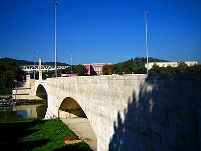
- Duke of Aosta Bridge, Roma,
- Dei Camporese Street, Roma,
- Andrea Bregno Street, Roma,
- Pier Della Francesca Street, Roma,
- Girolamo Rainaldi Square, Roma,
- Martino Longhi Street, Roma,
- Thaon di Revel Riverfront, Roma,
- Lauro De Bosis Square, Roma,
- Leopoldo Franchetti Street, Roma
Streets near Lungotevere Flaminio Riverfront, Roma
Get around Roma by public transit!
Traveling around Roma has never been so easy. See step by step directions as you travel to any attraction, street or major public transit station. View bus and train schedules, arrival times, service alerts and detailed routes on a map, so you know exactly how to get to anywhere in Roma.
When traveling to any destination around Roma use Moovit's Live Directions with Get Off Notifications to know exactly where and how far to walk, how long to wait for your line, and how many stops are left. Moovit will alert you when it's time to get off — no need to constantly re-check whether yours is the next stop.
Wondering how to use public transit in Roma or how to pay for public transit in Roma? Moovit public transit app can help you navigate your way with public transit easily, and at minimum cost. It includes public transit fees, ticket prices, and costs. Looking for a map of Roma public transit lines? Moovit public transit app shows all public transit maps in Roma with all Bus, Train, Metro, Light Rail, Ferry, Funicular and Gondola routes and stops on an interactive map.
Rome and Lazio has 7 transit type(s), including: Bus, Train, Metro, Light Rail, Ferry, Funicular and Gondola, operated by several transit agencies, including ATAC, Cotral, Trenitalia, Troiani Transportation Services, BIS, ATR Mobility, Tuscia, Shuttle, Seatour, Troiani Bus Lines, CSC Mobility, Terravision, ATRAL, Tambus and Sitbus