How to get to Lyons Locksmith by bus?
Click on the bus route to see step by step directions with maps, line arrival times and updated time schedules.
From Navy Lodge, Washington
120 minFrom St Elizabeths Hospital, Washington
70 minFrom Germantown Md, Washington
48 minFrom Silver Spring, Maryland, Montgomery County
68 minFrom Consulado General de El Salvador en El Dmv, Montgomery County
70 minFrom Penn Quarter, Washington DC, Washington
50 minFrom Ben's Chili Bowl, Washington
58 minFrom U.S. Naval Research Laboratory - NRL, Washington
116 minFrom Hilton Washington DC Capitol Hill, Washington
44 min
How to get to Lyons Locksmith by metro?
Click on the metro route to see step by step directions with maps, line arrival times and updated time schedules.
From St Elizabeths Hospital, Washington
59 minFrom Silver Spring, Maryland, Montgomery County
58 minFrom Consulado General de El Salvador en El Dmv, Montgomery County
63 minFrom Penn Quarter, Washington DC, Washington
40 minFrom Ben's Chili Bowl, Washington
49 minFrom Hilton Washington DC Capitol Hill, Washington
44 min
Bus stops near Lyons Locksmith in Washington
Metro stations near Lyons Locksmith in Washington
Bus lines to Lyons Locksmith in Washington
What are the closest stations to Lyons Locksmith?
The closest stations to Lyons Locksmith are:
- Prospect St Nw+36 St NW is 89 yards away, 2 min walk.
- Foggy Bottom Gwu Kennedy Center Metro Station is 203 yards away, 3 min walk.
- NW M St & NW 34th St is 421 yards away, 6 min walk.
- Q St Nw+35 St NW is 716 yards away, 9 min walk.
- NW Wisconsin Av & NW Dumbarton St is 788 yards away, 10 min walk.
- Dupont Circle Metro Station is 1215 yards away, 15 min walk.
Which bus lines stop near Lyons Locksmith?
These bus lines stop near Lyons Locksmith: A58, C91.
Which metro lines stop near Lyons Locksmith?
These metro lines stop near Lyons Locksmith: BLUE, ORANGE.
What’s the nearest metro station to Lyons Locksmith in Washington?
The nearest metro station to Lyons Locksmith in Washington is Foggy Bottom Gwu Kennedy Center Metro Station. It’s a 3 min walk away.
What’s the nearest bus station to Lyons Locksmith in Washington?
The nearest bus station to Lyons Locksmith in Washington is Prospect St Nw+36 St NW. It’s a 2 min walk away.
What time is the first metro to Lyons Locksmith in Washington?
The ORANGE is the first metro that goes to Lyons Locksmith in Washington. It stops nearby at 5:19 AM.
What time is the last metro to Lyons Locksmith in Washington?
The BLUE is the last metro that goes to Lyons Locksmith in Washington. It stops nearby at 12:18 AM.
What time is the first bus to Lyons Locksmith in Washington?
The D80 is the first bus that goes to Lyons Locksmith in Washington. It stops nearby at 3:11 AM.
What time is the last bus to Lyons Locksmith in Washington?
The D80 is the last bus that goes to Lyons Locksmith in Washington. It stops nearby at 3:11 AM.
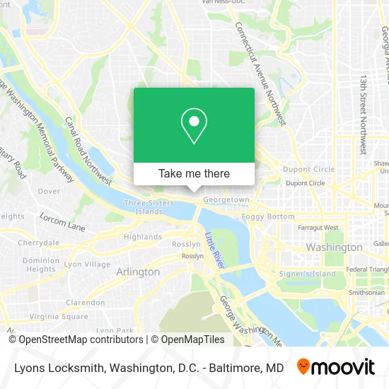
See Lyons Locksmith, Washington, on the map
Public Transit to Lyons Locksmith in Washington
Wondering how to get to Lyons Locksmith in Washington? Moovit helps you find the best way to get to Lyons Locksmith with step-by-step directions from the nearest public transit station.
Moovit provides free maps and live directions to help you navigate through your city. View schedules, routes, timetables, and find out how long does it take to get to Lyons Locksmith in real time.
Looking for the nearest stop or station to Lyons Locksmith? Check out this list of stops closest to your destination: Prospect St Nw+36 St NW; Foggy Bottom Gwu Kennedy Center Metro Station; NW M St & NW 34th St; Q St Nw+35 St NW; NW Wisconsin Av & NW Dumbarton St; Dupont Circle Metro Station.
Bus: A58, C91, C85, D94, D96, D80, D82.Metro: BLUE, ORANGE, SILVER, RED.
Want to see if there’s another route that gets you there at an earlier time? Moovit helps you find alternative routes or times. Get directions from and directions to Lyons Locksmith easily from the Moovit App or Website.
We make riding to Lyons Locksmith easy, which is why over 1.5 million users, including users in Washington, trust Moovit as the best app for public transit. You don’t need to download an individual bus app or train app, Moovit is your all-in-one transit app that helps you find the best bus time or train time available.
For information on prices of bus and metro, costs and ride fares to Lyons Locksmith, please check the Moovit app.
Use the app to navigate to popular places including to the airport, hospital, stadium, grocery store, mall, coffee shop, school, college, and university.
Lyons Locksmith Address: 1226 36th St NW Washington, DC 20007 street in Washington
- Tombs,
- The Tombs,
- Fitzgerald's,
- Prospect St 36th St,
- Maria & Alberto de la Cruz Art Gallery at Georgetown University,
- GUTS Shuttle Stop - Rosslyn at Car Barn,
- Life Sized Transformers,
- Lot WM,
- Exorcist Stairs,
- Cga Strategies LLC,
- Aramark,
- Car Barn - Georgetown University,
- The Exorcist Steps,
- Lohrfink Auditorium,
- LXR,
- The Car Barn,
- Holy Trinity Catholic Church,
- Calvin Klein,
- Lauinger Library - Georgetown University,
- Holy Trinity Catholic
Places Near Lyons Locksmith (Washington)
- Westfield Montgomery Mall, Montgomery County,
- National Zoo, Washington,
- The Anthem, Washington,
- National Mall, Washington,
- Marriott Marquis Washington, DC, Washington,
- Basilica of the National Shrine, Washington,
- National Museum of African American History and Culture, Washington,
- Georgetown, Washington,
- M&T Bank Stadium, Baltimore,
- PG Mall, Prince George's County,
- Museum Of The Bible, Washington,
- Washington National Cathedral, Washington,
- Camden Yards, Baltimore,
- Capital One Arena, Washington,
- Warner Theatre, Washington,
- Pennsylvania Ave NW (3rd st and pennsylvania), Washington,
- Sibley Memorial Hospital, Washington,
- Amazon Hq2, Arlington County,
- Rock Creek Tennis Center, Washington,
- Washington DC VA Medical Center, Washington
How to get to popular places in Washington, D.C. - Baltimore, MD with public transit
Get around Washington by public transit!
Traveling around Washington has never been so easy. See step by step directions as you travel to any attraction, street or major public transit station. View bus and train schedules, arrival times, service alerts and detailed routes on a map, so you know exactly how to get to anywhere in Washington.
When traveling to any destination around Washington use Moovit's Live Directions with Get Off Notifications to know exactly where and how far to walk, how long to wait for your line, and how many stops are left. Moovit will alert you when it's time to get off — no need to constantly re-check whether yours is the next stop.
Wondering how to use public transit in Washington or how to pay for public transit in Washington? Moovit public transit app can help you navigate your way with public transit easily, and at minimum cost. It includes public transit fees, ticket prices, and costs. Looking for a map of Washington public transit lines? Moovit public transit app shows all public transit maps in Washington with all Bus, Train, Metro, Light Rail and Ferry routes and stops on an interactive map.
Washington, D.C. - Baltimore, MD has 5 transit type(s), including: Bus, Train, Metro, Light Rail and Ferry, operated by several transit agencies, including WMATA, Montgomery County Ride On, Fairfax Connector, TheBus, PRTC, DASH - Alexandria, Arlington Transit (ART), RTA of Central Maryland, MDOT MTA, MDOT MTA Light RailLink, MDOT MTA Commuter Bus, MDOT MTA Local Bus, FXBGO!, Virginia Railway Express (VRE) and MARC