How to get to M3 Modas by bus?
Click on the bus route to see step by step directions with maps, line arrival times and updated time schedules.
From Rua: Antônio Pelaes Trajano De Souza, Macapá
51 minFrom Rua Tiradentes, Macapá
38 minFrom Ônibus Macapá/Santana - Via Coração, Santana
45 minFrom CRAS - Nova Esperança, Macapá
40 minFrom Rua Ubiracy De Azevedo Picanço, Macapá
75 minFrom Loteamento Terra Nova Bosque, Macapá
80 minFrom Rua Beira Rio, Macapá
49 minFrom Burado do teu cu!, Macapá
50 minFrom Petrobras, Santana
46 minFrom Rua Euclides Rodrigues, Santana
45 min
Bus stops near M3 Modas in Macapá
Bus lines to M3 Modas in Macapá
What are the closest stations to M3 Modas?
The closest stations to M3 Modas are:
- Avenida Ranolfo De Souza Gato, 225 is 205 meters away, 3 min walk.
- Avenida Do Marabaixo, 2148 is 221 meters away, 3 min walk.
- Santarém Com Sétima is 294 meters away, 4 min walk.
- Duca Com Maria Nair is 571 meters away, 8 min walk.
- Duca Com Ranolfo is 1178 meters away, 16 min walk.
Which bus lines stop near M3 Modas?
These bus lines stop near M3 Modas: 126, 144.
What’s the nearest bus station to M3 Modas in Macapá?
The nearest bus stations to M3 Modas in Macapá are Avenida Ranolfo De Souza Gato, 225 and Avenida Do Marabaixo, 2148. The closest one is a 3 min walk away.
What time is the first bus to M3 Modas in Macapá?
The 126 is the first bus that goes to M3 Modas in Macapá. It stops nearby at 5:53 AM.
What time is the last bus to M3 Modas in Macapá?
The 443 is the last bus that goes to M3 Modas in Macapá. It stops nearby at 1:14 AM.
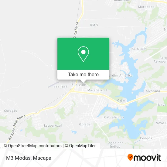
See M3 Modas, Macapá, on the map
Public Transit to M3 Modas in Macapá
Wondering how to get to M3 Modas in Macapá? Moovit helps you find the best way to get to M3 Modas with step-by-step directions from the nearest public transit station.
Moovit provides free maps and live directions to help you navigate through your city. View schedules, routes, timetables, and find out how long does it take to get to M3 Modas in real time.
Looking for the nearest stop or station to M3 Modas? Check out this list of stops closest to your destination: Avenida Ranolfo De Souza Gato; Avenida Do Marabaixo; Santarém Com Sétima; Duca Com Maria Nair; Duca Com Ranolfo.
Bus: 126, 144, 443, 500, 600.
Want to see if there’s another route that gets you there at an earlier time? Moovit helps you find alternative routes or times. Get directions from and directions to M3 Modas easily from the Moovit App or Website.
We make riding to M3 Modas easy, which is why over 1.5 million users, including users in Macapá, trust Moovit as the best app for public transit. You don’t need to download an individual bus app or train app, Moovit is your all-in-one transit app that helps you find the best bus time or train time available.
For information on prices of bus, costs and ride fares to M3 Modas, please check the Moovit app.
Use the app to navigate to popular places including to the airport, hospital, stadium, grocery store, mall, coffee shop, school, college, and university.
M3 Modas Address: Rua Ranolfo de Souza Gato, 586 Macapá Macapá-AP 68909-891 street in Macapá
- Point dos Caldos II,
- Castilho Confecções & Calçados,
- W. Menezes,
- Salao Venesa,
- WESTERN UNION,
- Center Kennedy,
- R N da Silva Materiai,
- Gran Posto de Coleta Laboratorial,
- Pereira & Santos Construcoes,
- Bradesco,
- Medclin Laboratório Popular - MARABAIXO II,
- Mr Pizza,
- Banco 24horas,
- Salão Capilar - Andressa Maia,
- Paroquia São Joâo Piamarta,
- Maf - Mariana Acessorios Fashion,
- Perêlepo's,
- Hiper Bike,
- Casa da Farinha Regional,
- Edifício Elaine
Places Near M3 Modas (Macapá)
- Casa do Caralho!, Macapá,
- Bairro Parque dos Buritis, Macapá,
- Mazagão, Macapá,
- Puteiro, Santana,
- Porto De Navegação Souza Mar, Santana,
- Puteiro Do Titio, Macapá,
- IFAP, Macapá,
- shopping Garden, Macapá,
- Universidade Federal do Amapá (UNIFAP), Macapá,
- Av. Presidente vargas - Centro ( Macapá - Ap ), Macapá,
- SAMF - Superitendência de Administração, Macapá,
- Avenida Professora Cora de Carvalho, Macapá,
- km 9 - linha E, Macapá,
- Ai! Que Fome, Macapá,
- Ferreira Gomes, Macapá,
- Avenida Coaracy Nunes, Macapá,
- Vhj, Macapá,
- Bairro Amazonas, Macapá,
- 7° Av do Congós, Macapá,
- Macapá Shopping, Macapá
How to get to popular places in Macapa with public transit
Get around Macapá by public transit!
Traveling around Macapá has never been so easy. See step by step directions as you travel to any attraction, street or major public transit station. View bus and train schedules, arrival times, service alerts and detailed routes on a map, so you know exactly how to get to anywhere in Macapá.
When traveling to any destination around Macapá use Moovit's Live Directions with Get Off Notifications to know exactly where and how far to walk, how long to wait for your line, and how many stops are left. Moovit will alert you when it's time to get off — no need to constantly re-check whether yours is the next stop.
Wondering how to use public transit in Macapá or how to pay for public transit in Macapá? Moovit public transit app can help you navigate your way with public transit easily, and at minimum cost. It includes public transit fees, ticket prices, and costs. Looking for a map of Macapá public transit lines? Moovit public transit app shows all public transit maps in Macapá with all bus routes and stops on an interactive map.
Macapa has 1 transit type(s), including: bus, operated by several transit agencies, including Sião Thur, Expresso União, Expresso Marco Zero, Amazontur and Capital Morena