How to get to MAPFRE by bus?
Click on the bus route to see step by step directions with maps, line arrival times and updated time schedules.
From Avenida de la Hispanidad s/n, Madrid
40 minFrom Clínica Universidad De Navarra, Área Metropolitana De Madrid Y Corredor Del Henares
42 minFrom Paseo de la Habana, Madrid
58 minFrom Calle de Arequipa 30, Madrid
57 minFrom Avenida de Monforte de Lemos 40, Madrid
61 minFrom Palacio De Hielo, Área Metropolitana De Madrid Y Corredor Del Henares
68 minFrom Centro De Especialidades Emigrantes, Área Metropolitana De Madrid Y Corredor Del Henares
57 minFrom Parada de Alsa En La T4, Madrid
26 minFrom Barrio del Pilar, Madrid
55 minFrom Parque Juan Carlos I, Madrid
71 min
How to get to MAPFRE by train?
Click on the train route to see step by step directions with maps, line arrival times and updated time schedules.
How to get to MAPFRE by metro?
Click on the metro route to see step by step directions with maps, line arrival times and updated time schedules.
Bus stops near MAPFRE in San Sebastián De Los Reyes
- Av. Sierra - Cervantes, 2 min walk,VIEW
- Av. Sierra - Navas De Tolosa, 2 min walk,VIEW
- Av. Sierra - C. C. La Viña, 3 min walk,VIEW
- Av. Valdelasfuentes - Av. Independencia, 5 min walk,VIEW
- Av. Independencia - Oviedo, 5 min walk,VIEW
- Av. España - Centro De Salud, 5 min walk,VIEW
- Av. España - Est. Alcobendas - S. S. Reyes, 6 min walk,VIEW
- Av. España - Est. Alcobendas S. Seb. Reyes, 7 min walk,VIEW
Metro station near MAPFRE in San Sebastián De Los Reyes
- Reyes Católicos, 10 min walk,VIEW
Train station near MAPFRE in San Sebastián De Los Reyes
- Alcobendas - San Sebastián De Los Reyes, 26 min walk,VIEW
Bus lines to MAPFRE in San Sebastián De Los Reyes
- 4, Moscatelares,VIEW
- 154, Av. Colmenar Viejo - Ntra. Sra. Carmen,VIEW
- 158, Av. San Luis - Av. Burgos,VIEW
- 827A, Iván Pavlov - Rectorado,VIEW
- 154C, Av. Quiñones - Cerro Del Baile,VIEW
- 5, San Sebastián de los Reyes,VIEW
- N102, Intercambiador De Plaza De Castilla (Nivel 0, Isla 4),VIEW
- 2, La Moraleja,VIEW
- 827, Av. España - M. Sebastián Izuel,VIEW
- 153, Pza. Universidad Popular - Est. Baunatal,VIEW
- 7, Circular (Estación FF.CC. - Polígonos - Estación FF.CC.),VIEW
- 11, Circular de Alcobendas,VIEW
- 151, Intercambiador De Plaza De Castilla (Nivel -3, Islas 1 Y 2),VIEW
- 9, Arroyo de la Vega,VIEW
- 180, Ronda De La Constitución - Alcalá,VIEW
- 191, Av. Madrid - Real,VIEW
- 193, Av. España - Est. Alcobendas S. Seb. Reyes,VIEW
- 828, Canillejas - Área Intermodal,VIEW
- N101, Intercambiador De Plaza De Castilla (Nivel 0, Isla 4),VIEW
- 197, Av. España - Est. Alcobendas S. Seb. Reyes,VIEW
What are the closest stations to MAPFRE?
The closest stations to MAPFRE are:
- Av. Sierra - Cervantes is 125 meters away, 2 min walk.
- Av. Sierra - Navas De Tolosa is 127 meters away, 2 min walk.
- Av. Sierra - C. C. La Viña is 209 meters away, 3 min walk.
- Av. Valdelasfuentes - Av. Independencia is 320 meters away, 5 min walk.
- Av. Independencia - Oviedo is 342 meters away, 5 min walk.
- Av. España - Centro De Salud is 344 meters away, 5 min walk.
- Av. España - Est. Alcobendas - S. S. Reyes is 386 meters away, 6 min walk.
- Av. España - Est. Alcobendas S. Seb. Reyes is 465 meters away, 7 min walk.
- Reyes Católicos is 734 meters away, 10 min walk.
- Alcobendas - San Sebastián De Los Reyes is 1983 meters away, 26 min walk.
Which bus lines stop near MAPFRE?
These bus lines stop near MAPFRE: 153, 154, 154C, 827.
Which train line stops near MAPFRE?
C4A (Alcobendas - S. S. De Los Reyes)
Which metro line stops near MAPFRE?
M-10 (Hospital Infanta Sofía)
What’s the nearest metro station to MAPFRE in San Sebastián De Los Reyes?
The nearest metro station to MAPFRE in San Sebastián De Los Reyes is Reyes Católicos. It’s a 10 min walk away.
What’s the nearest train station to MAPFRE in San Sebastián De Los Reyes?
The nearest train station to MAPFRE in San Sebastián De Los Reyes is Alcobendas - San Sebastián De Los Reyes. It’s a 26 min walk away.
What’s the nearest bus station to MAPFRE in San Sebastián De Los Reyes?
The nearest bus stations to MAPFRE in San Sebastián De Los Reyes are Av. Sierra - Cervantes and Av. Sierra - Navas De Tolosa. The closest one is a 2 min walk away.
What time is the first metro to MAPFRE in San Sebastián De Los Reyes?
The M-10 is the first metro that goes to MAPFRE in San Sebastián De Los Reyes. It stops nearby at 6:05 AM.
What time is the last metro to MAPFRE in San Sebastián De Los Reyes?
The M-10 is the last metro that goes to MAPFRE in San Sebastián De Los Reyes. It stops nearby at 1:52 AM.
What time is the first train to MAPFRE in San Sebastián De Los Reyes?
The C4A is the first train that goes to MAPFRE in San Sebastián De Los Reyes. It stops nearby at 5:30 AM.
What time is the last train to MAPFRE in San Sebastián De Los Reyes?
The C4A is the last train that goes to MAPFRE in San Sebastián De Los Reyes. It stops nearby at 12:02 AM.
What time is the first bus to MAPFRE in San Sebastián De Los Reyes?
The N101 is the first bus that goes to MAPFRE in San Sebastián De Los Reyes. It stops nearby at 3:00 AM.
What time is the last bus to MAPFRE in San Sebastián De Los Reyes?
The N101 is the last bus that goes to MAPFRE in San Sebastián De Los Reyes. It stops nearby at 3:00 AM.
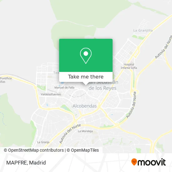
See MAPFRE, San Sebastián De Los Reyes, on the map
Public Transit to MAPFRE in San Sebastián De Los Reyes
Wondering how to get to MAPFRE in San Sebastián De Los Reyes? Moovit helps you find the best way to get to MAPFRE with step-by-step directions from the nearest public transit station.
Moovit provides free maps and live directions to help you navigate through your city. View schedules, routes, timetables, and find out how long does it take to get to MAPFRE in real time.
Looking for the nearest stop or station to MAPFRE? Check out this list of stops closest to your destination: Av. Sierra - Cervantes; Av. Sierra - Navas De Tolosa; Av. Sierra - C. C. La Viña; Av. Valdelasfuentes - Av. Independencia; Av. Independencia - Oviedo; Av. España - Centro De Salud; Av. España - Est. Alcobendas - S. S. Reyes; Av. España - Est. Alcobendas S. Seb. Reyes; Reyes Católicos; Alcobendas - San Sebastián De Los Reyes.
Bus: 153, 154, 154C, 827, 4, 158, 827A, 5, N102, 2.Train: C4A.Metro: M-10.
Want to see if there’s another route that gets you there at an earlier time? Moovit helps you find alternative routes or times. Get directions from and directions to MAPFRE easily from the Moovit App or Website.
We make riding to MAPFRE easy, which is why over 1.5 million users, including users in San Sebastián De Los Reyes, trust Moovit as the best app for public transit. You don’t need to download an individual bus app or train app, Moovit is your all-in-one transit app that helps you find the best bus time or train time available.
For information on prices of bus, metro and train, costs and ride fares to MAPFRE, please check the Moovit app.
Use the app to navigate to popular places including to the airport, hospital, stadium, grocery store, mall, coffee shop, school, college, and university.
MAPFRE Address: Avenida Guadarrama, 19 28701 San Sebastián de los Reyes street in San Sebastián De Los Reyes
- Afilado a Empresas Luis González,
- Servicios Auxiliares Novacivitas,
- Peluquería Alberto,
- Antonio de la Calle García,
- Eoi de San Sebastián de los Reyes,
- Pribasic,
- TUMOVIL Low Cost,
- Dahbi Barbershop,
- Monster Printing,
- Escuela Oficial de Idiomas de San Sebastian de los Reyes,
- Caricariau,
- Jesús Maria Alonso Simon,
- Cli Dental Campo de Mo,
- Jade. Centro de Belleza y Bienestar,
- Tezytattoo,
- EOI Juan de Mairena,
- El Remedio,
- Alimentación, frutos Secos, bazar,
- Cmercio Fanszhoung Wu,
- Promotora Constructora Diez sa
Places Near MAPFRE (San Sebastián De Los Reyes)
- Hospital Clínico Universitario San Carlos, Madrid,
- Nassica, Área Metropolitana De Madrid Y Corredor Del Henares,
- Plaza Mayor, Madrid,
- Hospital Universitario Ramón y Cajal, Madrid,
- Mendez Alvaro, Madrid,
- Mercadillo de Majadahonda, Majadahonda,
- Plenilunio, Área Metropolitana De Madrid Y Corredor Del Henares,
- Wizink Center, Madrid,
- Estacion de Chamartin, Madrid,
- Tres Aguas, Alcorcón,
- Sala La Riviera, Madrid,
- Estadio Wanda Metropolitano, Área Metropolitana De Madrid Y Corredor Del Henares,
- Calle de López de Hoyos 169, Madrid,
- Hospital Universitario La Paz, Madrid,
- Palacio De Vistalegre, Área Metropolitana De Madrid Y Corredor Del Henares,
- Centro Comercial Oasiz Madrid, Área Metropolitana De Madrid Y Corredor Del Henares,
- Centro Comercial La Gavia, Área Metropolitana De Madrid Y Corredor Del Henares,
- Centro Comercial Islazul, Área Metropolitana De Madrid Y Corredor Del Henares,
- Centro Comercial La Vaguada, Área Metropolitana De Madrid Y Corredor Del Henares,
- Rastro De Madrid, Área Metropolitana De Madrid Y Corredor Del Henares
How to get to popular places in Madrid with public transit
Get around San Sebastián De Los Reyes by public transit!
Traveling around San Sebastián De Los Reyes has never been so easy. See step by step directions as you travel to any attraction, street or major public transit station. View bus and train schedules, arrival times, service alerts and detailed routes on a map, so you know exactly how to get to anywhere in San Sebastián De Los Reyes.
When traveling to any destination around San Sebastián De Los Reyes use Moovit's Live Directions with Get Off Notifications to know exactly where and how far to walk, how long to wait for your line, and how many stops are left. Moovit will alert you when it's time to get off — no need to constantly re-check whether yours is the next stop.
Wondering how to use public transit in San Sebastián De Los Reyes or how to pay for public transit in San Sebastián De Los Reyes? Moovit public transit app can help you navigate your way with public transit easily, and at minimum cost. It includes public transit fees, ticket prices, and costs. Looking for a map of San Sebastián De Los Reyes public transit lines? Moovit public transit app shows all public transit maps in San Sebastián De Los Reyes with all Bus, Train, Metro and Light Rail routes and stops on an interactive map.
Madrid has 4 transit type(s), including: Bus, Train, Metro and Light Rail, operated by several transit agencies, including Metro de Madrid, Metro Ligero, Tranvía de Parla, Renfe Cercanías - Servicios de Autobús especiales, Renfe Cercanias, Renfe Cercanías, EMT, Interurbanos, Urbanos de Alcalá de Henares, Urbanos de Alcobendas, Urbanos de Alcorcón, Urbanos de Algete, Urbanos de Aranjuez, Urbanos de Arganda del Rey and Urbanos de Arroyomolinos