How to get to MAPFRE by bus?
Click on the bus route to see step by step directions with maps, line arrival times and updated time schedules.
From Comisaría de Policía de Madrid-Latina (y Oficina de Tramitación del DNI y Pasaporte), Madrid
38 minFrom El Corte Inglés El Bercial, Getafe
62 minFrom Tanatorio Servisa Madrid, Madrid
50 minFrom Avenida Poblados s/n, Madrid
38 minFrom Poligono Los Olivos, Getafe
56 minFrom Calle Puerto de la Morcuera 13, Leganés
43 minFrom Fundación Instituto San José, Madrid
39 minFrom X Madrid, Alcorcón
55 minFrom Calle Juan Mieg 3, Madrid
50 minFrom Hospital Fundación Alcorcón., Alcorcón
68 min
How to get to MAPFRE by train?
Click on the train route to see step by step directions with maps, line arrival times and updated time schedules.
How to get to MAPFRE by metro?
Click on the metro route to see step by step directions with maps, line arrival times and updated time schedules.
From Comisaría de Policía de Madrid-Latina (y Oficina de Tramitación del DNI y Pasaporte), Madrid
80 minFrom El Corte Inglés El Bercial, Getafe
36 minFrom Tanatorio Servisa Madrid, Madrid
111 minFrom Avenida Poblados s/n, Madrid
79 minFrom X Madrid, Alcorcón
50 minFrom Calle Juan Mieg 3, Madrid
111 minFrom Hospital Fundación Alcorcón., Alcorcón
53 min
Metro station near MAPFRE in Fuenlabrada
- Parque De Los Estados, 1 min walk,VIEW
Bus stop near MAPFRE in Fuenlabrada
- Leganés - Centro De Salud Mental, 3 min walk,VIEW
Train station near MAPFRE in Fuenlabrada
- Fuenlabrada, 18 min walk,VIEW
Bus lines to MAPFRE in Fuenlabrada
- 468, Getafe - Griñón/Casarrubuelos/Serranillos,VIEW
- 491, Madrid (Aluche) - Fuenlabrada (B.º Naranjo),VIEW
- 492, Madrid (Aluche) - Fuenlabrada (P. Granada),VIEW
- 493, Madrid (Aluche) - Fuenlabrada (Urb. Loranca),VIEW
- 497, Leganés (Parque Sur) - Moraleja de Enmedio (Las Colinas),VIEW
- 498, Móstoles - Arroyomolinos - Moraleja de Enmedio,VIEW
- N804, Madrid (Atocha) - Fuenlabrada,VIEW
- N807, Madrid (Atocha) - Getafe - Humanes - Griñón,VIEW
What are the closest stations to MAPFRE?
The closest stations to MAPFRE are:
- Parque De Los Estados is 64 meters away, 1 min walk.
- Leganés - Centro De Salud Mental is 194 meters away, 3 min walk.
- Fuenlabrada is 1371 meters away, 18 min walk.
Which bus lines stop near MAPFRE?
These bus lines stop near MAPFRE: 468, 491, 492, 493.
Which train line stops near MAPFRE?
C5 (Humanes)
Which metro line stops near MAPFRE?
M-12 (Andén 1)
What’s the nearest metro station to MAPFRE in Fuenlabrada?
The nearest metro station to MAPFRE in Fuenlabrada is Parque De Los Estados. It’s a 1 min walk away.
What’s the nearest train station to MAPFRE in Fuenlabrada?
The nearest train station to MAPFRE in Fuenlabrada is Fuenlabrada. It’s a 18 min walk away.
What’s the nearest bus station to MAPFRE in Fuenlabrada?
The nearest bus station to MAPFRE in Fuenlabrada is Leganés - Centro De Salud Mental. It’s a 3 min walk away.
What time is the first metro to MAPFRE in Fuenlabrada?
The M-12 is the first metro that goes to MAPFRE in Fuenlabrada. It stops nearby at 6:05 AM.
What time is the last metro to MAPFRE in Fuenlabrada?
The M-12 is the last metro that goes to MAPFRE in Fuenlabrada. It stops nearby at 2:10 AM.
What time is the first train to MAPFRE in Fuenlabrada?
The C5 is the first train that goes to MAPFRE in Fuenlabrada. It stops nearby at 5:29 AM.
What time is the last train to MAPFRE in Fuenlabrada?
The C5 is the last train that goes to MAPFRE in Fuenlabrada. It stops nearby at 12:36 AM.
What time is the first bus to MAPFRE in Fuenlabrada?
The 5 is the first bus that goes to MAPFRE in Fuenlabrada. It stops nearby at 3:01 AM.
What time is the last bus to MAPFRE in Fuenlabrada?
The N803 is the last bus that goes to MAPFRE in Fuenlabrada. It stops nearby at 2:55 AM.
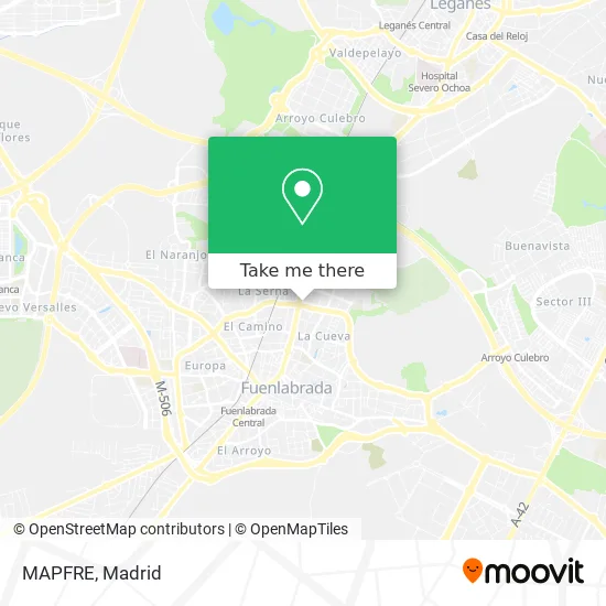
See MAPFRE, Fuenlabrada, on the map
Public Transit to MAPFRE in Fuenlabrada
Wondering how to get to MAPFRE in Fuenlabrada? Moovit helps you find the best way to get to MAPFRE with step-by-step directions from the nearest public transit station.
Moovit provides free maps and live directions to help you navigate through your city. View schedules, routes, timetables, and find out how long does it take to get to MAPFRE in real time.
Looking for the nearest stop or station to MAPFRE? Check out this list of stops closest to your destination: Parque De Los Estados; Leganés - Centro De Salud Mental; Fuenlabrada.
Bus: 468, 491, 492, 493, 497.Train: C5.Metro: M-12.
Want to see if there’s another route that gets you there at an earlier time? Moovit helps you find alternative routes or times. Get directions from and directions to MAPFRE easily from the Moovit App or Website.
We make riding to MAPFRE easy, which is why over 1.5 million users, including users in Fuenlabrada, trust Moovit as the best app for public transit. You don’t need to download an individual bus app or train app, Moovit is your all-in-one transit app that helps you find the best bus time or train time available.
For information on prices of bus, metro and train, costs and ride fares to MAPFRE, please check the Moovit app.
Use the app to navigate to popular places including to the airport, hospital, stadium, grocery store, mall, coffee shop, school, college, and university.
MAPFRE Address: Calle de Méjico, 1 28945 Fuenlabrada street in Fuenlabrada
- Calle de Méjico 1,
- Centro De Servicios Sociales,
- Avenida de la Hispanidad 2,
- Colegio Altamira,
- Centro de Arte Tomás y Valiente,
- Aldi,
- Dosan Asesores y Gestores de Inmuebles,
- Limpiezas Joyker,
- Joaquín Sánchez García,
- Eurocalor Instalaciones,
- Fija y Removible,
- Reformas Alysol,
- Renovetec Ingeniería,
- Orenes Sports Bar Salón de Juego,
- Pulpo Shisha Pub,
- Construcciones Jasisa,
- Agustín Garcia Mateos,
- Aluminios Gervaso,
- Bávaro Lounge,
- T. Alfredo
Places Near MAPFRE (Fuenlabrada)
- Plenilunio, Área Metropolitana De Madrid Y Corredor Del Henares,
- Wizink Center, Madrid,
- Centro Comercial La Gavia, Área Metropolitana De Madrid Y Corredor Del Henares,
- Calle de López de Hoyos 169, Madrid,
- Plaza Mayor, Madrid,
- Centro Comercial Oasiz Madrid, Área Metropolitana De Madrid Y Corredor Del Henares,
- Mendez Alvaro, Madrid,
- Nassica, Área Metropolitana De Madrid Y Corredor Del Henares,
- Tres Aguas, Alcorcón,
- Centro Comercial La Vaguada, Área Metropolitana De Madrid Y Corredor Del Henares,
- Hospital Universitario Ramón y Cajal, Madrid,
- Hospital Clínico Universitario San Carlos, Madrid,
- Hospital Universitario La Paz, Madrid,
- Sala La Riviera, Madrid,
- Estadio Wanda Metropolitano, Área Metropolitana De Madrid Y Corredor Del Henares,
- Rastro De Madrid, Área Metropolitana De Madrid Y Corredor Del Henares,
- Estacion de Chamartin, Madrid,
- Mercadillo de Majadahonda, Majadahonda,
- Centro Comercial Islazul, Área Metropolitana De Madrid Y Corredor Del Henares,
- Palacio De Vistalegre, Área Metropolitana De Madrid Y Corredor Del Henares
How to get to popular places in Madrid with public transit
Get around Fuenlabrada by public transit!
Traveling around Fuenlabrada has never been so easy. See step by step directions as you travel to any attraction, street or major public transit station. View bus and train schedules, arrival times, service alerts and detailed routes on a map, so you know exactly how to get to anywhere in Fuenlabrada.
When traveling to any destination around Fuenlabrada use Moovit's Live Directions with Get Off Notifications to know exactly where and how far to walk, how long to wait for your line, and how many stops are left. Moovit will alert you when it's time to get off — no need to constantly re-check whether yours is the next stop.
Wondering how to use public transit in Fuenlabrada or how to pay for public transit in Fuenlabrada? Moovit public transit app can help you navigate your way with public transit easily, and at minimum cost. It includes public transit fees, ticket prices, and costs. Looking for a map of Fuenlabrada public transit lines? Moovit public transit app shows all public transit maps in Fuenlabrada with all Bus, Train, Metro and Light Rail routes and stops on an interactive map.
Madrid has 4 transit type(s), including: Bus, Train, Metro and Light Rail, operated by several transit agencies, including Metro de Madrid, Metro Ligero, Tranvía de Parla, Renfe Cercanías - Servicios de Autobús especiales, Renfe Cercanias, Renfe Cercanías, EMT, Interurbanos, Urbanos de Alcalá de Henares, Urbanos de Alcobendas, Urbanos de Alcorcón, Urbanos de Algete, Urbanos de Aranjuez, Urbanos de Arganda del Rey and Urbanos de Arroyomolinos