How to get to MDH by bus?
Click on the bus route to see step by step directions with maps, line arrival times and updated time schedules.
From EsSalud Policlínico Chincha, Lima
48 minFrom Mercado Central, Lima
42 minFrom Jirón Camaná, Lima
47 minFrom Paradero Colectivos Chaclacayo - Chosica, Lima
43 minFrom Centro Comercial Real Plaza Santa Clara, Ate
36 minFrom Circuito Mágico Del Agua, Lima
55 minFrom Cruce Av. Canadá / Av. Aviación, San Luis
48 minFrom Paradero 5, Av. wiesse, San Juan D
61 minFrom Hospital Nacional Arzobispo Loayza, Lima
64 minFrom Estación España - Metropolitano, Breña
59 min
Bus lines to MDH in San Juan D
What are the closest stations to MDH?
The closest stations to MDH are:
- Los Cisnes is 919 meters away, 12 min walk.
- Candy Market Campoy is 1582 meters away, 20 min walk.
Which bus lines stop near MDH?
These bus lines stop near MDH: 1100, 1195, 1228.
What’s the nearest bus station to MDH in San Juan D?
The nearest bus station to MDH in San Juan D is Los Cisnes. It’s a 12 min walk away.
What time is the first bus to MDH in San Juan D?
The 1053 is the first bus that goes to MDH in San Juan D. It stops nearby at 5:00 AM.
What time is the last bus to MDH in San Juan D?
The 1060 is the last bus that goes to MDH in San Juan D. It stops nearby at 11:16 PM.
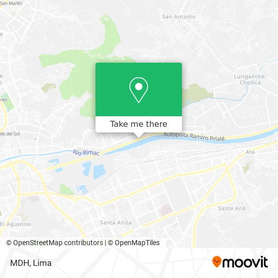
See MDH, San Juan D, on the map
Public Transit to MDH in San Juan D
Wondering how to get to MDH in San Juan D? Moovit helps you find the best way to get to MDH with step-by-step directions from the nearest public transit station.
Moovit provides free maps and live directions to help you navigate through your city. View schedules, routes, timetables, and find out how long does it take to get to MDH in real time.
Looking for the nearest stop or station to MDH? Check out this list of stops closest to your destination: Los Cisnes; Candy Market Campoy.
Bus: 1100, 1195, 1228, 4303, 1053, 1060.
Want to see if there’s another route that gets you there at an earlier time? Moovit helps you find alternative routes or times. Get directions from and directions to MDH easily from the Moovit App or Website.
We make riding to MDH easy, which is why over 1.5 million users, including users in San Juan D, trust Moovit as the best app for public transit. You don’t need to download an individual bus app or train app, Moovit is your all-in-one transit app that helps you find the best bus time or train time available.
For information on prices of bus, costs and ride fares to MDH, please check the Moovit app.
Use the app to navigate to popular places including to the airport, hospital, stadium, grocery store, mall, coffee shop, school, college, and university.
Location: San Juan D, Lima
- Institución Educativa 0089 Manuel Gonzales Prada,
- Colegio Manuel Gonzales Prada,
- Colegio 0090 Daniel Alcides Carrion,
- Av Malecon Checa,
- Colegio 0088 Nuestra Señora del Carmen,
- Divinas,
- Avenida Malecón Checa,
- Santa María de Campoy,
- Anticuchos y Pollo a la parrilla "Juanita",
- San Martín de Porras,
- Institución Educativa Inicial Amiguitos De Jesus - Campoy,
- Jvv S. R. Ltda.,
- Centro Cultural Acoria - Huancavelica,
- Centro De Salud Campoy,
- Estacionamiento Campo Fe,
- Aguas Gasificadas,
- H & S Logistic Cargo E Inversiones E.I.R.L.,
- Mercado Santa Rosa,
- Calle 8 & Avenida Malecón Checa,
- Campoy
Places Near MDH (San Juan D)
- Gamarra,
- Mall Del Sur,
- Av. Abancay, Lima,
- Av. La Marina, San Miguel,
- Larcomar, Miraflores,
- Miraflores, Miraflores,
- Real Plaza Puruchuco, Ate,
- Barranco, Barranco,
- Pontificia Universidad Católica del Perú - PUCP, San Miguel,
- Av. Salaverry, Jesus Mari,
- Plaza San Miguel, San Miguel,
- Circuito Mágico Del Agua, Lima,
- av arequipa, Lima,
- Parque Kennedy, Miraflores,
- Parque de las Leyendas, San Miguel,
- Aeropuerto Internacional Jorge Chávez, Ventanilla,
- Hospital Edgardo Rebagliati Martins, Jesus Mari,
- Paradero Av.Brasil,
- Jockey Plaza, Santiago D,
- Centro Comercial Plaza Norte, Independen
How to get to popular places in Lima with public transit
Get around San Juan D by public transit!
Traveling around San Juan D has never been so easy. See step by step directions as you travel to any attraction, street or major public transit station. View bus and train schedules, arrival times, service alerts and detailed routes on a map, so you know exactly how to get to anywhere in San Juan D.
When traveling to any destination around San Juan D use Moovit's Live Directions with Get Off Notifications to know exactly where and how far to walk, how long to wait for your line, and how many stops are left. Moovit will alert you when it's time to get off — no need to constantly re-check whether yours is the next stop.
Wondering how to use public transit in San Juan D or how to pay for public transit in San Juan D? Moovit public transit app can help you navigate your way with public transit easily, and at minimum cost. It includes public transit fees, ticket prices, and costs. Looking for a map of San Juan D public transit lines? Moovit public transit app shows all public transit maps in San Juan D with all Bus, Metro and Ferry routes and stops on an interactive map.
Lima has 3 transit type(s), including: Bus, Metro and Ferry, operated by several transit agencies, including Metro de Lima Línea 2 , Metro de Lima, Corredor Rojo, Metropolitano, Metropolitano - Alimentadores, Corredor Morado, Corredor Azul, Rutas Tradicionales, Transportes y Servicios La Esperanza S.A., Las Flores S.A., Virgen de la Asunción S.A., Consorcio HAM, Transportes y Service Canadá S.A., ETUL4SA and ETUCHISA