How to get to MR. B's Auto Collision by bus?
Click on the bus route to see step by step directions with maps, line arrival times and updated time schedules.
From Caprichos on Board, Tulsa
29 minFrom Weber Bruce G Precious Jewels, Tulsa
51 minFrom Electric Gnome Tattoo, Tulsa
64 minFrom Orthopedic and Trauma, Tulsa
55 minFrom Alamo Return-Tulsa Int'l, Tulsa
57 minFrom Radiation Oncology at Hillcrest: DRS. Diane Heaton, Tulsa
44 minFrom Advanced Orthopedics Physical Therapy - Midtown, Tulsa
63 minFrom Coast 2 Coast Vinyl Graphics, Tulsa
49 minFrom Southwest Blvd&W 21st St S, Tulsa
50 min
Bus stops near MR. B's Auto Collision in Tulsa
What are the closest stations to MR. B's Auto Collision?
The closest stations to MR. B's Auto Collision are:
- (8004) Peoria Ave & 46th St N Sb is 266 yards away, 4 min walk.
- (0114) N Hartford Ave & E 46th St N Sb is 827 yards away, 10 min walk.
Which bus line stops near MR. B's Auto Collision?
700 (To Peoria/54th N)
What’s the nearest bus station to MR. B's Auto Collision in Tulsa?
The nearest bus station to MR. B's Auto Collision in Tulsa is (8004) Peoria Ave & 46th St N Sb. It’s a 4 min walk away.
What time is the first bus to MR. B's Auto Collision in Tulsa?
The 110 is the first bus that goes to MR. B's Auto Collision in Tulsa. It stops nearby at 5:18 AM.
What time is the last bus to MR. B's Auto Collision in Tulsa?
The 700 is the last bus that goes to MR. B's Auto Collision in Tulsa. It stops nearby at 10:40 PM.
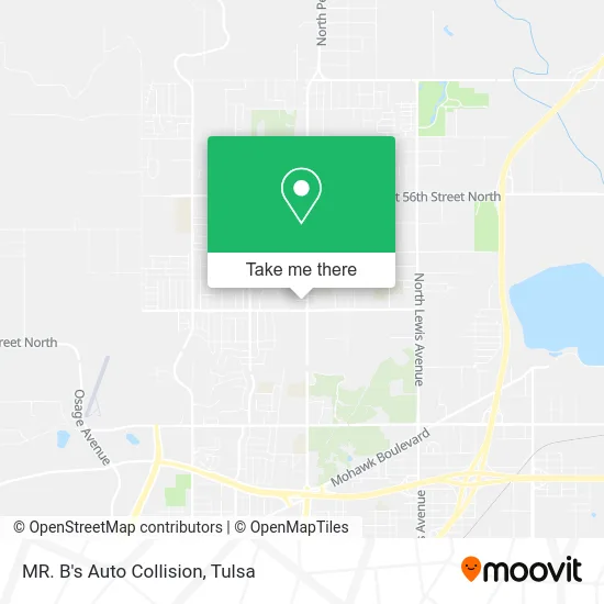
See MR. B's Auto Collision, Tulsa, on the map
Public Transit to MR. B's Auto Collision in Tulsa
Wondering how to get to MR. B's Auto Collision in Tulsa? Moovit helps you find the best way to get to MR. B's Auto Collision with step-by-step directions from the nearest public transit station.
Moovit provides free maps and live directions to help you navigate through your city. View schedules, routes, timetables, and find out how long does it take to get to MR. B's Auto Collision in real time.
Looking for the nearest stop or station to MR. B's Auto Collision? Check out this list of stops closest to your destination: (8004) Peoria Ave & 46th St N Sb; (0114) N Hartford Ave & E 46th St N Sb.
Bus: 700, 110.
Want to see if there’s another route that gets you there at an earlier time? Moovit helps you find alternative routes or times. Get directions from and directions to MR. B's Auto Collision easily from the Moovit App or Website.
We make riding to MR. B's Auto Collision easy, which is why over 1.5 million users, including users in Tulsa, trust Moovit as the best app for public transit. You don’t need to download an individual bus app or train app, Moovit is your all-in-one transit app that helps you find the best bus time or train time available.
For information on prices of bus, costs and ride fares to MR. B's Auto Collision, please check the Moovit app.
Use the app to navigate to popular places including to the airport, hospital, stadium, grocery store, mall, coffee shop, school, college, and university.
MR. B's Auto Collision Address: 1248 E 47th St N Tulsa, OK 74126 street in Tulsa
- T-Mobile,
- 46th Street North,
- Star of Bethlehem Baptist,
- NU Yu,
- H&R Block,
- Sadie's CNA Academy,
- Hawthorne Elementary,
- La Estrella Mexicana Food LLC,
- McLain JHS,
- Mclain High School,
- Meadors Insurance,
- Bubbled Up Car Wash & Detailing LLC,
- E 46th St N,
- smart Choice Medical Services,
- E 46th St N / N Iroquois Ave,
- 1143 E 50th Pl N,
- Fairhill East, Oklahoma,
- Addies Thrift Store,
- Church of Eternal Love,
- Foodyz Amazing Taste
Places Near MR. B's Auto Collision (Tulsa)
- Osage Casino, Tulsa,
- Walmart, Tulsa,
- Bixby, OK, Bixby,
- Zavala Plus, Tulsa,
- St Francis South Cardinal Building, Tulsa,
- 71st & Memorial, Tulsa,
- Alagon Spa (Olympus Spa), Tulsa,
- S Garnett Rd / E 21st St, Tulsa,
- Plaza Santa Cecilia, Tulsa,
- Hard Rock Casino, Tulsa,
- St. Francis Hospital Outpatient Infusion, Tulsa,
- Fallout Shelter, Tulsa,
- Tulsa State Fair, Tulsa,
- Tulsa Zoo, Tulsa,
- Tulsa Ok, Tulsa,
- Amazon Fulfillment Center-TUL2, Tulsa,
- River Spirit Casino, Tulsa,
- Broken Arrow, OK, Broken Arrow,
- Saint Francis Hospital, Tulsa,
- Woodland Hills Mall, Tulsa
How to get to popular places in Tulsa with public transit
Get around Tulsa by public transit!
Traveling around Tulsa has never been so easy. See step by step directions as you travel to any attraction, street or major public transit station. View bus and train schedules, arrival times, service alerts and detailed routes on a map, so you know exactly how to get to anywhere in Tulsa.
When traveling to any destination around Tulsa use Moovit's Live Directions with Get Off Notifications to know exactly where and how far to walk, how long to wait for your line, and how many stops are left. Moovit will alert you when it's time to get off — no need to constantly re-check whether yours is the next stop.
Wondering how to use public transit in Tulsa or how to pay for public transit in Tulsa? Moovit public transit app can help you navigate your way with public transit easily, and at minimum cost. It includes public transit fees, ticket prices, and costs. Looking for a map of Tulsa public transit lines? Moovit public transit app shows all public transit maps in Tulsa with all bus routes and stops on an interactive map.
Tulsa has 1 transit type(s), including: bus, operated by several transit agencies, including MetroLink Tulsa and Greyhound-us