How to get to M&D by bus?
Click on the bus route to see step by step directions with maps, line arrival times and updated time schedules.
From Changsha Wanda Wuhan Hotel, Kaifu District
34 minFrom National Defense University of Technology Building 3, Kaifu District
29 minFrom Changsha New City Wuyue Plaza, Changsha County
61 minFrom Guansha Ridge Street Public Service Station, Yuelu District
40 minFrom Changsha Underwater World, Kaifu District
34 minFrom Sany Heavy Industry, Changsha County
52 minFrom Guapiao Mountain, Yuelu District
56 minFrom Changsha Mingde Middle School Branch, Yuhua District
44 minFrom Hunan Science and Technology Museum - Lecture Hall, Tianxin District
52 minFrom Parlement Dance Hall, Kaifu District
30 min
How to get to M&D by metro?
Click on the metro route to see step by step directions with maps, line arrival times and updated time schedules.
From Changsha Wanda Wuhan Hotel, Kaifu District
22 minFrom National Defense University of Technology Building 3, Kaifu District
23 minFrom Changsha New City Wuyue Plaza, Changsha County
50 minFrom Guansha Ridge Street Public Service Station, Yuelu District
66 minFrom Sany Heavy Industry, Changsha County
51 minFrom Changsha Mingde Middle School Branch, Yuhua District
43 minFrom Hunan Science and Technology Museum - Lecture Hall, Tianxin District
47 minFrom Parlement Dance Hall, Kaifu District
32 min
Bus stops near M&D in Furong District
Metro stations near M&D in Furong District
Bus lines to M&D in Furong District
- Route 66, Changsha South Railway,VIEW
- Route 122, South Suburb Park,VIEW
- Route 802, Steel Market,VIEW
- Route 810, Route 810 Terminal,VIEW
- Route 915, Sea World,VIEW
- Route 405, East Hehua Road,VIEW
- Route 208, Changsha South Railway,VIEW
- Route 702, Changsha University of Science and Technology Yuntang Campus,VIEW
- Temporary Route 131, West Fuyuan Road Bridge,VIEW
- Route 130, Labor Square,VIEW
- Route 707, Huaxia,VIEW
- Route 143 Outer Ring, Guitang River,VIEW
- Route 143 Inner Loop, Guitang River,VIEW
What are the closest stations to M&D?
The closest stations to M&D are:
- Wanjiali Plaza is 273 meters away, 5 min walk.
- Wanjiali Plaza South is 285 meters away, 5 min walk.
- Furong District Government East is 378 meters away, 6 min walk.
- Mawangdui is 568 meters away, 8 min walk.
Which bus lines stop near M&D?
These bus lines stop near M&D: Route 405, Route 66, Route 802, Route 810, Route 915.
Which metro lines stop near M&D?
These metro lines stop near M&D: Line 2, Line 5.
What’s the nearest metro station to M&D in Furong District?
The nearest metro station to M&D in Furong District is Mawangdui. It’s a 8 min walk away.
What’s the nearest bus station to M&D in Furong District?
The nearest bus stations to M&D in Furong District are Wanjiali Plaza and Wanjiali Plaza South. The closest one is a 5 min walk away.
What time is the first metro to M&D in Furong District?
The Line 2 is the first metro that goes to M&D in Furong District. It stops nearby at 6:30 AM.
What time is the last metro to M&D in Furong District?
The Line 2 is the last metro that goes to M&D in Furong District. It stops nearby at 11:35 PM.
What time is the first bus to M&D in Furong District?
The Route 130 is the first bus that goes to M&D in Furong District. It stops nearby at 5:56 AM.
What time is the last bus to M&D in Furong District?
The Route 143 Outer Ring is the last bus that goes to M&D in Furong District. It stops nearby at 10:59 PM.
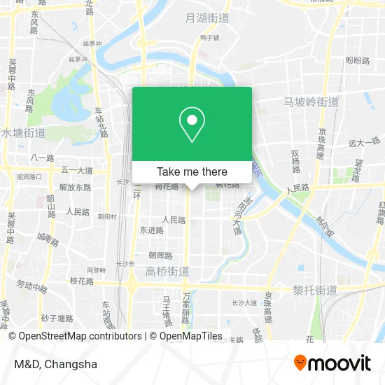
See M&D, Furong District, on the map
Public Transit to M&D in Furong District
Wondering how to get to M&D in Furong District? Moovit helps you find the best way to get to M&D with step-by-step directions from the nearest public transit station.
Moovit provides free maps and live directions to help you navigate through your city. View schedules, routes, timetables, and find out how long does it take to get to M&D in real time.
Looking for the nearest stop or station to M&D? Check out this list of stops closest to your destination: Wanjiali Plaza; Wanjiali Plaza South; Furong District Government East; Mawangdui.
Bus: Route 405, Route 66, Route 802, Route 810, Route 915, Route 66, Route 122, Route 802, Route 810, Route 915, Route 405, Route 208, Route 702, Temporary Route 131, Route 130, Route 707, Route 143 Outer Ring.Metro: Line 2, Line 5, Line 5, Line 2.
Want to see if there’s another route that gets you there at an earlier time? Moovit helps you find alternative routes or times. Get directions from and directions to M&D easily from the Moovit App or Website.
We make riding to M&D easy, which is why over 1.5 million users, including users in Furong District, trust Moovit as the best app for public transit. You don’t need to download an individual bus app or train app, Moovit is your all-in-one transit app that helps you find the best bus time or train time available.
For information on prices of bus and metro, costs and ride fares to M&D, please check the Moovit app.
Use the app to navigate to popular places including to the airport, hospital, stadium, grocery store, mall, coffee shop, school, college, and university.
M&D Address: 长沙市芙蓉区万家丽中路99号万家丽国际购物广场F4 street in Furong District
- KFC (Dongxi Gate Restaurant),
- Renrenle (Mawangdui Middle Road Store),
- Le Ding Hunan Changsha Furong Wangjiali Plaza Store,
- Boshjie Watch (Wanjiali International Shopping Plaza Store),
- Home Convenience Store (Wanjiali International Shopping Plaza Store),
- Wanjiali International Shopping Plaza - Men's Restroom,
- South Gate,
- ROYALANTONY (Wanjiali Plaza Branch),
- Yichun (Wanjiali International Shopping Plaza Store),
- Wanjiali International Shopping Plaza (South Gate),
- Xiabu Xiabu (Changsha Wanjiali MALL Branch),
- F.O.X,
- Lingdao Children's Toy City (Wanjiali International Shopping Mall Branch),
- Zi Han (Wanjiali Plaza Store),
- oo&vv,
- Bebibear Mother and Baby Supplies Lifestyle Store (Wanjiali Plaza Branch),
- Wanjiali Plaza Taishi Ji Ancient Style Fresh Baked Cake,
- Korean Myeongdong Cuisine (Wanjiali International Branch),
- Xiangyu Delicious Online,
- Keisifude (Wanjiali International Shopping Mall)
Places Near M&D (Furong District)
- Changsha Bank ATM (Sifang Branch), Kaifu District,
- First Affiliated Hospital of Hunan University of Traditional Chinese Medicine - Outpatient Department, Yuhua District,
- Wanjiali International Mall, Furong District,
- Hunan Provincial Maternal and Child Health Hospital - Outpatient Department, Kaifu District,
- Changsha South Station Square, Yuelu District,
- Apple Authorized Dealer (Sam Changsha Store), Yuhua District,
- Xingsha Police Station Songya Community Police Room, Changsha County,
- National University of Defense Technology (North Gate), Kaifu District,
- Desiqin City Square, Yuhua District,
- Yuelu Mountain Juzizhou Tourist Area, Yuelu District,
- Changsha South Station, Yuhua District,
- Hunan University of Traditional Chinese Medicine First Affiliated Hospital, Yuhua District,
- Hunan Provincial Museum - Multipurpose Hall, Kaifu District,
- Changsha Yangming Mountain Funeral Home, Yuhua District,
- Central South University Xiangya Second Hospital, Furong District,
- First Club, Kaifu District,
- Hunan Province Tumor Hospital, Yuelu District,
- Zhongnan University Xiangya Hospital, Kaifu District,
- Du Fu River Pavilion, Tianxin District,
- Changsha Bank (Sifang Branch), Kaifu District
How to get to popular places in Changsha with public transit
Get around Furong District by public transit!
Traveling around Furong District has never been so easy. See step by step directions as you travel to any attraction, street or major public transit station. View bus and train schedules, arrival times, service alerts and detailed routes on a map, so you know exactly how to get to anywhere in Furong District.
When traveling to any destination around Furong District use Moovit's Live Directions with Get Off Notifications to know exactly where and how far to walk, how long to wait for your line, and how many stops are left. Moovit will alert you when it's time to get off — no need to constantly re-check whether yours is the next stop.
Wondering how to use public transit in Furong District or how to pay for public transit in Furong District? Moovit public transit app can help you navigate your way with public transit easily, and at minimum cost. It includes public transit fees, ticket prices, and costs. Looking for a map of Furong District public transit lines? Moovit public transit app shows all public transit maps in Furong District with all Bus and Metro routes and stops on an interactive map.
Changsha has 2 transit type(s), including: Bus and Metro, operated by several transit agencies, including Changsha Metro and Changsha Bus Group