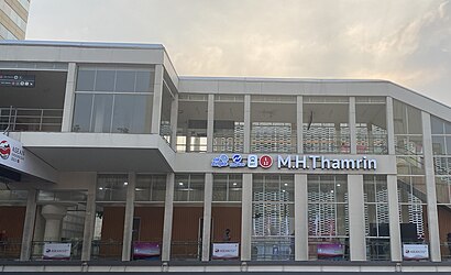
M.H. Thamrin 2 stop - Tuesday schedule
| Line | Direction | Time |
|---|---|---|
| FEEDER KERETA BANDARA | Gambir | 5:07 AM |
| TRANSJABODETABEK CIAWI - TANAH ABANG | Tanah Abang | 5:47 AM |
| AC52A | Tanah Abang | 5:50 AM |
| FEEDER KERETA BANDARA | Gambir | 6:07 AM |
| P50 | Tanah Abang | 6:12 AM |
| AC52 | Tanah Abang | 6:13 AM |
| TRANSJABODETABEK CIAWI - TANAH ABANG | Tanah Abang | 6:17 AM |
| AC52A | Tanah Abang | 6:20 AM |
| TRANSJABODETABEK BEKASI - TANAH ABANG | Tanah Abang | 6:39 AM |
| P50 | Tanah Abang | 6:42 AM |
| AC52 | Tanah Abang | 6:43 AM |
| JRC GRAND WISATA TAMBUN | Grand Paragon | 6:45 AM |
| AC52A | Tanah Abang | 6:50 AM |
| TRANSJABODETABEK BEKASI - TANAH ABANG | Tanah Abang | 6:54 AM |
| JRC JATIWARNA | Monas | 6:55 AM |
| TRANSJABODETABEK CIAWI - TANAH ABANG | Tanah Abang | 7:02 AM |
| FEEDER KERETA BANDARA | Gambir | 7:09 AM |
| TRANSJABODETABEK BEKASI - TANAH ABANG | Tanah Abang | 7:11 AM |
| P50 | Tanah Abang | 7:15 AM |
| AC52 | Tanah Abang | 7:17 AM |
| JRC JATIWARNA | Monas | 7:19 AM |
| JRC GRAND WISATA TAMBUN | Grand Paragon | 7:19 AM |
| AC52A | Tanah Abang | 7:25 AM |
| TRANSJABODETABEK BEKASI - TANAH ABANG | Tanah Abang | 7:31 AM |
| TRANSJABODETABEK CIAWI - TANAH ABANG | Tanah Abang | 7:41 AM |
Directions to M.H. Thamrin 2 stop (Jakarta Pusat) with public transit
The following transit lines have routes that pass near M.H. Thamrin 2
 Bus: 1, 6A, 9D, AC52, P50.
- Train: BOGOR LINE, RANGKAS BITUNG LINE, LINGKAR CIKARANG LINE.
- Metro: M.
How to get to M.H. Thamrin 2 stop by bus?
Click on the bus route to see step by step directions with maps, line arrival times and updated time schedules.
How to get to M.H. Thamrin 2 stop by train?
Click on the train route to see step by step directions with maps, line arrival times and updated time schedules.
How to get to M.H. Thamrin 2 stop by metro?
Click on the metro route to see step by step directions with maps, line arrival times and updated time schedules.
Bus stops near M.H. Thamrin 2 stop in Jakarta Pusat
- MH Thamrin 2, 1 min walk,
- MH Thamrin, 1 min walk,
- MH Thamrin 3, 4 min walk,
- Menara Topaz, 4 min walk,
- M.H. Thamrin 1, 4 min walk,
- Sari Pan Pacific, 5 min walk,
- H. Agus Salim 1, 7 min walk,
Metro stations near M.H. Thamrin 2 station in Jakarta Pusat
- Bundaran HI, 5 min walk,
Train stations near M.H. Thamrin 2 station in Jakarta Pusat
- Gondangdia, 17 min walk,
- Tanahabang, 23 min walk,
- Sudirman Baru (Bni City), 26 min walk,
Bus lines to M.H. Thamrin 2 stop in Jakarta Pusat
- 1N, Tanah Abang,
- 1P, Senen,
- 1T, Cibubur,
- BW4, Pencakar Langit,
- 1, Monumen Nasional,
- 6A, Balai Kota Dan Ragunan Via Kuningan,
- 6B, Balai Kota Dan Ragunan Via Semanggi,
- 9D, Pasar Minggu,
- 1H, Stasiun Gondangdia Dan Tanah Abang,
- 1R, Tanah Abang Dan Senen,
- JRC GRAND WISATA TAMBUN, Grand Paragon,
- AC52, Bekasi,
- AC52A, Jati Asih,
- FEEDER KERETA BANDARA, Stasiun Sudirman,
- JRC JATIWARNA, Grandhika City Jatiwarna,
- TRANSJABODETABEK BEKASI - TANAH ABANG, Bekasi (Tol Timur),
- TRANSJABODETABEK CIAWI - TANAH ABANG, Ciawi,
- P50, Bekasi,
- JAC ARYADUTA, Bandara Soekarno Hatta,
- JAK.10A, Cikini Dan Gondangdia Via Salemba Raya,
What are the closest stations to M.H. Thamrin 2?
The closest stations to M.H. Thamrin 2 are:
- MH Thamrin 2 is 1 meters away, 1 min walk.
- MH Thamrin is 62 meters away, 1 min walk.
- MH Thamrin 3 is 238 meters away, 4 min walk.
- Menara Topaz is 270 meters away, 4 min walk.
- M.H. Thamrin 1 is 272 meters away, 4 min walk.
- Bundaran HI is 353 meters away, 5 min walk.
- Sari Pan Pacific is 354 meters away, 5 min walk.
- H. Agus Salim 1 is 460 meters away, 7 min walk.
- Gondangdia is 1282 meters away, 17 min walk.
- Sudirman Baru (Bni City) is 1617 meters away, 26 min walk.
- Tanahabang is 1757 meters away, 23 min walk.
Which bus lines stop near M.H. Thamrin 2?
These bus lines stop near M.H. Thamrin 2: 1, 6A, 9D, AC52, P50.
Which train line stops near M.H. Thamrin 2?
BOGOR LINE (Jakarta Kota)
Which metro line stops near M.H. Thamrin 2?
M (Bundaran HI)
What’s the nearest metro station to M.H. Thamrin 2 in Jakarta Pusat?
The nearest metro station to M.H. Thamrin 2 in Jakarta Pusat is Bundaran HI. It’s a 5 min walk away.
What’s the nearest train station to M.H. Thamrin 2 in Jakarta Pusat?
The nearest train station to M.H. Thamrin 2 in Jakarta Pusat is Gondangdia. It’s a 17 min walk away.
What’s the nearest bus station to M.H. Thamrin 2 in Jakarta Pusat?
The nearest bus stations to M.H. Thamrin 2 in Jakarta Pusat are MH Thamrin 2 and MH Thamrin. The closest one is a 1 min walk away.
What time is the first metro to M.H. Thamrin 2 in Jakarta Pusat?
The M is the first metro that goes to M.H. Thamrin 2 in Jakarta Pusat. It stops nearby at 5:06 AM.
What time is the last metro to M.H. Thamrin 2 in Jakarta Pusat?
The M is the last metro that goes to M.H. Thamrin 2 in Jakarta Pusat. It stops nearby at 11:55 PM.
What time is the first train to M.H. Thamrin 2 in Jakarta Pusat?
The RANGKAS BITUNG LINE is the first train that goes to M.H. Thamrin 2 in Jakarta Pusat. It stops nearby at 4:19 AM.
What time is the last train to M.H. Thamrin 2 in Jakarta Pusat?
The BOGOR LINE is the last train that goes to M.H. Thamrin 2 in Jakarta Pusat. It stops nearby at 12:22 AM.
What time is the first bus to M.H. Thamrin 2 in Jakarta Pusat?
The 1 is the first bus that goes to M.H. Thamrin 2 in Jakarta Pusat. It stops nearby at 3:01 AM.
What time is the last bus to M.H. Thamrin 2 in Jakarta Pusat?
The 1 is the last bus that goes to M.H. Thamrin 2 in Jakarta Pusat. It stops nearby at 4:25 AM.
See M.H. Thamrin 2 stop, Jakarta Pusat, on the map
Public transit to M.H. Thamrin 2 stop in Jakarta Pusat
Looking for directions to M.H. Thamrin 2 in Jakarta Pusat, Indonesia?
Download the Moovit App to find the current schedule and step-by-step directions for Bus, Metro or Train routes that pass through M.H. Thamrin 2.
Looking for the nearest stops closest to M.H. Thamrin 2 ? Check out this list of closest stops to your destination: MH Thamrin 2; MH Thamrin; MH Thamrin 3; Menara Topaz; M.H. Thamrin 1; Bundaran HI; Sari Pan Pacific; H. Agus Salim 1; Gondangdia; Sudirman Baru (Bni City); Tanahabang.
Bus: 1, 6A, 9D, AC52, P50, 1N, 1P, 1T, BW4, 6B.Train: BOGOR LINE, RANGKAS BITUNG LINE, LINGKAR CIKARANG LINE.Metro: M.
We make riding on public transit to M.H. Thamrin 2 easy, which is why over 1.5 million users, including users in Jakarta Pusat trust Moovit as the best app for public transit.
Use the app to navigate to popular places including to the airport, hospital, stadium, grocery store, mall, coffee shop, school, college, and university.
The first line to this stop is FEEDER KERETA BANDARA, at 5:07 AM, and the last line is P50 at 11:03 PM.
TransJakarta Busway Koridor 1 (Kota-Blok M), Jakarta Pusat, Indonesia
This stop serves Sinar Jaya Megah Langgeng, Mayasari Bakti and PPD (Pengangkutan Penumpang Djakarta)’s lines
Popular routes from M.H. Thamrin 2 stop, Jakarta Pusat
- MH Thamrin 2,
- MH Thamrin,
- MH Thamrin 3,
- Menara Topaz,
- M.H. Thamrin 1,
- Sari Pan Pacific,
- H. Agus Salim 1
Bus stops near M.H. Thamrin 2 stop
- Bundaran HI
Metro station near M.H. Thamrin 2 station
- Gondangdia,
- Tanahabang,
- Sudirman Baru (Bni City)
Train stations near M.H. Thamrin 2 station
- Stasiun Bekasi Timur,
- Jalan Griya Asri Ii. Tambun Selatan. Bekasi,
- 4 Jalan Mutiara Gading Timur Raya. Tambun Selatan. Bekasi,
- Vihara Gayatri 1,
- 75 Jalan Raya Cikarang Cibarusah. Cikarang Selatan. Bekasi,
- Pegangsaan Timur,
- Simpang Kota Bambu Utara I,
- Kebon Nanas,
- Sudimara,
- Pasar Induk,
- Gatot Subroto 1,
- Jalan Gaga Rawa Kompeni,
- Jalan Raya Narogong,
- Stasiun Tanjung Barat 2,
- 19 Jalan Sultan Hasanudin. Tambun Selatan. Bekasi,
- Haji Nawi,
- Warung Mangga 2,
- ITC Cipulir,
- 14 Jalan Raya Bogor. Cimanggis. Kota Depok,
- GANG Haji Ahmad Nado
Popular public transit stations in Jakarta Pusat
Get around Jakarta Pusat by public transit!
Traveling around Jakarta Pusat has never been so easy. See step by step directions as you travel to any attraction, street or major public transit station. View bus and train schedules, arrival times, service alerts and detailed routes on a map, so you know exactly how to get to anywhere in Jakarta Pusat.
When traveling to any destination around Jakarta Pusat use Moovit's Live Directions with Get Off Notifications to know exactly where and how far to walk, how long to wait for your line, and how many stops are left. Moovit will alert you when it's time to get off — no need to constantly re-check whether yours is the next stop.
Wondering how to use public transit in Jakarta Pusat or how to pay for public transit in Jakarta Pusat? Moovit public transit app can help you navigate your way with public transit easily, and at minimum cost. It includes public transit fees, ticket prices, and costs. Looking for a map of Jakarta Pusat public transit lines? Moovit public transit app shows all public transit maps in Jakarta Pusat with all Bus, Train, Metro and LRT routes and stops on an interactive map.
Jakarta has 4 transit type(s), including: Bus, Train, Metro and LRT, operated by several transit agencies, including MRT Jakarta, LRT Jakarta, LRT Jabodebek, PT. Kereta Commuter Indonesia, Transjakarta BRT, Transjakarta, Transjakarta Microbus, RoyalTrans, TransJabodetabek, KWK (Koperasi Wahana Kalpika), PPD (Pengangkutan Penumpang Djakarta), Mayasari Bakti, Angkutan Tangerang, KOASI (Koperasi Angkutan Bekasi) and Angkutan Kota Depok