How to get to M M by bus?
Click on the bus route to see step by step directions with maps, line arrival times and updated time schedules.
From Tilak Maharashtra Vidyapeeth, Pune & Velhe
51 minFrom Kondhwa, Pune & Velhe
47 minFrom agricultural college grounds, Pune & Velhe
70 minFrom Agriculture College Ground, Pune & Velhe
69 minFrom Gurudwara Guru Nanak Darbar (Hollywood Gurudwara), Pune & Velhe
37 minFrom Deccan Education Society-Fergusson College, Pune & Velhe
64 minFrom Prabhat Road, Pune & Velhe
48 minFrom Irani Cafe, Pune & Velhe
51 minFrom Clover Hills Plaza, Pune & Velhe
65 minFrom Bharati Vidyapeeth Deemed University Pune 30, Pune & Velhe
48 min
Bus stop near M M in Pune & Velhe
- Bapusaheb Magar Wasti, 2 min walk,VIEW
Train station near M M in Pune & Velhe
- Hadapsar (Pune), 27 min walk,VIEW
Bus lines to M M in Pune & Velhe
- 149, Hadapsar Gadital - Nigdi Bhakti Shakti Terminal,VIEW
- 156, Hadapsar Gadital - Kharadi Bypass,VIEW
- 167, Bhekrainagar Depot - Kesnand Phata Wagholi,VIEW
- 179, Hadapsar Gadital - Khandoba Maal Lohegaon,VIEW
- 200, Shewalewadi Depot - Alandi ST Stand,VIEW
- 220, Hadapsar Gadital - ZP School Kesnand Gaon,VIEW
- 138A, Hadapsar Gadital - Bakori Gaon,VIEW
- 156A, Hadapsar Gadital - Hadapsar Railway Station Mundhwa,VIEW
- 221A, Hadapsar Gadital - Kesnand Phata Wagholi,VIEW
- 376A, Shewalewadi Depot - Dehu Gaon Krida Sankul,VIEW
- 149M, Hadapsar Gadital - Nigdi Bhakti Shakti Terminal (Ladies Sp),VIEW
- 167M, Hadapsar Gadital - Kesnand Phata Wagholi (Ladies Sp),VIEW
- METRO SHUTTLE 22, Hadapsar Gadital - Kalyani Nagar Metro Station,VIEW
- METRO SHUTTLE 20A, Bhekrainagar Depot - Ramwadi Metro Station,VIEW
What are the closest stations to M M?
The closest stations to M M are:
- Bapusaheb Magar Wasti is 128 meters away, 2 min walk.
- Hadapsar (Pune) is 2064 meters away, 27 min walk.
Which bus lines stop near M M?
These bus lines stop near M M: 149, 167, 200.
What’s the nearest train station to M M in Pune & Velhe?
The nearest train station to M M in Pune & Velhe is Hadapsar (Pune). It’s a 27 min walk away.
What’s the nearest bus station to M M in Pune & Velhe?
The nearest bus station to M M in Pune & Velhe is Bapusaheb Magar Wasti. It’s a 2 min walk away.
What time is the first train to M M in Pune & Velhe?
The 71402 is the first train that goes to M M in Pune & Velhe. It stops nearby at 7:10 AM.
What time is the last train to M M in Pune & Velhe?
The 71413 is the last train that goes to M M in Pune & Velhe. It stops nearby at 8:20 PM.
What time is the first bus to M M in Pune & Velhe?
The 167 is the first bus that goes to M M in Pune & Velhe. It stops nearby at 5:01 AM.
What time is the last bus to M M in Pune & Velhe?
The 149 is the last bus that goes to M M in Pune & Velhe. It stops nearby at 1:50 AM.
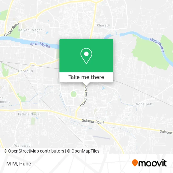
See M M, Pune & Velhe, on the map
Public Transit to M M in Pune & Velhe
Wondering how to get to M M in Pune & Velhe? Moovit helps you find the best way to get to M M with step-by-step directions from the nearest public transit station.
Moovit provides free maps and live directions to help you navigate through your city. View schedules, routes, timetables, and find out how long does it take to get to M M in real time.
Looking for the nearest stop or station to M M? Check out this list of stops closest to your destination: Bapusaheb Magar Wasti; Hadapsar (Pune).
Bus: 149, 167, 200, 156, 179.Train: 51401, 71402, 71404, 71405, 71406.
Want to see if there’s another route that gets you there at an earlier time? Moovit helps you find alternative routes or times. Get directions from and directions to M M easily from the Moovit App or Website.
We make riding to M M easy, which is why over 1.5 million users, including users in Pune & Velhe, trust Moovit as the best app for public transit. You don’t need to download an individual bus app or train app, Moovit is your all-in-one transit app that helps you find the best bus time or train time available.
For information on prices of bus, costs and ride fares to M M, please check the Moovit app.
Use the app to navigate to popular places including to the airport, hospital, stadium, grocery store, mall, coffee shop, school, college, and university.
M M Address: पुणे 411028 MH street in Pune & Velhe
- Decathlon,
- Ohel David - Lal Deval,
- Village,
- Amanora Town Centre In Gate,
- Manipal K12 School,
- Dinshaw's,
- Neel Enterprises,
- Home Town Amanora Mall,
- Toysrus,
- Lenskart,
- Kunal Mehandi Artist,
- Duville Riverdale Heights,
- Om Medicare,
- K F Bioplants Pvt. Ltd.,
- Reliance Digital,
- Amanora Town Centre,
- Amanora Mall,
- K F Bioplant,
- WeWork,
- Cinepolis Multiplex
Places Near M M (Pune & Velhe)
- Swaminarayan Mandir, Pune & Velhe,
- ISKCON Pune, Pune & Velhe,
- Dagdusheth Halwai Ganpati Mandir, Pune & Velhe,
- Symbiosis Lavale Bus Stop, Pune & Velhe,
- Raviwar Peth, Pune & Velhe,
- Tulshibaug, Pune & Velhe,
- Dagadusheth Halwai Ganapati Temple, Pune & Velhe,
- Cognizant Deccan Campus (CDC), Paud,
- Vishwakarma Institute Of Technology (Vit), Pune & Velhe,
- Sarasbaug, Pune & Velhe,
- Laxmi Road, Pune & Velhe,
- Pune Okayama Friendship Garden, Pune & Velhe,
- Senapati Bapat Road, Pune & Velhe,
- ISKCON Nvcc Temple, Pune & Velhe,
- Fc Road, Pune & Velhe,
- Westend Mall, Pune & Velhe,
- Pvr Icon - Pavilion Mall, Pune & Velhe,
- Ion Digital Zone, Pune & Velhe,
- Chaturshringi Temple, Pune & Velhe,
- M G Road, Pune & Velhe
How to get to popular places in Pune with public transit
Get around Pune & Velhe by public transit!
Traveling around Pune & Velhe has never been so easy. See step by step directions as you travel to any attraction, street or major public transit station. View bus and train schedules, arrival times, service alerts and detailed routes on a map, so you know exactly how to get to anywhere in Pune & Velhe.
When traveling to any destination around Pune & Velhe use Moovit's Live Directions with Get Off Notifications to know exactly where and how far to walk, how long to wait for your line, and how many stops are left. Moovit will alert you when it's time to get off — no need to constantly re-check whether yours is the next stop.
Wondering how to use public transit in Pune & Velhe or how to pay for public transit in Pune & Velhe? Moovit public transit app can help you navigate your way with public transit easily, and at minimum cost. It includes public transit fees, ticket prices, and costs. Looking for a map of Pune & Velhe public transit lines? Moovit public transit app shows all public transit maps in Pune & Velhe with all Bus, Train and Metro routes and stops on an interactive map.
Pune has 3 transit type(s), including: Bus, Train and Metro, operated by several transit agencies, including Pune Metro (Maha Metro), PMPML, PMPML Night Bus Service (Ratrani) and Central Railways (Indian Railways)