Directions to M Square Healthcare (Baltimore) with public transportation
The following transit lines have routes that pass near M Square Healthcare
 Bus: CITYLINK NAVY, GREEN ROUTE, ORANGE ROUTE, 150, CITYLINK LIME.
- Metro: METRO.
- Ferry: HC1.
How to get to M Square Healthcare by bus?
Click on the bus route to see step by step directions with maps, line arrival times and updated time schedules.
From Walmart Supercenter, Baltimore County
45 minFrom University Of Maryland Baltimore (Umbc), Baltimore County
46 minFrom Guinness Open Gate Brewery & Barrel House, Baltimore County
69 minFrom Pimlico Race Course, Baltimore
69 minFrom Western High School, Baltimore
49 minFrom Mva, Baltimore
59 minFrom NSA Friendship Annex (FANX), Anne Arundel County
92 minFrom Loyola University Maryland, Baltimore
41 minFrom Dundalk, Maryland, Baltimore County
35 minFrom Good Samaritan Hospital, Baltimore
49 min
How to get to M Square Healthcare by metro?
Click on the metro route to see step by step directions with maps, line arrival times and updated time schedules.
Bus stops near M Square Healthcare in Baltimore
Metro station near M Square Healthcare in Baltimore
- Shot Tower Metro, 14 min walk,VIEW
Ferry stations near M Square Healthcare in Baltimore
Bus lines to M Square Healthcare in Baltimore
What are the closest stations to M Square Healthcare?
The closest stations to M Square Healthcare are:
- Fleet St & Exeter St Eb is 289 yards away, 4 min walk.
- Fleet & Exeter is 289 yards away, 4 min walk.
- Eastern Ave & Albemarle St is 561 yards away, 7 min walk.
- Caroline St & Eastern Ave FS Sb is 586 yards away, 8 min walk.
- Shot Tower Metro is 1168 yards away, 14 min walk.
- Maritime Park is 2601 yards away, 31 min walk.
- Pier Five is 3142 yards away, 38 min walk.
- Locust Point is 5128 yards away, 61 min walk.
Which bus lines stop near M Square Healthcare?
These bus lines stop near M Square Healthcare: CITYLINK NAVY, GREEN ROUTE, ORANGE ROUTE.
Which metro line stops near M Square Healthcare?
METRO (Towards John Hopkins)
What’s the nearest metro station to M Square Healthcare in Baltimore?
The nearest metro station to M Square Healthcare in Baltimore is Shot Tower Metro. It’s a 14 min walk away.
What’s the nearest bus station to M Square Healthcare in Baltimore?
The nearest bus stations to M Square Healthcare in Baltimore are Fleet St & Exeter St Eb and Fleet & Exeter. The closest one is a 4 min walk away.
What time is the first metro to M Square Healthcare in Baltimore?
The METRO is the first metro that goes to M Square Healthcare in Baltimore. It stops nearby at 5:07 AM.
What time is the last metro to M Square Healthcare in Baltimore?
The METRO is the last metro that goes to M Square Healthcare in Baltimore. It stops nearby at 12:27 AM.
What time is the first bus to M Square Healthcare in Baltimore?
The CITYLINK NAVY is the first bus that goes to M Square Healthcare in Baltimore. It stops nearby at 3:32 AM.
What time is the last bus to M Square Healthcare in Baltimore?
The CITYLINK NAVY is the last bus that goes to M Square Healthcare in Baltimore. It stops nearby at 3:10 AM.
What time is the first ferry to M Square Healthcare in Baltimore?
The HC1 is the first ferry that goes to M Square Healthcare in Baltimore. It stops nearby at 6:00 AM.
What time is the last ferry to M Square Healthcare in Baltimore?
The HC3 is the last ferry that goes to M Square Healthcare in Baltimore. It stops nearby at 8:07 PM.
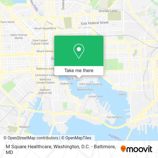
See M Square Healthcare, Baltimore, on the map
Public Transit to M Square Healthcare in Baltimore
Wondering how to get to M Square Healthcare in Baltimore? Moovit helps you find the best way to get to M Square Healthcare with step-by-step directions from the nearest public transit station.
Moovit provides free maps and live directions to help you navigate through your city. View schedules, routes, timetables, and find out how long does it take to get to M Square Healthcare in real time.
Looking for the nearest stop or station to M Square Healthcare? Check out this list of stops closest to your destination: Fleet St & Exeter St Eb; Fleet & Exeter; Eastern Ave & Albemarle St; Caroline St & Eastern Ave FS Sb; Shot Tower Metro; Maritime Park; Pier Five; Locust Point.
Bus: CITYLINK NAVY, GREEN ROUTE, ORANGE ROUTE, 150, CITYLINK LIME.Metro: METRO.Ferry: HC1.
Want to see if there’s another route that gets you there at an earlier time? Moovit helps you find alternative routes or times. Get directions from and directions to M Square Healthcare easily from the Moovit App or Website.
We make riding to M Square Healthcare easy, which is why over 1.5 million users, including users in Baltimore, trust Moovit as the best app for public transit. You don’t need to download an individual bus app or train app, Moovit is your all-in-one transit app that helps you find the best bus time or train time available.
For information on prices of bus, metro and light rail, costs and ride fares to M Square Healthcare, please check the Moovit app.
Use the app to navigate to popular places including to the airport, hospital, stadium, grocery store, mall, coffee shop, school, college, and university.
M Square Healthcare Address: 1000 Lancaster St Baltimore, MD 21202 street in Baltimore
- Courtyard Baltimore Downtown / Inner Harbor,
- Amazon Locker-Innerharbor,
- Amazon Counter at Whole Foods Market,
- Liberty Garage (Premium Parking Lot #P2312),
- Mac Gym,
- Liberty,
- Platagy,
- Edward W. Ted Smith - Morgan Stanley,
- Paul J Fallace - Morgan Stanley,
- Decapite Group - Morgan Stanley,
- 1001 Fleet St,
- Breathing Dragon,
- 100 International Dr Garage,
- Trawlerfest,
- Inner Harbor East,
- S Central Central Ave,
- Harbor East,
- Four Seasons Baltimore and Residences,
- Exelon,
- Gift, Antique and Art
Places Near M Square Healthcare (Baltimore)
- Capital One Arena, Washington,
- Warner Theatre, Washington,
- Georgetown, Washington,
- Sibley Memorial Hospital, Washington,
- The Anthem, Washington,
- Washington DC VA Medical Center, Washington,
- National Museum of African American History and Culture, Washington,
- Pennsylvania Ave NW (3rd st and pennsylvania), Washington,
- Amazon Hq2, Arlington County,
- Museum Of The Bible, Washington,
- Westfield Montgomery Mall, Montgomery County,
- Marriott Marquis Washington, DC, Washington,
- Basilica of the National Shrine, Washington,
- Camden Yards, Baltimore,
- PG Mall, Prince George's County,
- Washington National Cathedral, Washington,
- National Zoo, Washington,
- M&T Bank Stadium, Baltimore,
- Rock Creek Tennis Center, Washington,
- National Mall, Washington
How to get to popular places in Washington, D.C. - Baltimore, MD with public transit
Get around Baltimore by public transit!
Traveling around Baltimore has never been so easy. See step by step directions as you travel to any attraction, street or major public transit station. View bus and train schedules, arrival times, service alerts and detailed routes on a map, so you know exactly how to get to anywhere in Baltimore.
When traveling to any destination around Baltimore use Moovit's Live Directions with Get Off Notifications to know exactly where and how far to walk, how long to wait for your line, and how many stops are left. Moovit will alert you when it's time to get off — no need to constantly re-check whether yours is the next stop.
Wondering how to use public transit in Baltimore or how to pay for public transit in Baltimore? Moovit public transit app can help you navigate your way with public transit easily, and at minimum cost. It includes public transit fees, ticket prices, and costs. Looking for a map of Baltimore public transit lines? Moovit public transit app shows all public transit maps in Baltimore with all Bus, Train, Metro, Light Rail and Ferry routes and stops on an interactive map.
Washington, D.C. - Baltimore, MD has 5 transit type(s), including: Bus, Train, Metro, Light Rail and Ferry, operated by several transit agencies, including WMATA, Montgomery County Ride On, Fairfax Connector, TheBus, PRTC, DASH - Alexandria, Arlington Transit (ART), RTA of Central Maryland, MDOT MTA, MDOT MTA Light RailLink, MDOT MTA Commuter Bus, MDOT MTA Local Bus, FXBGO!, Virginia Railway Express (VRE) and MARC