How to get to Mac Insurance & Registry by bus?
Click on the bus route to see step by step directions with maps, line arrival times and updated time schedules.
From John E. Brownlee Building, Edmonton
70 minFrom Misericordia Community Hospital, Edmonton
84 minFrom Safeway, Edmonton
80 minFrom Panzica's Animal Trapping and Relocation, Edmonton
78 minFrom Archbishop MacDonald High School, Edmonton
74 minFrom T5G, Edmonton
62 minFrom Edmonton Tower, Edmonton
63 minFrom Highlands, Edmonton
111 minFrom 10111 104 Avenue Northwest, Edmonton
64 min
Bus stops near Mac Insurance & Registry in Edmonton
Bus lines to Mac Insurance & Registry in Edmonton
What are the closest stations to Mac Insurance & Registry?
The closest stations to Mac Insurance & Registry are:
- 125 Street & Rapperswill Drive is 174 meters away, 3 min walk.
- 127 Street & 167 Avenue is 550 meters away, 8 min walk.
- 127 Street & 167 Avenue Nearside is 675 meters away, 9 min walk.
Which bus lines stop near Mac Insurance & Registry?
These bus lines stop near Mac Insurance & Registry: 051, 103, 112.
What’s the nearest bus station to Mac Insurance & Registry in Edmonton?
The nearest bus station to Mac Insurance & Registry in Edmonton is 125 Street & Rapperswill Drive. It’s a 3 min walk away.
What time is the first bus to Mac Insurance & Registry in Edmonton?
The 112 is the first bus that goes to Mac Insurance & Registry in Edmonton. It stops nearby at 10:04 AM.
What time is the last bus to Mac Insurance & Registry in Edmonton?
The 112 is the last bus that goes to Mac Insurance & Registry in Edmonton. It stops nearby at 7:13 PM.
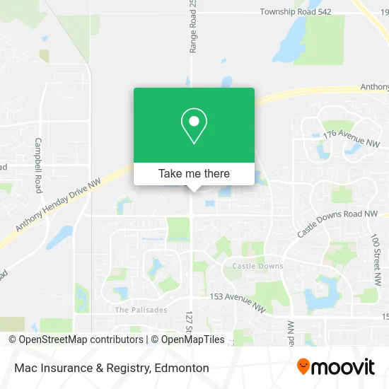
See Mac Insurance & Registry, Edmonton, on the map
Public Transit to Mac Insurance & Registry in Edmonton
Wondering how to get to Mac Insurance & Registry in Edmonton? Moovit helps you find the best way to get to Mac Insurance & Registry with step-by-step directions from the nearest public transit station.
Moovit provides free maps and live directions to help you navigate through your city. View schedules, routes, timetables, and find out how long does it take to get to Mac Insurance & Registry in real time.
Looking for the nearest stop or station to Mac Insurance & Registry? Check out this list of stops closest to your destination: 125 Street & Rapperswill Drive; 127 Street & 167 Avenue; 127 Street & 167 Avenue Nearside.
Bus: 051, 103, 112, 618, 624, 109, 140X, 625.
Want to see if there’s another route that gets you there at an earlier time? Moovit helps you find alternative routes or times. Get directions from and directions to Mac Insurance & Registry easily from the Moovit App or Website.
We make riding to Mac Insurance & Registry easy, which is why over 1.5 million users, including users in Edmonton, trust Moovit as the best app for public transit. You don’t need to download an individual bus app or train app, Moovit is your all-in-one transit app that helps you find the best bus time or train time available.
For information on prices of bus, costs and ride fares to Mac Insurance & Registry, please check the Moovit app.
Use the app to navigate to popular places including to the airport, hospital, stadium, grocery store, mall, coffee shop, school, college, and university.
Mac Insurance & Registry Address: 16977 127 St NW Edmonton, AB T6V 0T1 street in Edmonton
- Orange Julius,
- Deansgate Medical,
- Memphis Blues,
- Kumon,
- So Much Maple,
- STARBUCKS,
- Firehouse Subs Edmonton Newcastle Centre,
- Minute Key,
- Western Union Agent Location,
- Encore Group LTD,
- Smartstyle Family Hair Salon,
- 16940 127 Street Northwest,
- Walmart,
- Duck Donuts,
- Mary Browns New Castle,
- WESTERN UNION,
- Divine Spine Albany,
- Giuseppe Sestito,
- Amazon Locker-Britta,
- Becky Qu - TD Financial Planner
Places Near Mac Insurance & Registry (Edmonton)
- Edmonton Valley Zoo, Edmonton,
- Alberta Legislature Building, Edmonton,
- MacEwan University, Edmonton,
- Canada Place Service Canada Centre, Edmonton,
- Borden Park, Edmonton,
- Fort Edmonton Park, Edmonton,
- Edmonton Commonwealth Stadium, Edmonton,
- Whyte Avenue, Edmonton,
- Kingsway Mall, Edmonton,
- Rogers Place, Edmonton,
- Cross Cancer Institute, Edmonton,
- Edmonton EXPO Centre, Edmonton,
- University of Alberta, Edmonton,
- Grey Nuns Community Hospital, Edmonton,
- Kaye Edmonton Clinic, Edmonton,
- Edmonton VIA Rail Station, Edmonton,
- Northgate Centre, Edmonton,
- West Edmonton Mall, Edmonton,
- Londonderry Mall, Edmonton,
- Royal Alexandra Hospital, Edmonton
How to get to popular places in Edmonton with public transit
Get around Edmonton by public transit!
Traveling around Edmonton has never been so easy. See step by step directions as you travel to any attraction, street or major public transit station. View bus and train schedules, arrival times, service alerts and detailed routes on a map, so you know exactly how to get to anywhere in Edmonton.
When traveling to any destination around Edmonton use Moovit's Live Directions with Get Off Notifications to know exactly where and how far to walk, how long to wait for your line, and how many stops are left. Moovit will alert you when it's time to get off — no need to constantly re-check whether yours is the next stop.
Wondering how to use public transit in Edmonton or how to pay for public transit in Edmonton? Moovit public transit app can help you navigate your way with public transit easily, and at minimum cost. It includes public transit fees, ticket prices, and costs. Looking for a map of Edmonton public transit lines? Moovit public transit app shows all public transit maps in Edmonton with all Bus and Light Rail routes and stops on an interactive map.
Edmonton has 2 transit type(s), including: Bus and Light Rail, operated by several transit agencies, including ETS LRT, ETS, Strathcona County Transit, St. Albert Transit, Spruce Grove Transit, Fort Saskatchewan Transit, Beaumont Transit and Leduc Transit