How to get to Mac Logistic & Service by bus?
Click on the bus route to see step by step directions with maps, line arrival times and updated time schedules.
From The Salvation Army, Miami
51 minFrom Coral Gables High School, Miami
72 minFrom Le Jeune Rd / E 49th St, Hialeah
77 minFrom Calle Ocho, Miami
71 minFrom NW 23rd St / NW 21st Ave, Miami
78 minFrom Tropical Park, Miami
72 minFrom Consulado General de Honduras en Miami, Miami
59 minFrom Florida International University-Modesto A. Maidique Campus, South Westside
62 minFrom Venetian Pool, Miami
84 minFrom NW 27th Ave / NW 79th St, Miami
71 min
Bus stops near Mac Logistic & Service in North Westside
Bus lines to Mac Logistic & Service in North Westside
What are the closest stations to Mac Logistic & Service?
The closest stations to Mac Logistic & Service are:
- Nw 82nd Ave @ Nw 31st St is 175 yards away, 3 min walk.
- NW 79 AV @ NW 29 ST is 632 yards away, 8 min walk.
- Nw 87 Av & Nw 30 Te is 838 yards away, 10 min walk.
Which bus lines stop near Mac Logistic & Service?
These bus lines stop near Mac Logistic & Service: 36, 87, DLOOP2.
What’s the nearest bus station to Mac Logistic & Service in North Westside?
The nearest bus station to Mac Logistic & Service in North Westside is Nw 82nd Ave @ Nw 31st St. It’s a 3 min walk away.
What time is the first bus to Mac Logistic & Service in North Westside?
The 36 is the first bus that goes to Mac Logistic & Service in North Westside. It stops nearby at 4:12 AM.
What time is the last bus to Mac Logistic & Service in North Westside?
The 36 is the last bus that goes to Mac Logistic & Service in North Westside. It stops nearby at 12:41 AM.
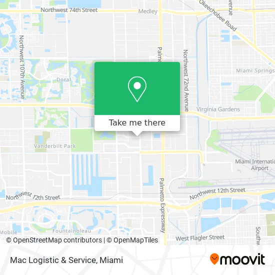
See Mac Logistic & Service, North Westside, on the map
Public Transit to Mac Logistic & Service in North Westside
Wondering how to get to Mac Logistic & Service in North Westside? Moovit helps you find the best way to get to Mac Logistic & Service with step-by-step directions from the nearest public transit station.
Moovit provides free maps and live directions to help you navigate through your city. View schedules, routes, timetables, and find out how long does it take to get to Mac Logistic & Service in real time.
Looking for the nearest stop or station to Mac Logistic & Service? Check out this list of stops closest to your destination: Nw 82nd Ave @ Nw 31st St; NW 79 AV @ NW 29 ST; Nw 87 Av & Nw 30 Te.
Bus: 36, 87, DLOOP2, 115, 95, DLOOP1.
Want to see if there’s another route that gets you there at an earlier time? Moovit helps you find alternative routes or times. Get directions from and directions to Mac Logistic & Service easily from the Moovit App or Website.
We make riding to Mac Logistic & Service easy, which is why over 1.5 million users, including users in North Westside, trust Moovit as the best app for public transit. You don’t need to download an individual bus app or train app, Moovit is your all-in-one transit app that helps you find the best bus time or train time available.
For information on prices of bus and train, costs and ride fares to Mac Logistic & Service, please check the Moovit app.
Use the app to navigate to popular places including to the airport, hospital, stadium, grocery store, mall, coffee shop, school, college, and university.
Mac Logistic & Service Address: 8228 NW 30th Ter Miami, FL 33122 street in North Westside
- Lan Global Corp,
- BCS Express,
- Ipest Control,
- Open Sea Import Export,
- Estrella Plumbing Contractors, Inc.,
- Alarm Line,
- Espana Distributors,
- Miami Express Import & Export,
- Als Freight Forwarding,
- Pegasus,
- CWW - USA,
- Mia Flowers,
- Goosehead Insurance - Raul Loys,
- T F Logistics,
- Simpson's Greens & Floral,
- Novagraphics,
- Bestway Group International,
- Iberiabank,
- Florida Coastal Cocker Rescue,
- Drew Gaddis Attorney at Law
Places Near Mac Logistic & Service (North Westside)
- Miami Design District, Miami,
- Brickell City Centre, Miami,
- Dolphin Mall Bus, Miami,
- Miami-Dade County Courthouse, Miami,
- Keiser University Flagship Campus, West Palm Beach,
- Aventura Mall, Miami,
- Bayside Marketplace, Miami,
- Aventura Mall, Miami Beach,
- Wynwood, Miami,
- Sawgrass Mall, Miami,
- Dolphin Mall, Miami,
- Marlins Park, Miami,
- Hard Rock Stadium, Miami Gardens,
- Zoo Miami, Miami,
- Richard E. Gerstein Justice Building, Miami,
- Miami Freedom Park, Miami,
- Little Havana, Miami,
- Sawgrass mall ( FL ), Miami Beach,
- 1351 NW 12th St, Miami,
- Port of Miami Cruise Terminal, Miami
How to get to popular places in Miami with public transit
Get around North Westside by public transit!
Traveling around North Westside has never been so easy. See step by step directions as you travel to any attraction, street or major public transit station. View bus and train schedules, arrival times, service alerts and detailed routes on a map, so you know exactly how to get to anywhere in North Westside.
When traveling to any destination around North Westside use Moovit's Live Directions with Get Off Notifications to know exactly where and how far to walk, how long to wait for your line, and how many stops are left. Moovit will alert you when it's time to get off — no need to constantly re-check whether yours is the next stop.
Wondering how to use public transit in North Westside or how to pay for public transit in North Westside? Moovit public transit app can help you navigate your way with public transit easily, and at minimum cost. It includes public transit fees, ticket prices, and costs. Looking for a map of North Westside public transit lines? Moovit public transit app shows all public transit maps in North Westside with all Bus, Train, Light Rail and Ferry routes and stops on an interactive map.
Miami has 4 transit type(s), including: Bus, Train, Light Rail and Ferry, operated by several transit agencies, including Broward County Transit, Miami-Dade Transit, Metrorail, Palm Tran, Tri-Rail, Brightline, MARTY, City of Homestead Trolley, Key West Transit, Treasure Coast Connector, GoLine IRT, Amtrak, Greyhound-us, FlixBus-us and Aventura Express Shuttle Bus