How to get to Mainware by bus?
Click on the bus route to see step by step directions with maps, line arrival times and updated time schedules.
From Montgomery Blair High School, Montgomery County
43 minFrom National Archives at College Park, Prince George's County
80 minFrom Wheaton High School, Montgomery County
60 minFrom IKEA, Prince George's County
71 minFrom Wheaton, Maryland, Montgomery County
66 minFrom Wheaton Mall, Montgomery County
52 minFrom College Park Marriott Hotel & Conference Center, Prince George's County
94 minFrom Northwestern High School, Prince George's County
90 minFrom IKEA - College Park, Prince George's County
67 minFrom Beltway Plaza Mall, Prince George's County
89 min
Bus stops near Mainware in Montgomery County
Bus lines to Mainware in Montgomery County
What are the closest stations to Mainware?
The closest stations to Mainware are:
- Gateshead Manor Way & Aston Manor Dr is 376 yards away, 5 min walk.
- Ballinger Dr+Autumn Glen Cir is 1389 yards away, 17 min walk.
- Castle Bl+#13900 is 2067 yards away, 25 min walk.
- Castle Blvd & is 2233 yards away, 27 min walk.
Which bus line stops near Mainware?
M54 (North To Greencastle)
What’s the nearest bus station to Mainware in Montgomery County?
The nearest bus station to Mainware in Montgomery County is Gateshead Manor Way & Aston Manor Dr. It’s a 5 min walk away.
What time is the first bus to Mainware in Montgomery County?
The M54 is the first bus that goes to Mainware in Montgomery County. It stops nearby at 4:26 AM.
What time is the last bus to Mainware in Montgomery County?
The M54 is the last bus that goes to Mainware in Montgomery County. It stops nearby at 2:15 AM.
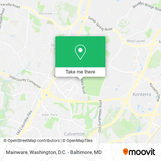
See Mainware, Montgomery County, on the map
Public Transit to Mainware in Montgomery County
Wondering how to get to Mainware in Montgomery County? Moovit helps you find the best way to get to Mainware with step-by-step directions from the nearest public transit station.
Moovit provides free maps and live directions to help you navigate through your city. View schedules, routes, timetables, and find out how long does it take to get to Mainware in real time.
Looking for the nearest stop or station to Mainware? Check out this list of stops closest to your destination: Gateshead Manor Way & Aston Manor Dr; Ballinger Dr+Autumn Glen Cir; Castle Bl+#13900; Castle Blvd &.
Bus: M54, 21, 39, M52, FLASH.
Want to see if there’s another route that gets you there at an earlier time? Moovit helps you find alternative routes or times. Get directions from and directions to Mainware easily from the Moovit App or Website.
We make riding to Mainware easy, which is why over 1.5 million users, including users in Montgomery County, trust Moovit as the best app for public transit. You don’t need to download an individual bus app or train app, Moovit is your all-in-one transit app that helps you find the best bus time or train time available.
For information on prices of bus, costs and ride fares to Mainware, please check the Moovit app.
Use the app to navigate to popular places including to the airport, hospital, stadium, grocery store, mall, coffee shop, school, college, and university.
Mainware Address: 3800 Ski Lodge Dr Burtonsville, MD 20866 street in Montgomery County
- Skilled Heating & Cooling Repair,
- Greencastle Manor Townhouse,
- Fairland Recreational Park,
- Raes Sheas Skin Care,
- Lularoe Whitney Syvers,
- Greencastle Ridge ter St Burtonsville MD,
- Embrace Your Mind Foundation,
- Valor Apartments,
- Palmer Non-Medical Transportation,
- P+R Briggs Chaney,
- Fairland Crossing Apartments,
- Shanihomeimprovement,
- Shootaz Soccer Academy,
- Willow Manor at Fairland,
- Blink Charging,
- Locksmith Fairland,
- Greencastle Park & Ride,
- Briggs Chaney Park and Ride,
- East County Community Recreation Center,
- The Gardens Ice House
Places Near Mainware (Montgomery County)
- Pennsylvania Ave NW (3rd st and pennsylvania), Washington,
- M&T Bank Stadium, Baltimore,
- Westfield Montgomery Mall, Montgomery County,
- PG Mall, Prince George's County,
- Washington National Cathedral, Washington,
- National Museum of African American History and Culture, Washington,
- Capital One Arena, Washington,
- The Anthem, Washington,
- Museum Of The Bible, Washington,
- Marriott Marquis Washington, DC, Washington,
- Camden Yards, Baltimore,
- Washington DC VA Medical Center, Washington,
- National Zoo, Washington,
- Basilica of the National Shrine, Washington,
- Warner Theatre, Washington,
- Sibley Memorial Hospital, Washington,
- Georgetown, Washington,
- Rock Creek Tennis Center, Washington,
- Amazon Hq2, Arlington County,
- National Mall, Washington
How to get to popular places in Washington, D.C. - Baltimore, MD with public transit
Get around Montgomery County by public transit!
Traveling around Montgomery County has never been so easy. See step by step directions as you travel to any attraction, street or major public transit station. View bus and train schedules, arrival times, service alerts and detailed routes on a map, so you know exactly how to get to anywhere in Montgomery County.
When traveling to any destination around Montgomery County use Moovit's Live Directions with Get Off Notifications to know exactly where and how far to walk, how long to wait for your line, and how many stops are left. Moovit will alert you when it's time to get off — no need to constantly re-check whether yours is the next stop.
Wondering how to use public transit in Montgomery County or how to pay for public transit in Montgomery County? Moovit public transit app can help you navigate your way with public transit easily, and at minimum cost. It includes public transit fees, ticket prices, and costs. Looking for a map of Montgomery County public transit lines? Moovit public transit app shows all public transit maps in Montgomery County with all Bus, Train, Metro, Light Rail and Ferry routes and stops on an interactive map.
Washington, D.C. - Baltimore, MD has 5 transit type(s), including: Bus, Train, Metro, Light Rail and Ferry, operated by several transit agencies, including WMATA, Montgomery County Ride On, Fairfax Connector, TheBus, PRTC, DASH - Alexandria, Arlington Transit (ART), RTA of Central Maryland, MDOT MTA, MDOT MTA Light RailLink, MDOT MTA Commuter Bus, MDOT MTA Local Bus, FXBGO!, Virginia Railway Express (VRE) and MARC