Directions to Mainz-Kastel station (Wiesbaden) with public transit
The following transit lines have routes that pass near Mainz-Kastel
How to get to Mainz-Kastel station by bus?
Click on the bus route to see step by step directions with maps, line arrival times and updated time schedules.
How to get to Mainz-Kastel station by train?
Click on the train route to see step by step directions with maps, line arrival times and updated time schedules.
Bus stops near Mainz-Kastel in Wiesbaden
- Wiesbaden-Mainz-Kastel Brückenkopf, 1 min walk,
- Wiesbaden-Mainz-Kastel Bahnhof, 4 min walk,
- Wiesbaden-Mainz-Kastel Eleonorenstraße, 6 min walk,
- Mainz, Landtag, 11 min walk,
- Mainz, Brückenplatz, 13 min walk,
Ferry station near Mainz-Kastel in Wiesbaden
- Mainz Kd, 12 min walk,
Light Rail stations near Mainz-Kastel in Wiesbaden
- Mainz, Hauptbahnhof, 26 min walk,
Bus lines to Mainz-Kastel station in Wiesbaden
- 6, Wiesbaden Platz Der Deutschen Einheit,
- 9, Wiesbaden-Schierstein Oderstraße,
- 28, Mainz, Bismarckplatz,
- 54, Lerchenberg, Hindemithstr.,
- 55, Lerchenberg,
- 56, Ingelheim, Bahnhof,
- 57, Arena,
- 58, Ginsheim-Gustavsburg-Ginsheim Igs Mainspitze,
- 68, Mainz, Hauptbahnhof,
- 91, Wackernheim,
- E, Wiesbaden-Bierstadt Venatorstraße,
- E6, Wiesbaden Nordfriedhof,
- 70, Mainz, Straßenbahnamt - Mainz, Marienborn,
- 71, Mainz, Straßenbahnamt - Finthen, Poststraße,
- E, Gonsenheim, Wildpark,
- 65, Hartenberg, Ketteler-Kolleg - Weisenau, Paul-Gerhardt-Weg,
- 66, Zornheim, Hahnheimer Straße - Hechtsheim, Mühldreieck,
- 79, Mainz, Hauptbahnhof - Ingelheim, Bahnhof,
What are the closest stations to Mainz-Kastel?
The closest stations to Mainz-Kastel are:
- Wiesbaden-Mainz-Kastel Brückenkopf is 41 meters away, 1 min walk.
- Wiesbaden-Mainz-Kastel Bahnhof is 270 meters away, 4 min walk.
- Wiesbaden-Mainz-Kastel Eleonorenstraße is 414 meters away, 6 min walk.
- Mainz, Landtag is 859 meters away, 11 min walk.
- Mainz Kd is 916 meters away, 12 min walk.
- Mainz, Brückenplatz is 976 meters away, 13 min walk.
- Mainz, Hauptbahnhof is 1996 meters away, 26 min walk.
Which train lines stop near Mainz-Kastel?
These train lines stop near Mainz-Kastel: LRS, RB10.
Which bus lines stop near Mainz-Kastel?
These bus lines stop near Mainz-Kastel: 54, 56, 6.
What’s the nearest light rail station to Mainz-Kastel in Wiesbaden?
The nearest light rail station to Mainz-Kastel in Wiesbaden is Mainz, Hauptbahnhof. It’s a 26 min walk away.
What’s the nearest bus stop to Mainz-Kastel in Wiesbaden?
The nearest bus stop to Mainz-Kastel in Wiesbaden is Wiesbaden-Mainz-Kastel Brückenkopf. It’s a 1 min walk away.
What’s the nearest ferry station to Mainz-Kastel in Wiesbaden?
The nearest ferry station to Mainz-Kastel in Wiesbaden is Mainz Kd. It’s a 12 min walk away.
What time is the first light rail to Mainz-Kastel in Wiesbaden?
The 50 is the first light rail that goes to Mainz-Kastel in Wiesbaden. It stops nearby at 3:00 AM.
What time is the last light rail to Mainz-Kastel in Wiesbaden?
The 50 is the last light rail that goes to Mainz-Kastel in Wiesbaden. It stops nearby at 3:00 AM.
What time is the first train to Mainz-Kastel in Wiesbaden?
The S1 is the first train that goes to Mainz-Kastel in Wiesbaden. It stops nearby at 3:13 AM.
What time is the last train to Mainz-Kastel in Wiesbaden?
The S1 is the last train that goes to Mainz-Kastel in Wiesbaden. It stops nearby at 1:45 AM.
What time is the first bus to Mainz-Kastel in Wiesbaden?
The S8E is the first bus that goes to Mainz-Kastel in Wiesbaden. It stops nearby at 3:02 AM.
What time is the last bus to Mainz-Kastel in Wiesbaden?
The S8E is the last bus that goes to Mainz-Kastel in Wiesbaden. It stops nearby at 3:36 AM.
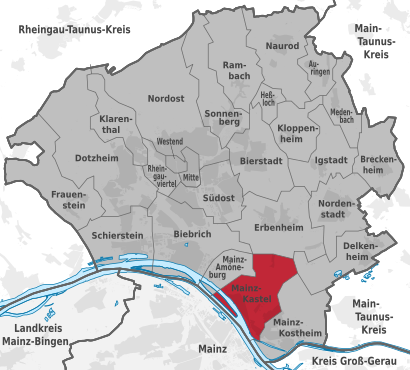
See Mainz-Kastel, Wiesbaden, on the map
Public Transit to Mainz-Kastel in Wiesbaden
Wondering how to get to Mainz-Kastel in Wiesbaden, Germany? Moovit helps you find the best way to get to Mainz-Kastel with step-by-step directions from the nearest public transit station.
Moovit provides free maps and live directions to help you navigate through your city. View schedules, routes, timetables, and find out how long does it take to get to Mainz-Kastel in real time.
Looking for the nearest stop or station to Mainz-Kastel? Check out this list of stops closest to your destination: Wiesbaden-Mainz-Kastel Brückenkopf; Wiesbaden-Mainz-Kastel Bahnhof; Wiesbaden-Mainz-Kastel Eleonorenstraße; Mainz; Mainz Kd; Mainz; Mainz.
Train: LRS, RB10.Bus: 54, 56, 6, 9, 28, 55, E, E6, 70, 71, E.Ferry: SCH.
Want to see if there’s another route that gets you there at an earlier time? Moovit helps you find alternative routes or times. Get directions from and directions to Mainz-Kastel easily from the Moovit App or Website.
We make riding to Mainz-Kastel easy, which is why over 1.5 million users, including users in Wiesbaden, trust Moovit as the best app for public transit. You don’t need to download an individual bus app or train app, Moovit is your all-in-one transit app that helps you find the best bus time or train time available.
For information on prices of bus and train, costs and ride fares to Mainz-Kastel, please check the Moovit app.
Use the app to navigate to popular places including to the airport, hospital, stadium, grocery store, mall, coffee shop, school, college, and university.
Mainz-Kastel Address: Mainz-Kastel, 55252 Wiesbaden, Deutschland street in Wiesbaden
Places Near Mainz-Kastel (Wiesbaden)
How to get to popular places in Rhein-Main Gebiet with public transit
Get around Wiesbaden by public transit!
Traveling around Wiesbaden has never been so easy. See step by step directions as you travel to any attraction, street or major public transit station. View bus and train schedules, arrival times, service alerts and detailed routes on a map, so you know exactly how to get to anywhere in Wiesbaden.
When traveling to any destination around Wiesbaden use Moovit's Live Directions with Get Off Notifications to know exactly where and how far to walk, how long to wait for your line, and how many stops are left. Moovit will alert you when it's time to get off — no need to constantly re-check whether yours is the next stop.
Wondering how to use public transit in Wiesbaden or how to pay for public transit in Wiesbaden? Moovit public transit app can help you navigate your way with public transit easily, and at minimum cost. It includes public transit fees, ticket prices, and costs. Looking for a map of Wiesbaden public transit lines? Moovit public transit app shows all public transit maps in Wiesbaden with all Bus, Train, Subway, Light Rail and Ferry routes and stops on an interactive map.
Rhein-Main Gebiet has 5 transit type(s), including: Bus, Train, Subway, Light Rail and Ferry, operated by several transit agencies, including VAB, VRM, Verkehrsgesellschaft Untermain, Verkehrsgesellschaft Gersprenztal/Sauter, Private nicht im VRN, Sonstige Fährbetriebe, Stadtverkehr Ingelheim, ORN im RNN, Stadtverkehr Bingen, Verkehrsbetriebe Westfalen-Süd GmbH, Ruftaxi, FahrPlan Verkehrsgesellschaft mbH, Omnibus Sauter, HLB Hessenbus Hofheim and Stadtwerke Verkehrsgesellschaft Frankfurt